May 2026 is likely to bring above-normal temperatures and rainfall totals between 40 and 169 mm across Trinidad and 50 to 81 mm across Tobago, marking the transition out of the Dry Season, according to the Trinidad and Tobago Meteorological Service (TTMS).
While the official Wet Season has not yet been declared, May typically sees the first sustained increase in shower activity as tropical waves or the ITCZ begin to affect the region, following the driest stretch of the year in March and April.
May 2026 Rainfall Outlook
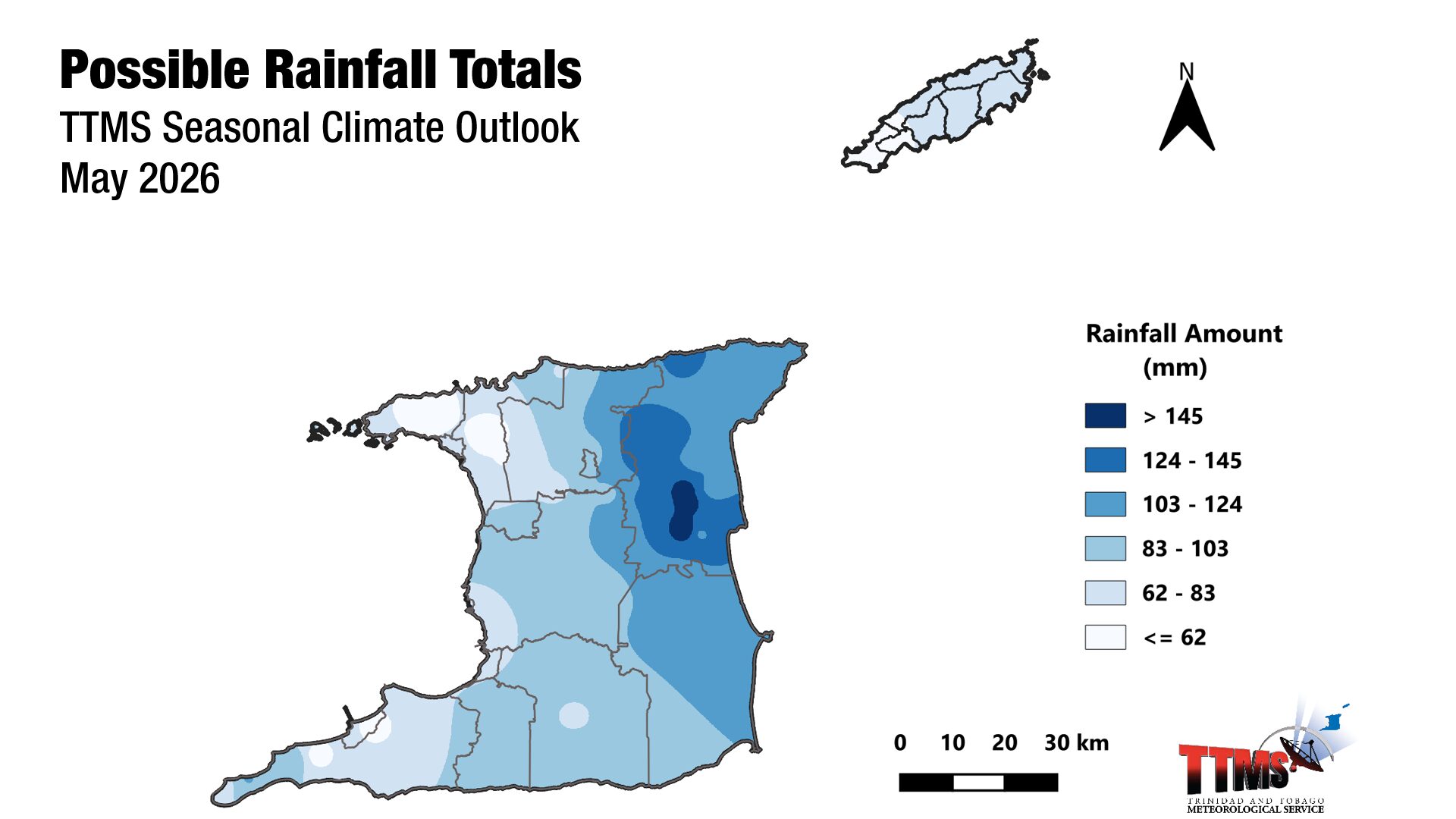
According to the TTMS, the May rainfall totals with the highest chance of occurring range from 40 to 169 mm across Trinidad and from 50 to 81 mm across Tobago.
Piarco records 109.4 millimeters of rainfall in an average May, while Crown Point records 86.6 millimeters based on averages between 1991 and 2020.
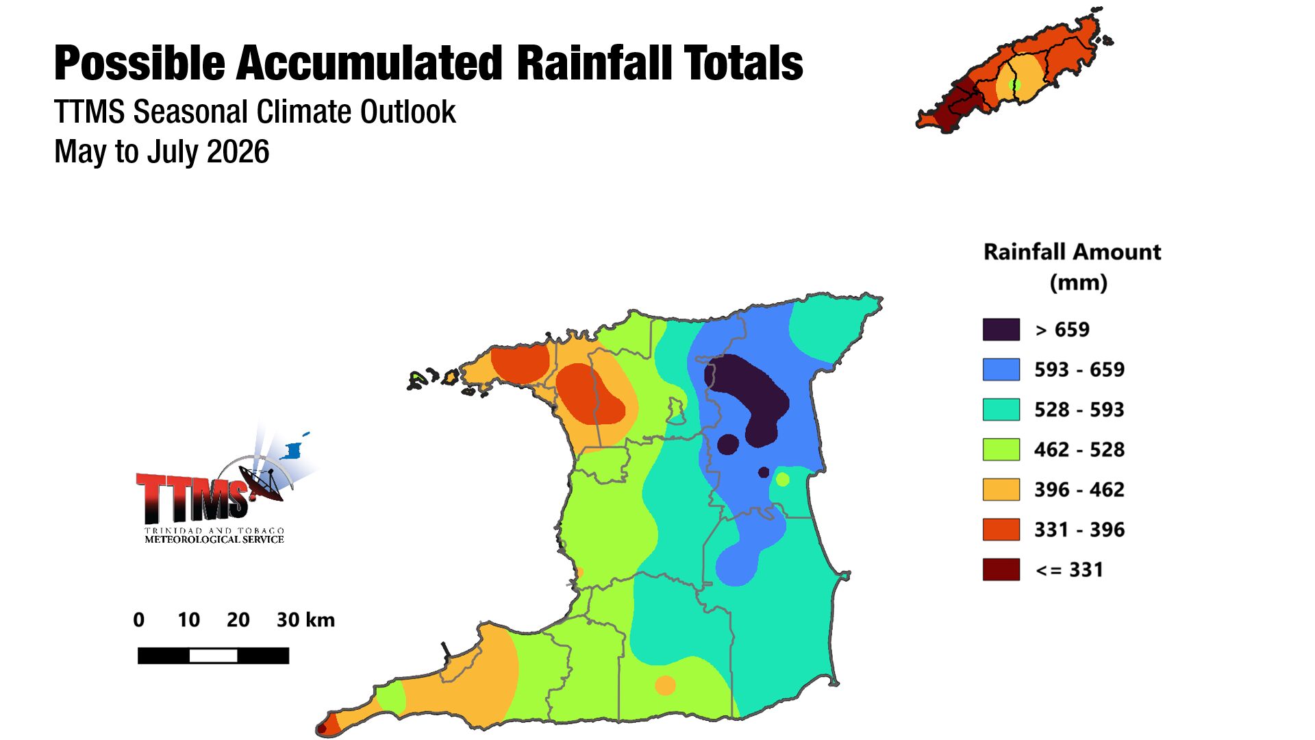
The broader May–July (MJJ) 2026 period is most likely to deliver near-normal rainfall over Trinidad and below-normal rainfall over Tobago, with the highest accumulated three-month totals favored across northern and eastern Trinidad, including North Oropouche, Valencia, and Sangre Grande, where MJJ totals could approach 756 mm. In central Tobago, areas such as Goodwood and Fort Granby are forecast for around 469 mm.
What’s driving May rainfall?
The weak La Niña that influenced the early Dry Season has ended, and climate models give a moderate probability (61%) that El Niño conditions will develop between May and July, continuing through the end of 2026. El Niño typically suppresses Wet Season rainfall across the southern Caribbean, which partly underpins the below-normal signal for Tobago.
Sea surface temperatures in waters surrounding Trinidad and Tobago and farther east of the islands are average to slightly above average, and most climate models indicate these conditions will persist through July 2026.
The North Atlantic Oscillation (NAO), which was strongly positive throughout April, is forecast to shift to a weak negative phase in May, contributing a small positive influence on local rainfall. Surface wind speeds are expected to be normal to above-normal during May.
The Madden-Julian Oscillation (MJO), which can enhance overall rainfall when active in the Western Hemisphere, has stalled in the Indian Ocean and is not expected to influence rainfall across Trinidad and Tobago during May. Equatorial Rossby and Kelvin waves are similarly not expected to drive rainfall during the month.
Recent Rainfall Trends
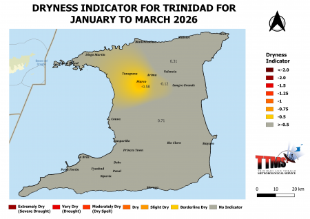
The lead-up to May has been notably dry across parts of the country. By the end of March 2026, the TTMS observed below-normal rainfall at Piarco in north-central Trinidad and Crown Point in southwest Tobago, with March totals of 23.8 mm (about 65% of average) and 27.9 mm (about 59% of average), respectively. Neither station recorded a wet day (10 mm or more) during the month, though both saw multiple days of light rainfall.
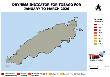
Vegetation browsing was noticeable across north-central and western Trinidad by the end of March, and borderline dry conditions developed around Piarco and in north-central Trinidad during January–March 2026. Tobago, by contrast, showed no significant dryness concerns over the same three-month window.
May 2026 Temperature Outlook
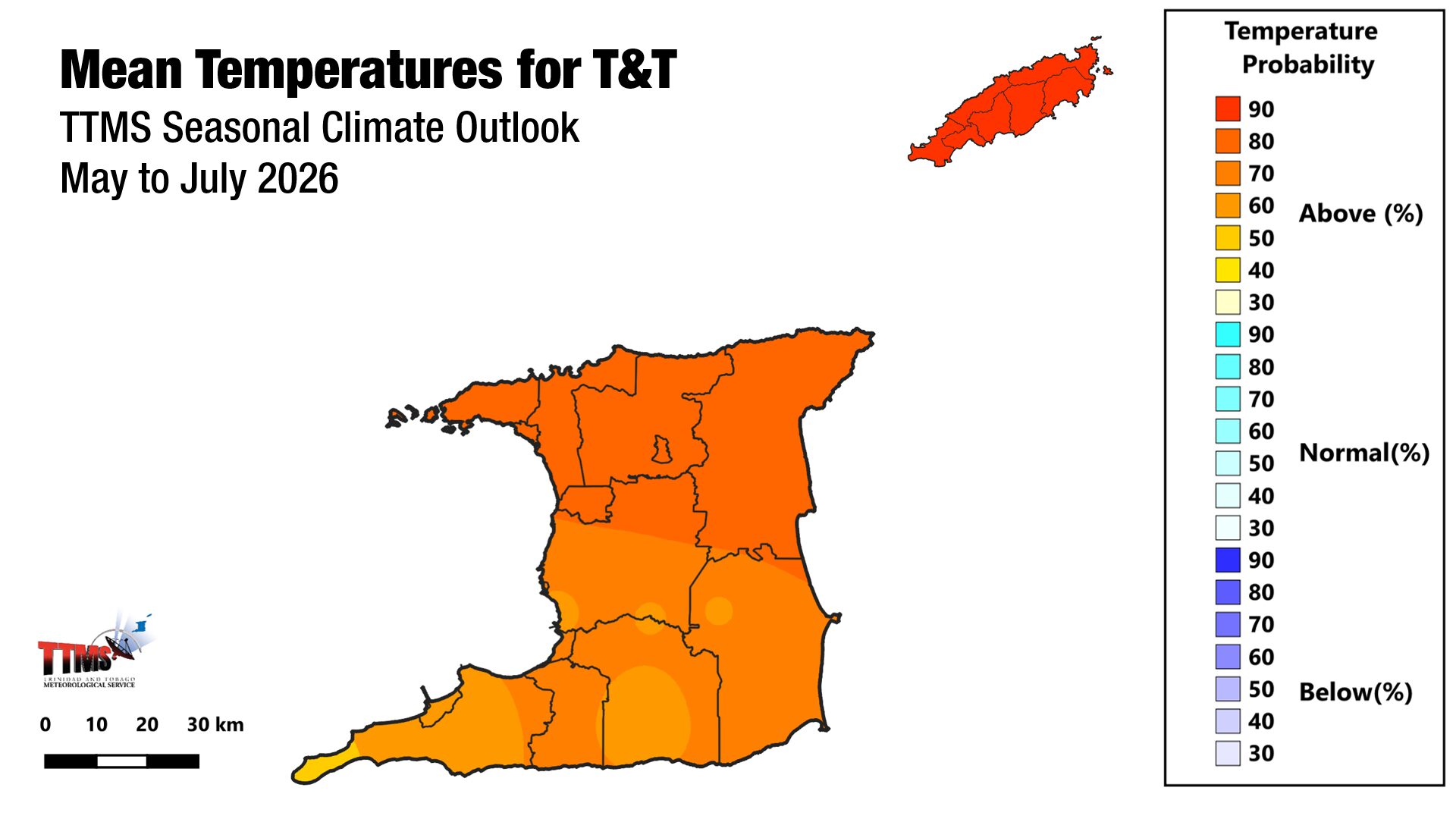
Mean temperatures in May 2026 are likely to be above normal across both islands. Urban and built-up areas have the greatest odds of warmer-than-average days and nights.
The TTMS’ MJJ 2026 outlook indicates a moderate (64%) chance of warmer-than-average days in urban and built-up areas across both islands, alongside a moderate (62%) chance of short-duration hot spells, with maximum temperatures exceeding 34.0°C in Trinidad and 33.0°C in Tobago.