

An active Intertropical Convergence Zone has been affecting Trinidad and Tobago on Sunday, July 12th, 2026, bringing showers and thunderstorms. While these conditions have briefly subsided, additional showers and thunderstorms remain forecast after midnight tonight through Monday afternoon. With already saturated soils from Sunday’s rainfall, according to the Trinidad and Tobago Meteorological Service, “there is now a heightened concern for streams and smaller watercourses to overtop.”
What you need to know
— What: Low-level perturbations interacting with the Intertropical Convergence Zone (ITCZ) are forecast to affect T&T through Monday. As a result, watercourses are likely to continue rising across Trinidad, with many already having risen following Sunday’s rainfall. Additional rainfall accumulations between 12.5mm and 25mm are forecast across Trinidad and Tobago, with isolated totals up to 60 mm favoring eastern Trinidad.
— Where: While both islands are forecast to experience showers and thunderstorms, overall heavier rainfall is forecast across Trinidad, particularly southern and eastern areas.
— When: The TTMS issued a Localized Flood Alert for Trinidad, going into effect at 5:00 AM Monday, July 13th, 2026, and ending at 4:00 PM Monday.
— Impacts: The primary hazards will be localized street/flash flooding and ponding, especially in low- lying and flood-prone areas; potential traffic delays due to water accumulation on roadways; and landslips may occur in areas that are usually susceptible. Long-lived riverine flooding is not expected.
— What Should You Do: Monitor weather conditions and assess your surroundings before venturing out. Follow the instructions of government officials. If you encounter flood waters, turn around. If you hear thunder, head indoors.
Latest Alerts

Localized Flood Alert Issued For Trinidad
Trinidad and Tobago is NOT under any tropical storm or hurricane threat, watch, or warning.
The Localized Flood Alert
The Trinidad and Tobago Meteorological Service has issued a Localized Flood Alert (Yellow Level) on Sunday, July 12th, at 7:29 PM. The alert goes into effect at 5:00 AM Monday, July 13th, 2026, and remains in effect until 4:00 PM Monday, July 13th, 2026.
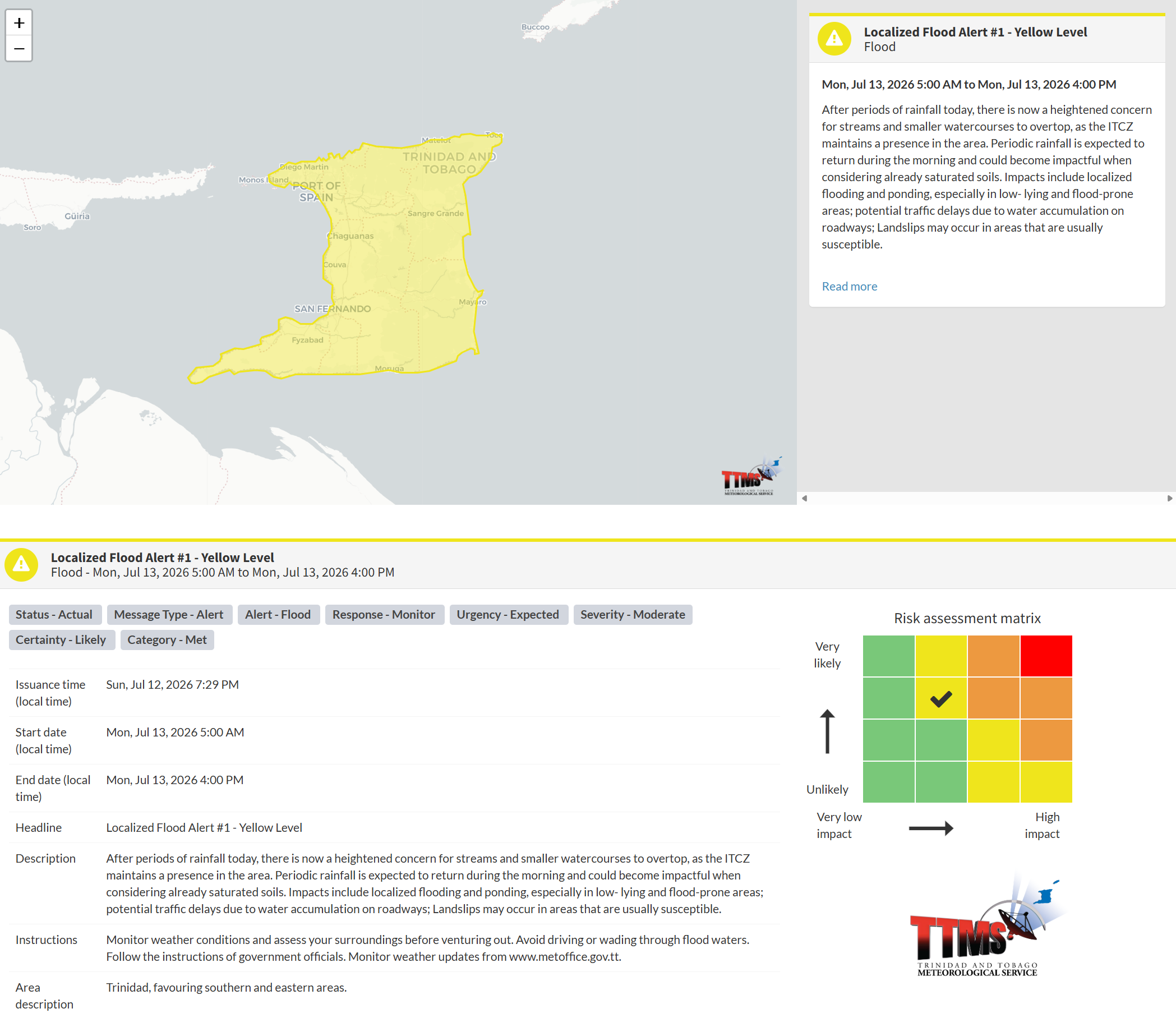
According to the TTMS: “After periods of rainfall today, there is now a heightened concern for streams and smaller watercourses to overtop, as the ITCZ maintains a presence in the area. Periodic rainfall is expected to return in the morning and could become impactful given already saturated soils. Impacts include localized flooding and ponding, especially in low- lying and flood-prone areas; potential traffic delays due to water accumulation on roadways; Landslips may occur in areas that are usually susceptible.”
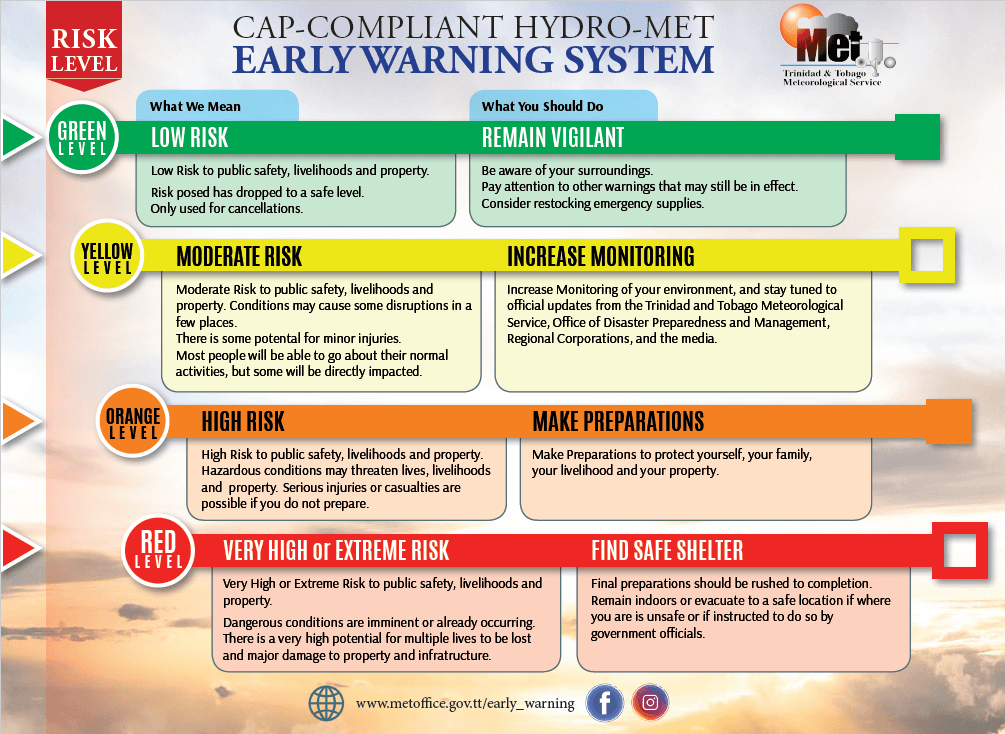
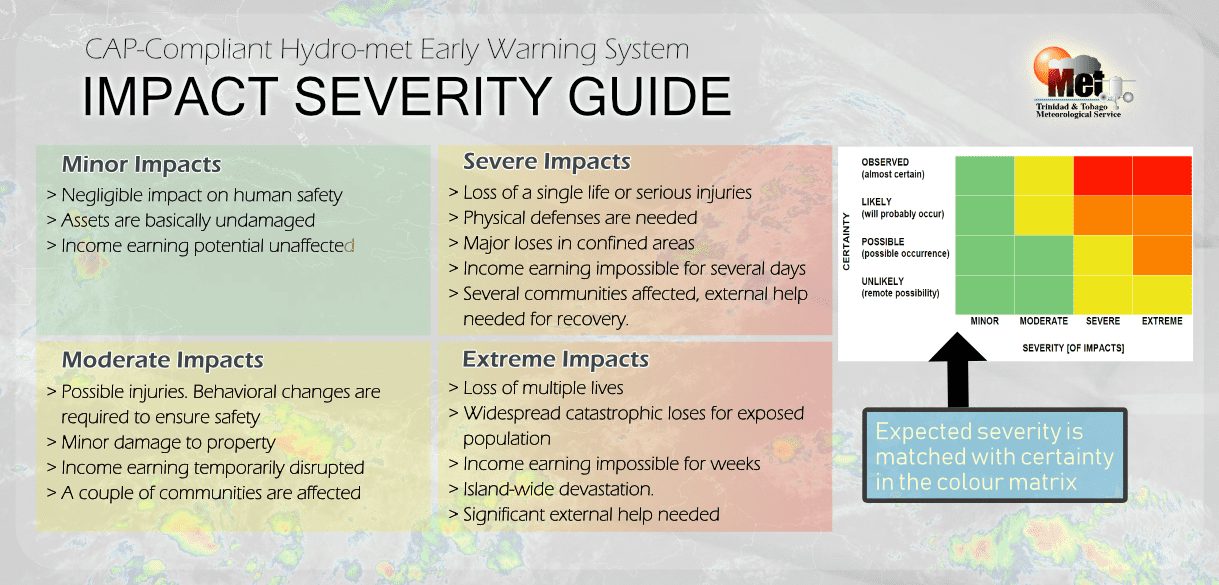
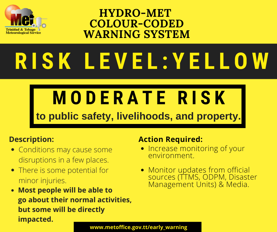
The alert’s color indicates the event’s severity and likelihood. Currently, the alert level is Yellow. This means the hazards are very likely and the impacts are moderate for this particular alert. You should know the hazards in your area associated with street, flash, and possible minor riverine flooding.
For a moderate Localized Flood Alert, there is the potential for possible injuries, where behavioral changes are required to ensure safety. There may be minor damage to property, with income-earning temporarily disrupted and a couple of communities affected.
The Met Office advises the public to monitor weather conditions and assess your surroundings before venturing out, avoid driving or wading through flood waters, and follow the instructions of government officials.