Trinidad and Tobago experienced its coldest morning for 2026 on Friday, with temperatures dipping below 20°C across most of Trinidad.
In the valleys, temperatures ranged from 17°C to 20°C. At T&T’s highest weather station at El Tucuche, the country’s second-highest peak, temperatures reached a chilly 15.4°C at 6:00 AM.
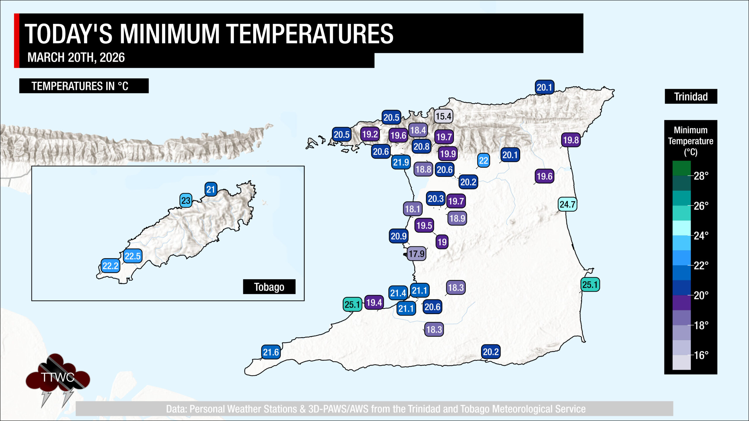
A minimum of 20.4°C was recorded at Piarco and 22.2°C at Crown Point. These temperatures are now the coolest official nighttime lows recorded for 2026 to date. The low at Piarco hasn’t dropped below 20°C so far this year, but with a mass of drier air forecast to move across the area this weekend, nighttime temperatures may drop even lower.
Is this record-breaking?
According to the Trinidad and Tobago Meteorological Service, the coolest minimum low recorded at Piarco in March was 17.2°C on March 2nd, 1962. However, the TTMS has recorded even lower temperatures in the past. The lowest minimum temperature on record at Piarco is 16.1°C, which occurred on the nights of January 21st and 30th, 1964.
Temperature records elsewhere, like Penal, Brasso, Caroni, and El Reposo in Sangre Grande, where both automated weather stations exist, and cooler temperatures than Piarco are usually recorded, have not been recorded as long as those in Piarco.
For T&T, the climate reference sites are Piarco in Trinidad, where records have been kept since 1946, and Crown Point in Tobago, where records have been kept since 1969.
What’s causing the cool temperatures?
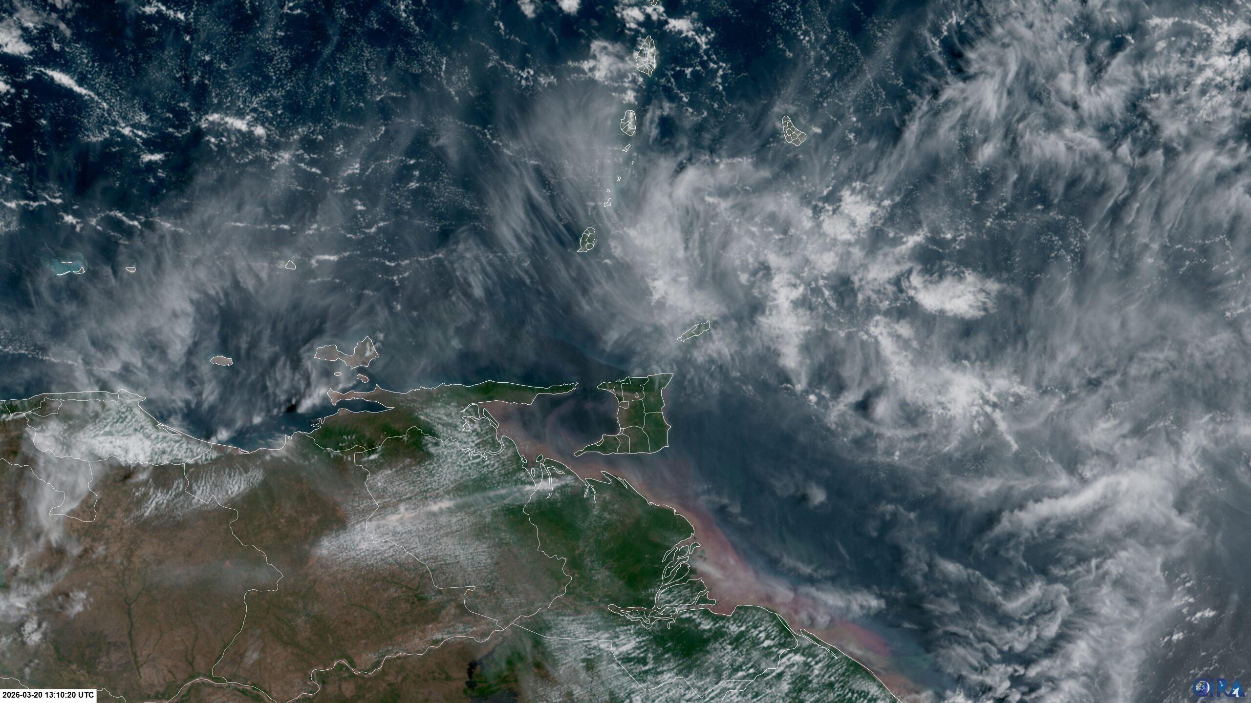
Over the last several days, an Atlantic high-pressure system remained in place across the region, including Trinidad and Tobago, channeling cooler, drier air into the area. This initial air mass inhibited cloud formation at night, with little moisture (water vapor), allowing heat to escape from the ground.
This dry and cool airmass has been traced back to originating over the North Atlantic and making its way down to the Caribbean due to atmospheric circulation over the Atlantic Ocean – namely, the persistent high-pressure system in the North Atlantic.
While moisture and temperature increased on its journey to T&T, the conditions remained dry and stable enough to hinder clouds’ development. Situations like these are not frequent, but they tend to occur several times during our dry season.
However, this isn’t just anomalously dry air. Based on reanalysis data, the airmass that has affected T&T on Friday and will persist through Sunday ranks among the driest air masses affecting the area at this time of year.
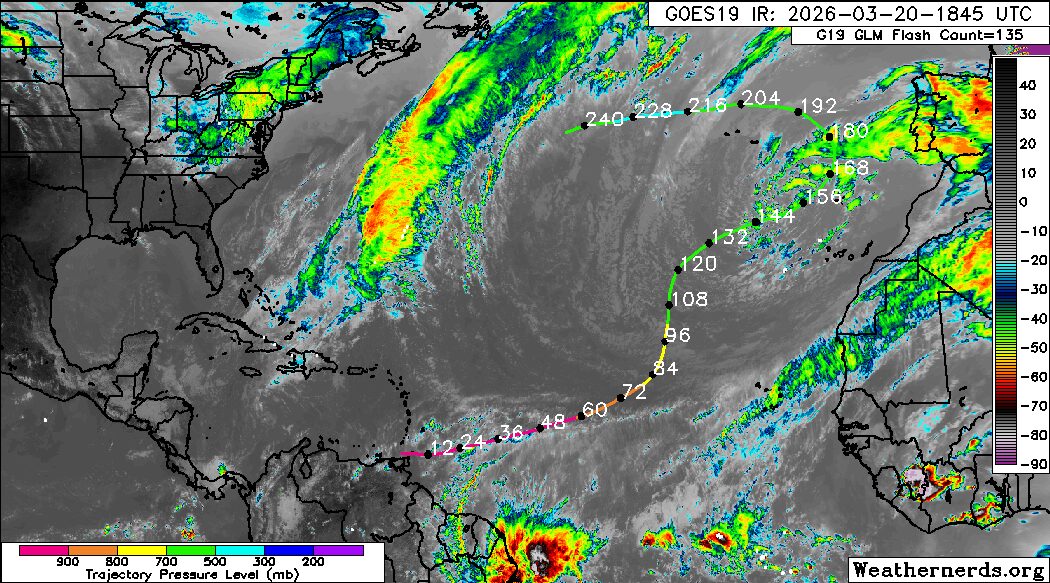
Winds also play a role, with wind speeds dramatically decreasing over the past five days across the area, due to a combination of a weakening cold front in the western Caribbean Sea and a developing low-level trough, set to move across the central and northern Windwards tonight into the weekend.
Low temperatures during this time of year are normal, as the Northern Hemisphere experiences winter, although the official start of spring was today, March 20th.
Cool temperatures across Trinidad result from several factors occurring:
- Low amounts of low-level moisture (water vapor/relative humidity);
- Calm/near-calm winds;
- Little to no cloud coverage;
- Winds originating from the northeast to the north at the lower levels of the atmosphere;
The dew point is the atmospheric temperature below which water droplets begin to condense, and dew can form. Meteorologists can determine the moisture content of the atmosphere near the surface and estimate the minimum temperature.
A lower dew point means that there is less water vapor in the air. Water vapor can absorb and radiate heat back to the surface. Hence, the lower the water vapor content, the more infrared radiation (i.e., long-wave radiation) can escape from the Earth’s surface, leading to rapid cooling.
Lack of cloud cover also leads to fairly warm days, with temperatures reaching 30-32°C.
For vulnerable people who may be especially susceptible to cooler temperatures, such as babies or people with arthritis, it may be best to layer up to keep warm at night.
Forecast Into The Weekend
The short version: Sunny days with clear, cool nights through Sunday evening.
As a weak low-level trough moves across the Lesser Antilles tonight through tomorrow, there will be a marginal increase in low-level moisture across T&T, which will result in slightly warmer nighttime lows on Saturday morning, with temperatures still in the upper teens (18°C to 20°C) in valleys and low-lying interior areas of Trinidad, as well as very high mountain peaks. However, most areas will experience nighttime lows between 21°C and 24°C on Saturday morning, with temperatures trending warmer near the coastlines.
Daytime temperatures will climb between 30°C and 33°C on Saturday, as an even drier airmass moves in by the afternoon.
This dry airmass will linger into Sunday morning and will lead to minimal cloud cover, low moisture, and light winds. As a result, nighttime temperatures could bottom out between 17°C and 19°C across valleys and low-lying interior areas of Trinidad, and even cooler at very high mountain peaks.
By late Sunday, moisture levels begin to tick upwards across T&T, resulting in some passing showers, increased cloudiness, and nighttime lows into Monday trending closer to 22-24°C – still slightly cooler for this time of year.