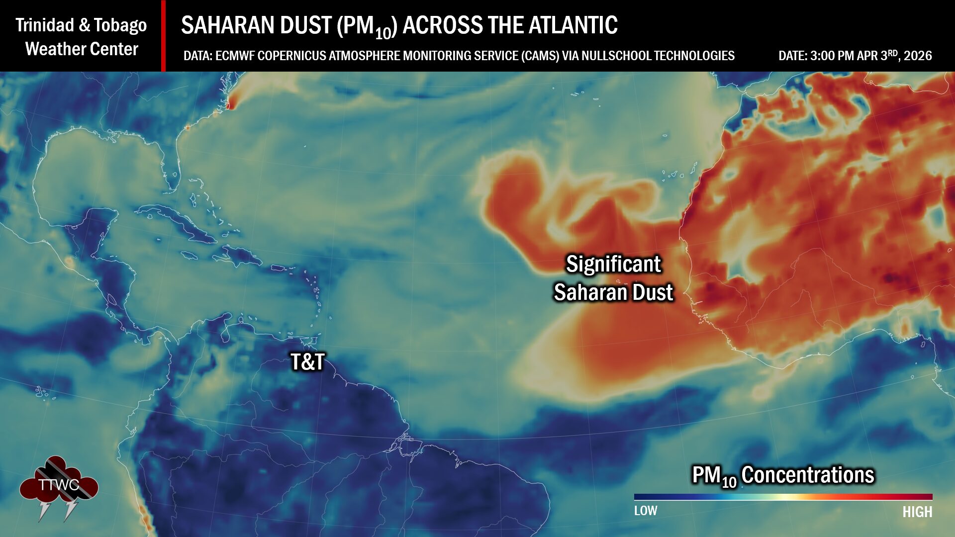
A mild to moderate concentration surge of Saharan Dust is forecast to move across Trinidad and Tobago tonight through Sunday. However, the main dust event is forecast to unfold by midweek, with a major Saharan Dust surge set to move across the Caribbean region, with high dust levels approaching the southeastern United States by the end of the upcoming week. Notably, the highest dust concentrations are forecast to remain north of Trinidad and Tobago through the next ten days.
What you need to know
— Saharan Dust Surges: A mild to moderate concentration surge of Saharan Dust is forecast to move across Trinidad and Tobago tonight through Sunday, July 16th, 2023. For Trinidad and Tobago, through the next ten days, mild to moderate concentrations of dust is forecast to linger, with concentrations becoming high from July 20th into the 21st.
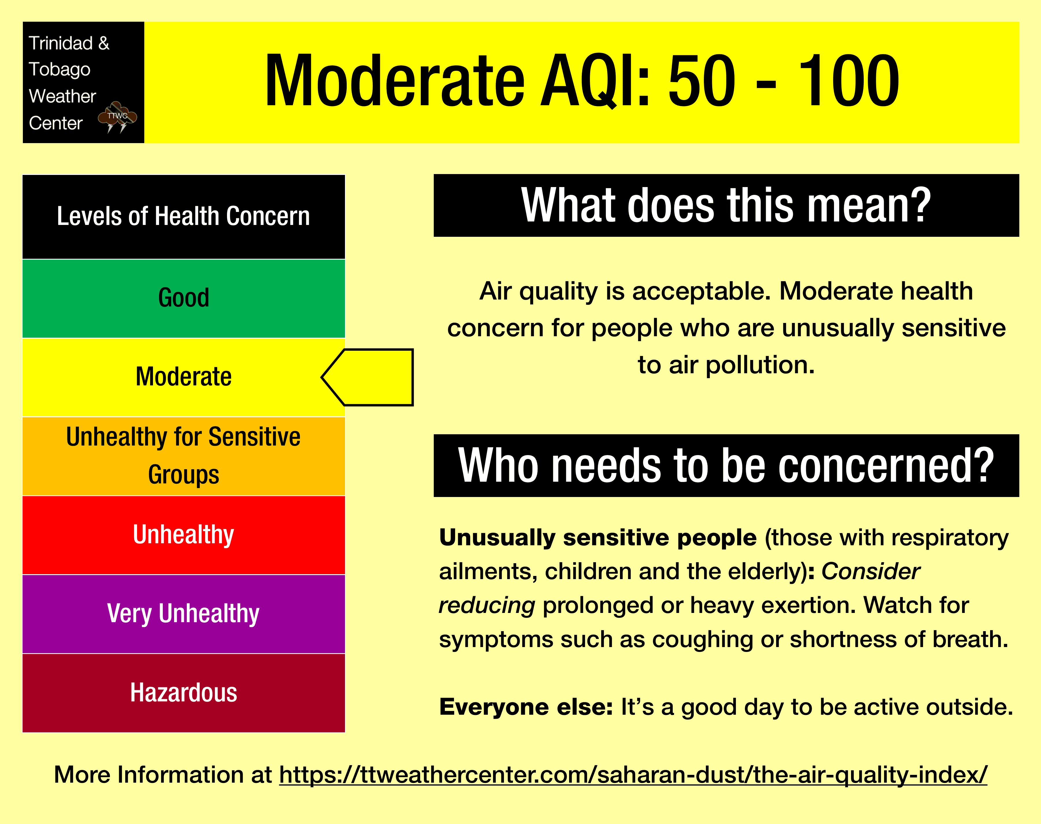
— Impacts: Through the next seven to ten days, air quality levels across Trinidad and Tobago are forecast to remain between good and moderate levels. Islands north of Trinidad and Tobago, particularly from July 18th, could see further reductions in air quality and visibility. Air quality levels may reduce to unhealthy for sensitive groups in T&T between July 20th and 21st.
— What Should You Do: Sensitive groups may need to take the necessary precautions, particularly during high-traffic periods and in the vicinity of bushfires.
Current AQI Levels Across T&T
The official air quality monitoring stations from the Environmental Management Agency (EMA) at Point Lisas, Arima, and San Fernando are reporting good air quality levels. Stations at Beetham, and Signal Hill, Tobago, are not reporting PM2.5 or PM10 data as of Monday afternoon.
These measurements are based on PM2.5 (particulates the size of 2.5 micrometers and smaller, usually associated with increases in Saharan Dust, vehicle exhaust, and smoke) and PM10 particulates.
Over the last 24 hours, visibility remained unaffected by Saharan Dust and smoke at the A.N.R. Robinson International Airport at Crown Point, Tobago, and at the Piarco International Airport, Trinidad.
Saharan Dust Forecast
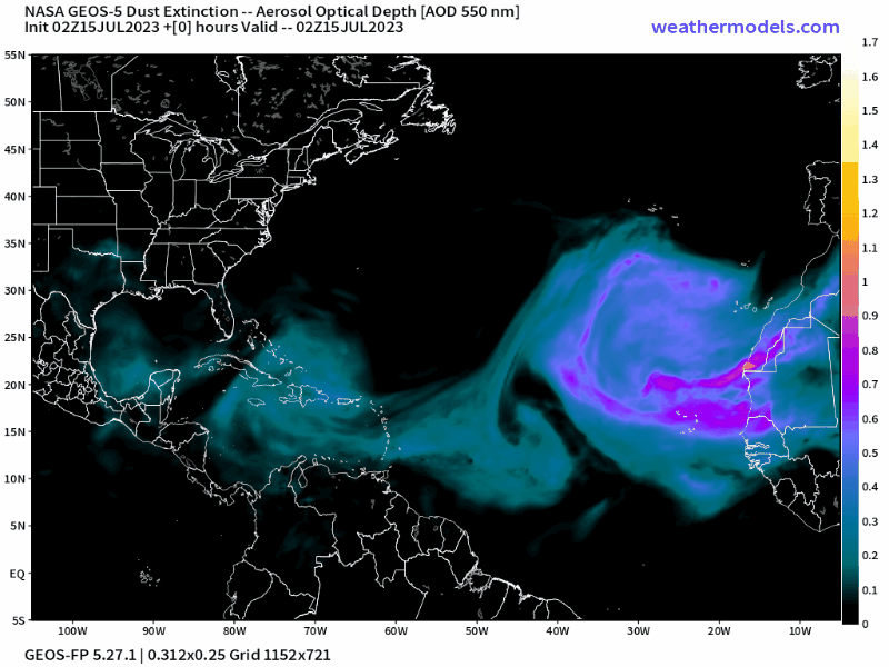
Major Mid-Week Saharan Dust Surge
Following the passage of Tropical Wave 23 on Saturday, July 15th, 2023, a mild to moderate surge of dust is forecast to move across T&T and the Lesser Antilles. Dust levels are forecast to remain relatively unchanged as Tropical Wave 24 moves through the region on Tuesday, July 18th, 2023.
However, following this wave’s passage, a significant Saharan Dust surge is forecast to move across the Leewards and northern Windwards, with moderate to high dust levels moving across the central and southern Windwards, including Trinidad and Tobago, through the upcoming week. Specifically for Trinidad and Tobago, dust levels will be high between July 20th and 21st, with some improvement into the weekend.
This significant surge of dust will continue progressing westward in the North Atlantic Ocean through the week, with high dust concentrations making it to the Greater Antilles by the end of the upcoming week and the southeastern United States by the weekend.
For Trinidad and Tobago, dust levels are forecast to remain elevated through the end of the forecast period, with longer-range modelling suggesting Saharan Dust remaining across the Lesser Antilles through the end of July.
Through the next seven to ten days, air quality levels across Trinidad and Tobago are forecast to remain between good and moderate levels. Islands north of Trinidad and Tobago, particularly from July 18th, could see further reductions in air quality and visibility. Air quality levels may reduce to unhealthy for sensitive groups in T&T between July 20th and 21st.
What does this mean for you?
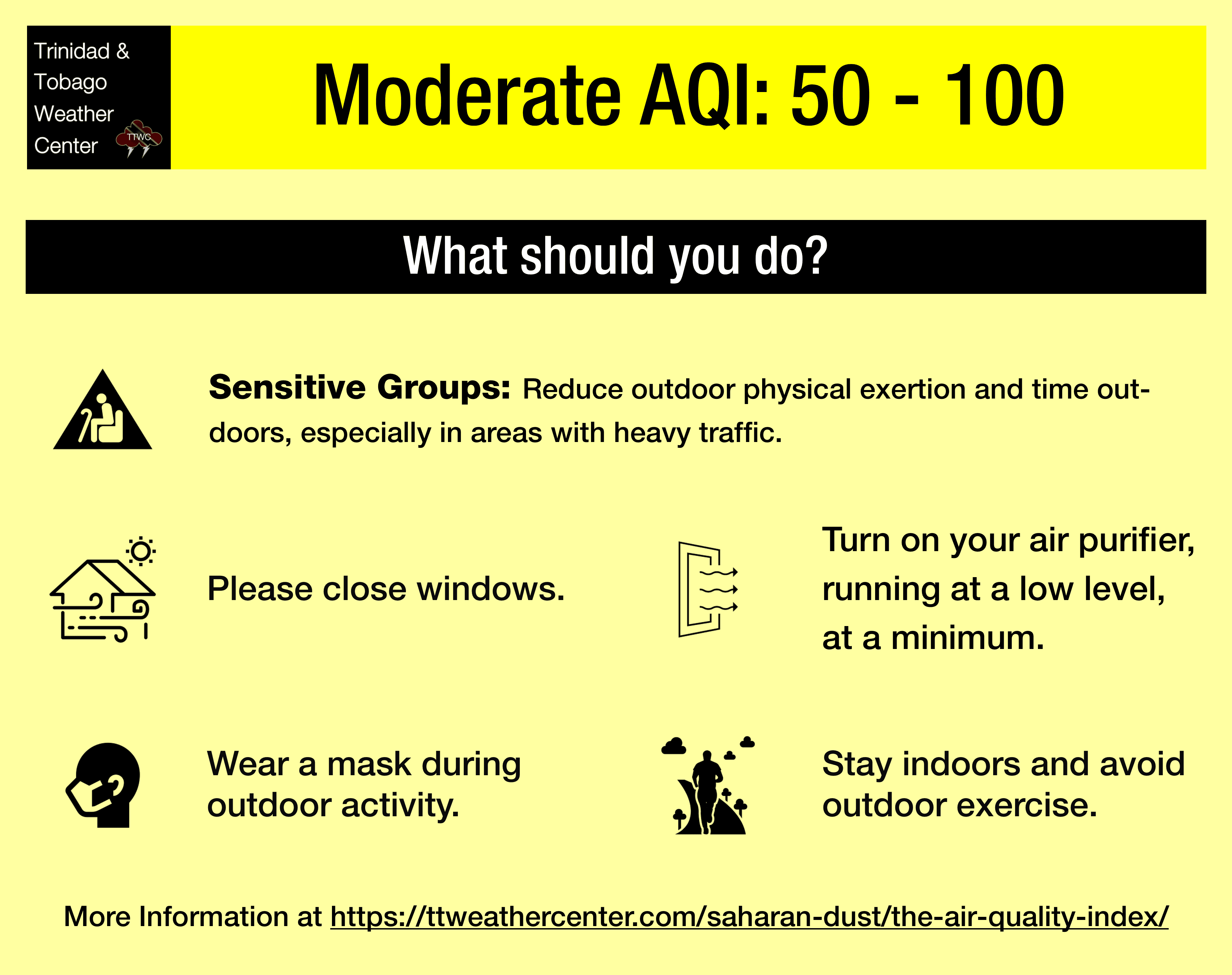
The air quality is forecast to be lowered primarily during high traffic periods, particularly between 6:00 AM and 9:00 AM and again from 3:00 PM through 6:30 PM.
We’re in a period where the Intertropical Convergence Zone and tropical waves and occasional tropical cyclones may shield Trinidad and Tobago from the Saharan Dust events. While Tropical Waves play a notable role in moving dust across the Atlantic and the Eastern Caribbean, these periodic tropical waves also improve air quality.
The concentration of the dust that follows the wave depends on its strength as it moves off the West African Coast. This is because of stronger thunderstorms across Central Africa. As strong winds move downward and outward from these thunderstorms, the wind kicks up dust as it moves across parts of the Saharan Desert and transports it into the upper atmosphere. This “plume” of dust follows the axis of the wave as it progresses westward into the Atlantic.
Dust that makes it into the upper levels of the atmosphere can then get transported across the Atlantic Ocean. The plumes of dust eventually affect the Eastern Caribbean.
Larger, more concentrated plumes of Saharan dust begin in April and continue through November.