Two surges of Saharan Dust are forecast over the next seven days, with both set to reduce the air quality index to at least moderate levels.
What you need to know
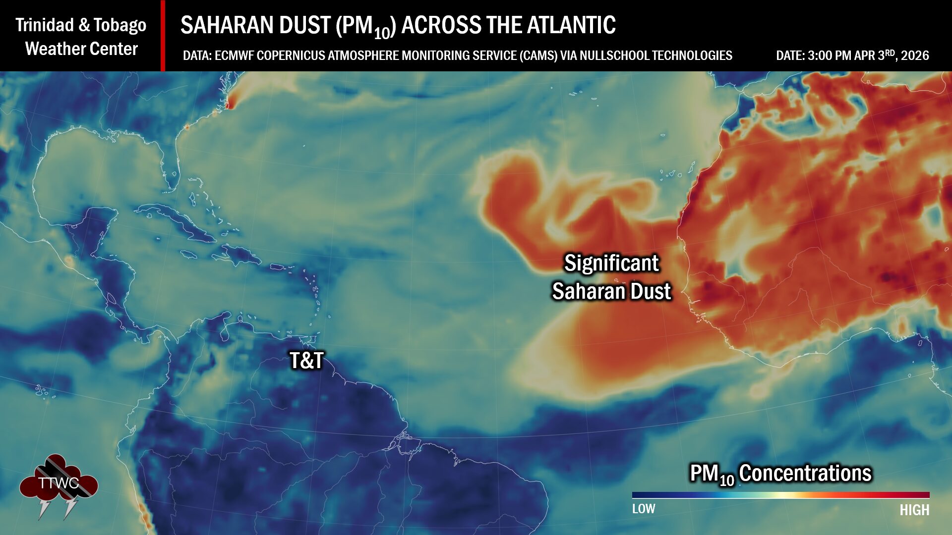
— Saharan Dust Surges: A mild to moderate surge of Saharan Dust is forecast to move across Trinidad and Tobago on Sunday through Monday, with another round of dust, potentially moderate to high concentrations, arriving by Wednesday.
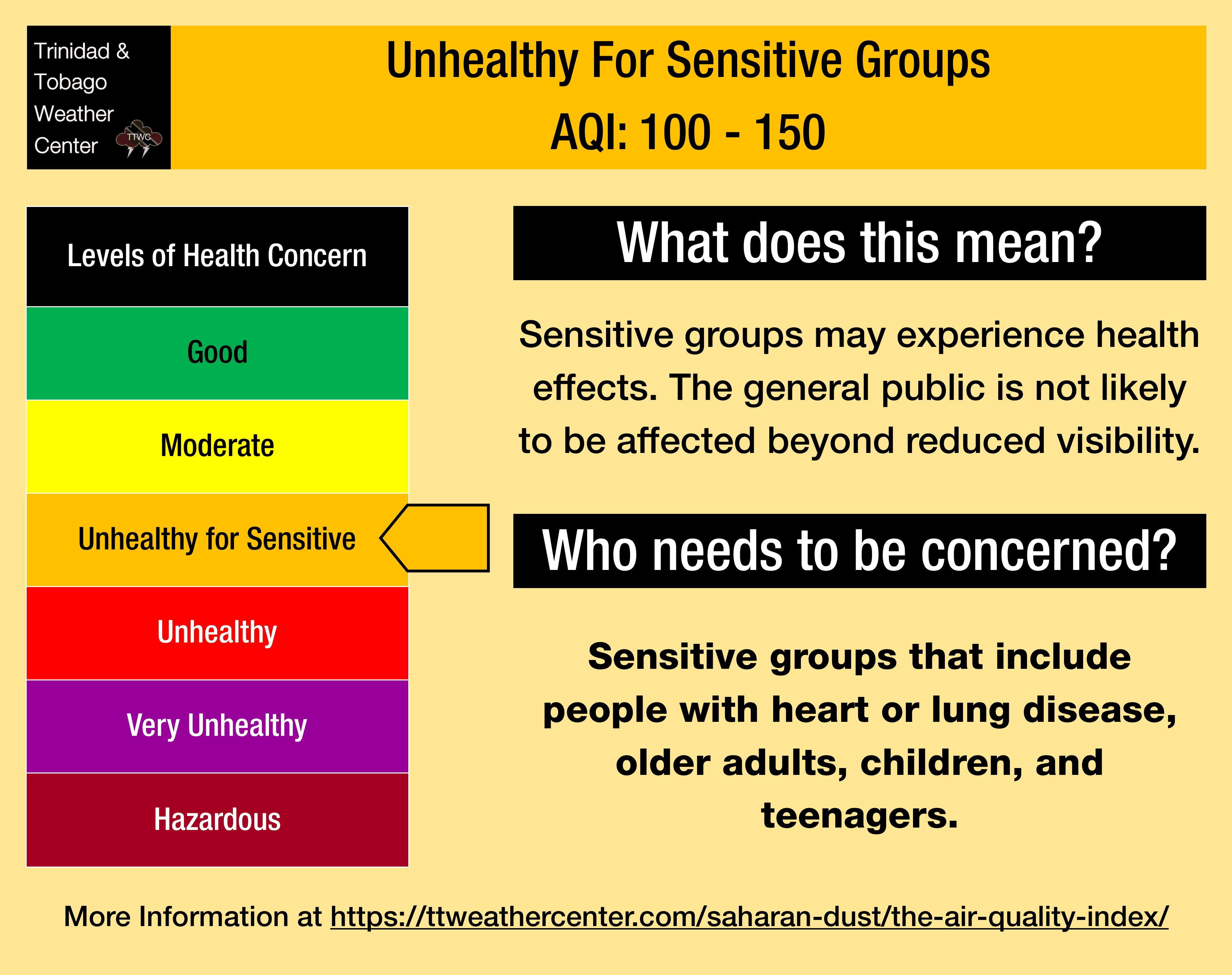
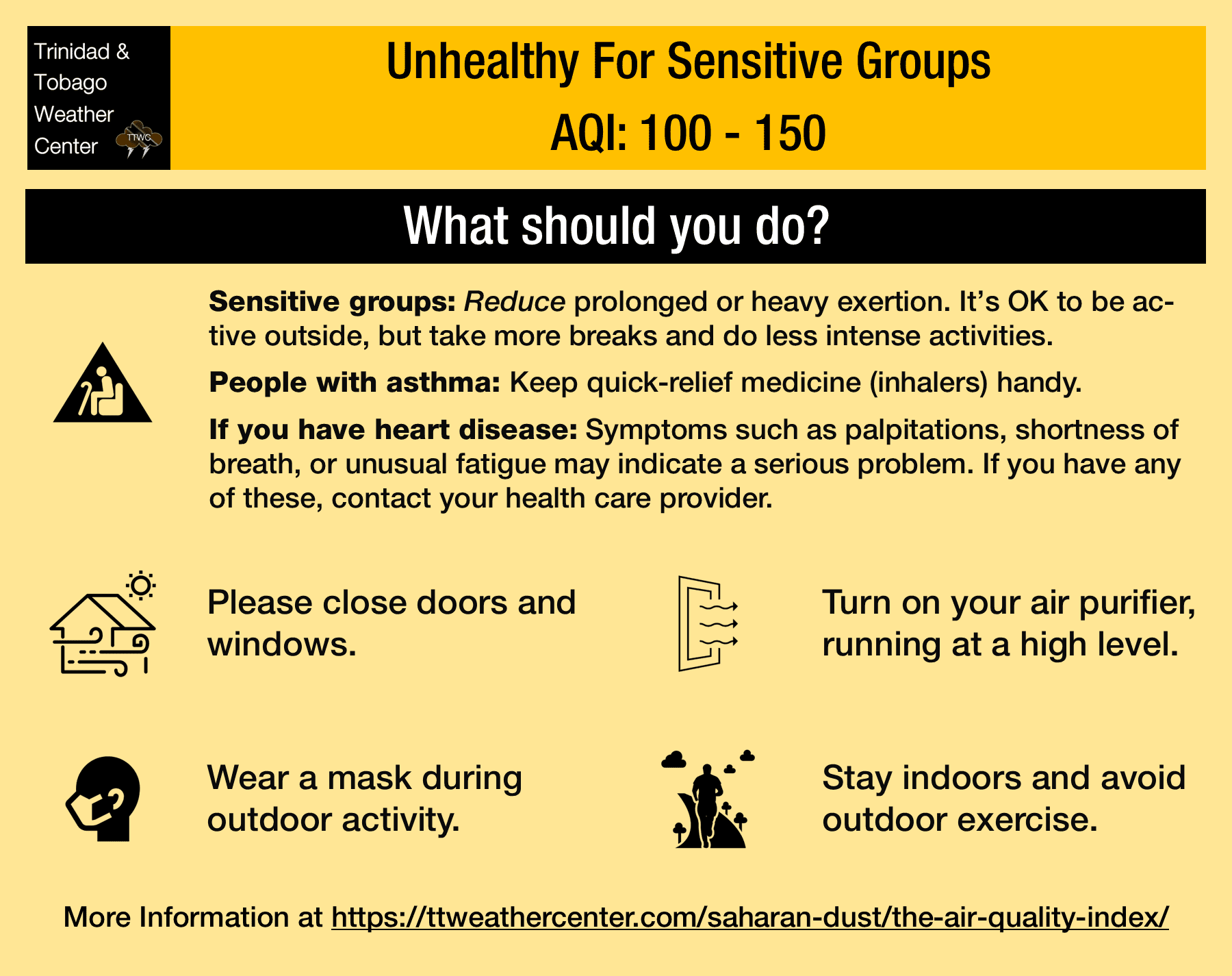
— What Should You Do: Sensitive groups should continue to take the necessary precautions, particularly during high traffic and in the vicinity of fires.
Current AQI Levels Across T&T
As of 4:00 PM March 14th, 2026, all official air quality monitoring stations from the Environmental Management Agency (EMA) are not reporting PM2.5 (particulates smaller than 2.5 micrometers in size, typically associated with increases in Saharan Dust, vehicle exhaust, and smoke) and PM10 particulate data.
However, unofficial air quality monitoring stations in Longdenville and Woodbrook report good air quality.
Outside of rainfall, visibility, used as a proxy for Saharan Dust concentrations, is 10 kilometers at A.N.R. Robinson International Airport at Crown Point, Tobago, and at Piarco International Airport, Piarco, Trinidad.
Editor’s note: The EMA’s air quality dashboard has not been reporting PM2.5 or PM10 particulate data for some time due to equipment upgrades. Although the EMA’s dashboard may show good air quality during this week, the data are based on carbon monoxide, ozone, nitrous oxide, and sulphur dioxide measurements, not on Saharan Dust particulates.
Saharan Dust Forecast For T&T
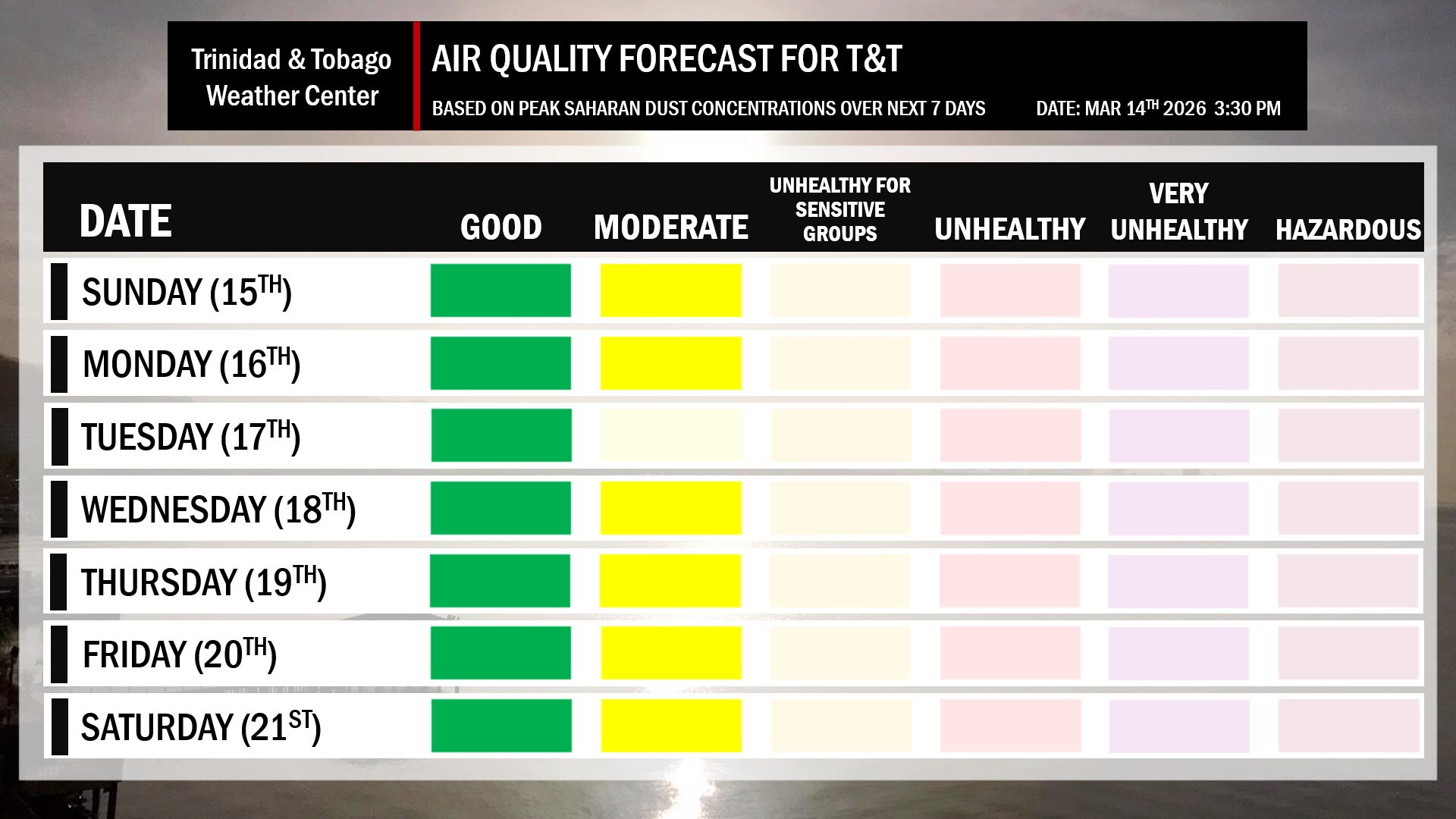
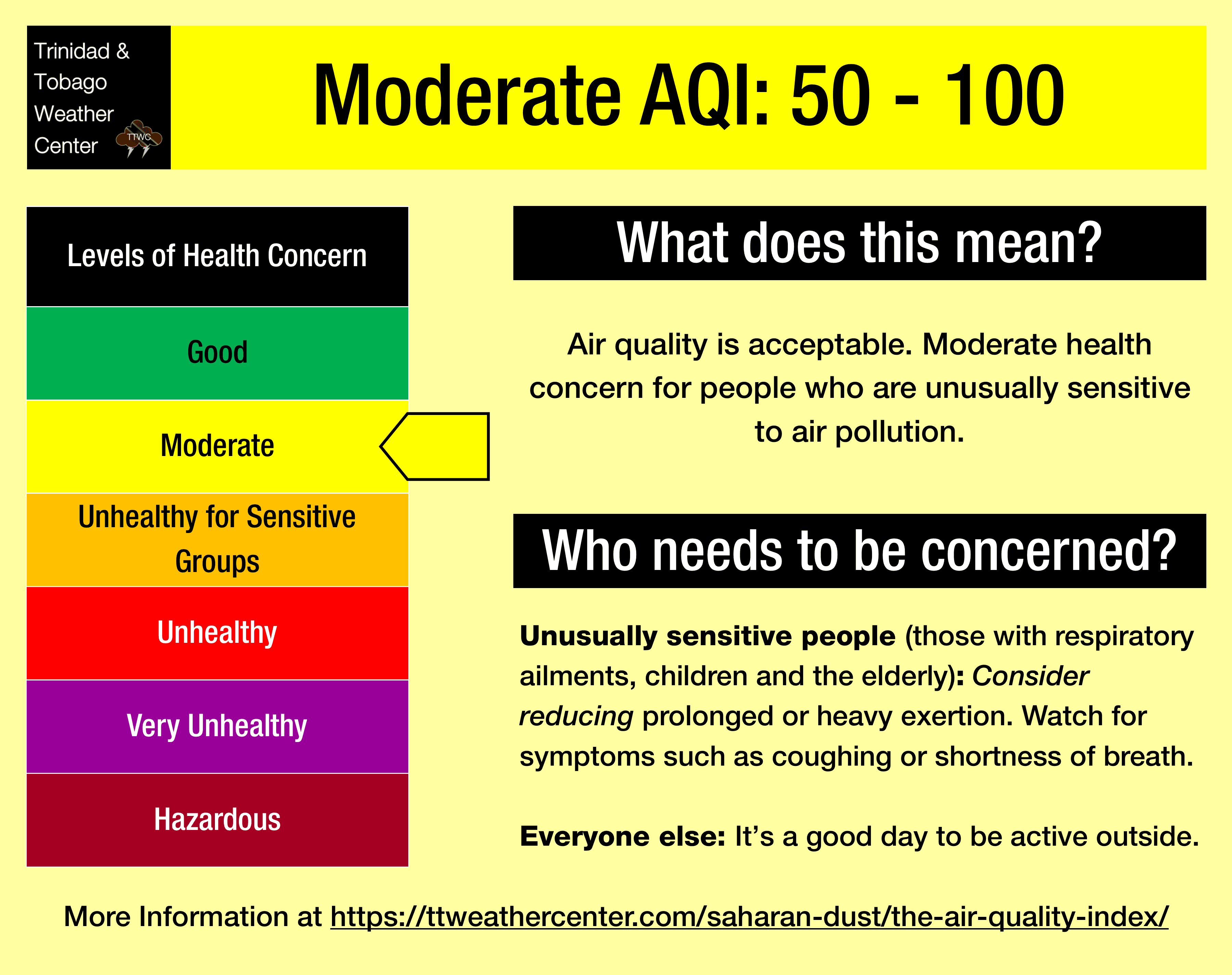
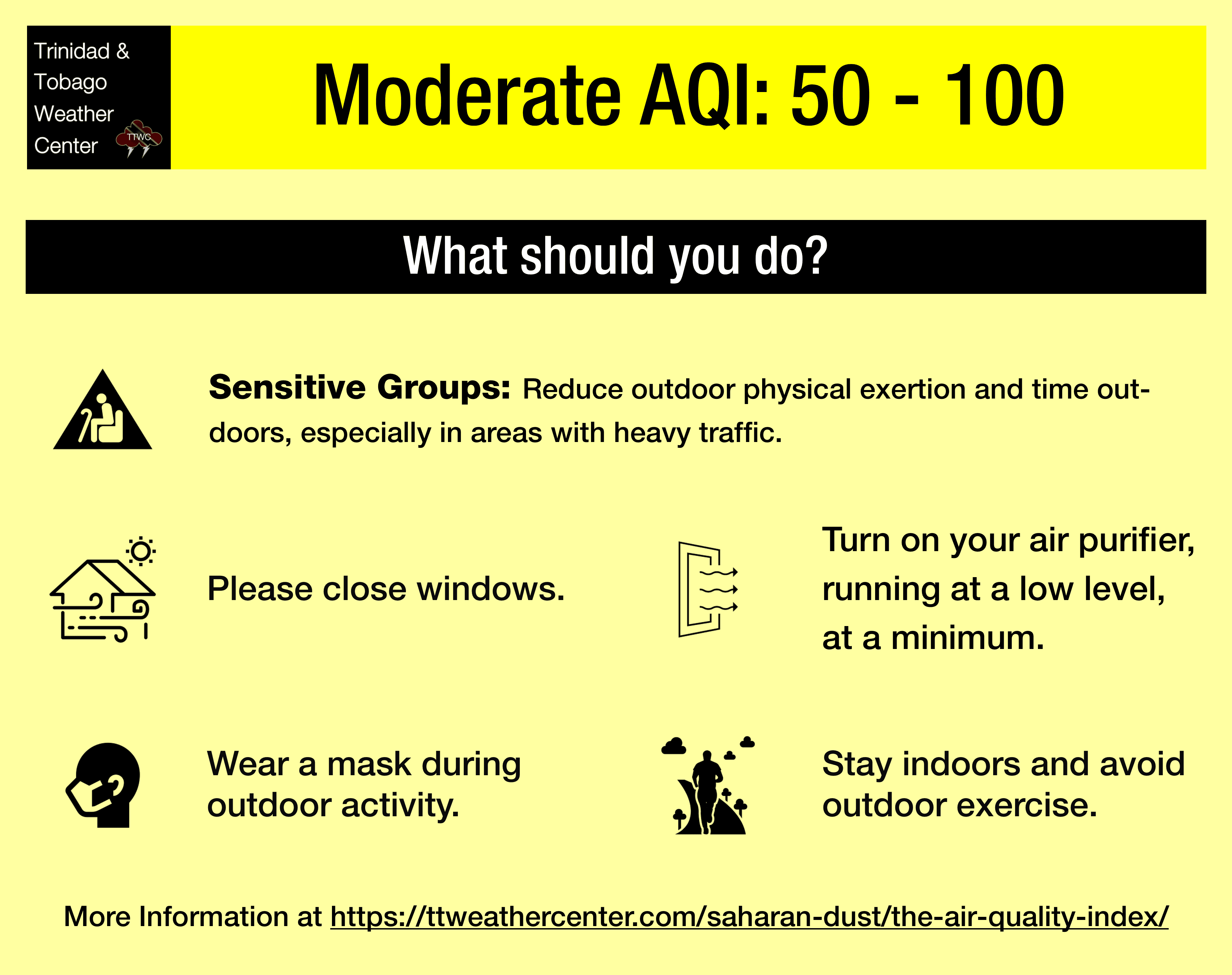
March 15th-16th: Moderate concentrations of Saharan Dust across T&T. Air quality levels at moderate. Horizontal visibility marginally affected, near 9-10 kilometers.
March 17th: Little to no Saharan Dust across T&T. Air quality level at good. Horizontal visibility is unaffected.
March 18th-21st: Moderate to high concentrations of Saharan Dust across T&T. Air quality levels at moderate to unhealthy for sensitive groups (particularly on Wednesday, March 18th). Horizontal visibility affected, near 7-10 kilometers.
What does this mean for you?
Over the next seven days, air quality across Trinidad and Tobago will be reduced, with peak dust concentrations likely on March 18th. However, with drier conditions increasing the risk of fires, air quality may be further reduced locally in areas affected by fires, smoke, dust, and high traffic.
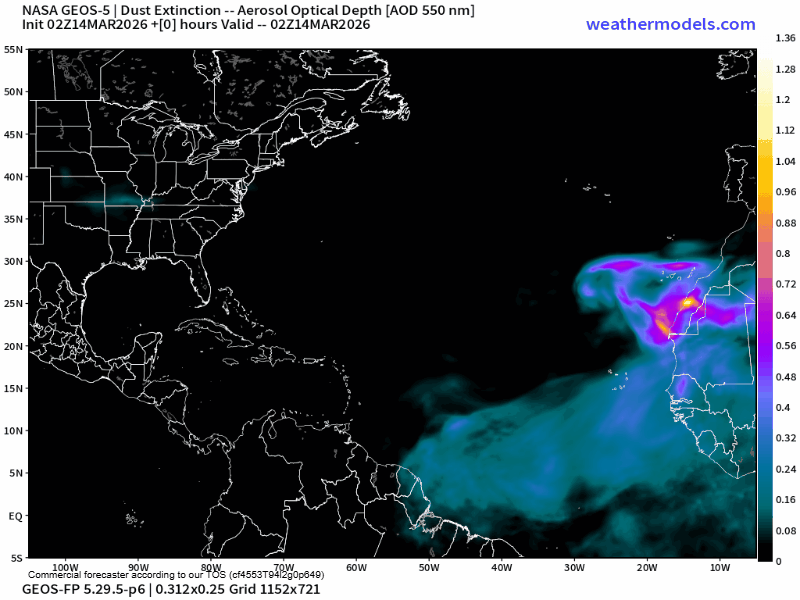
We’ve entered a period in which a ridge of high pressure remains over the central Sahara Desert, while the Intertropical Convergence Zone (ITCZ) remains over the Gulf of Guinea, extending southwestward to Brazil. The Harmattan wind (see below) accelerates when it blows across the mountain massifs of Northwest Africa. If its speed is high enough and it blows over dust source regions, it lifts the dust and disperses it.
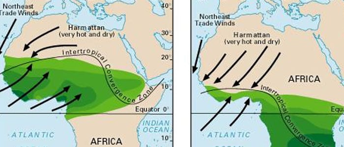
The dust surges during this time of year are due to the Harmattan, a season across the West African subcontinent that occurs between the end of November and the middle of March. During this season, a predominant northeasterly trade wind (dubbed the Harmattan Winds) blows from the Sahara Desert over Western Africa into the Gulf of Guinea.
Dust that reaches the upper levels of the atmosphere can then be transported across the Atlantic Ocean and affect the Eastern Caribbean. These Saharan Dust outbreaks tend to be milder in the Eastern Caribbean.
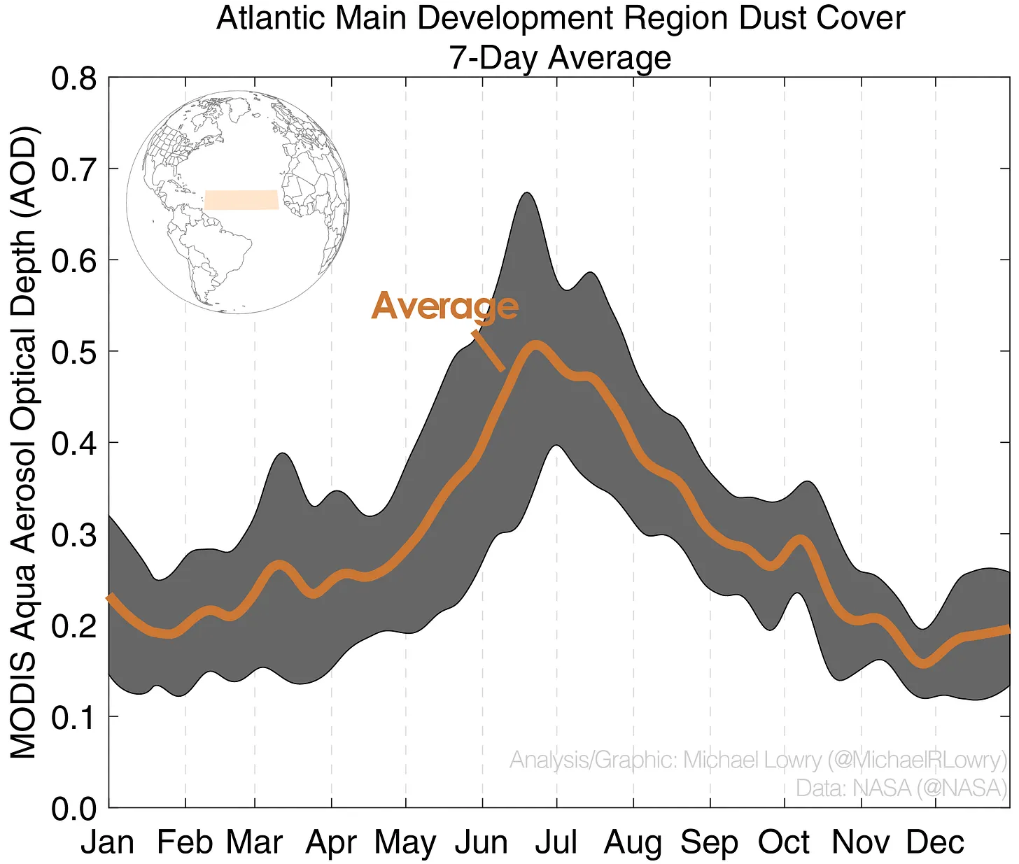
Larger, more concentrated plumes of Saharan dust begin in April and continue through November.