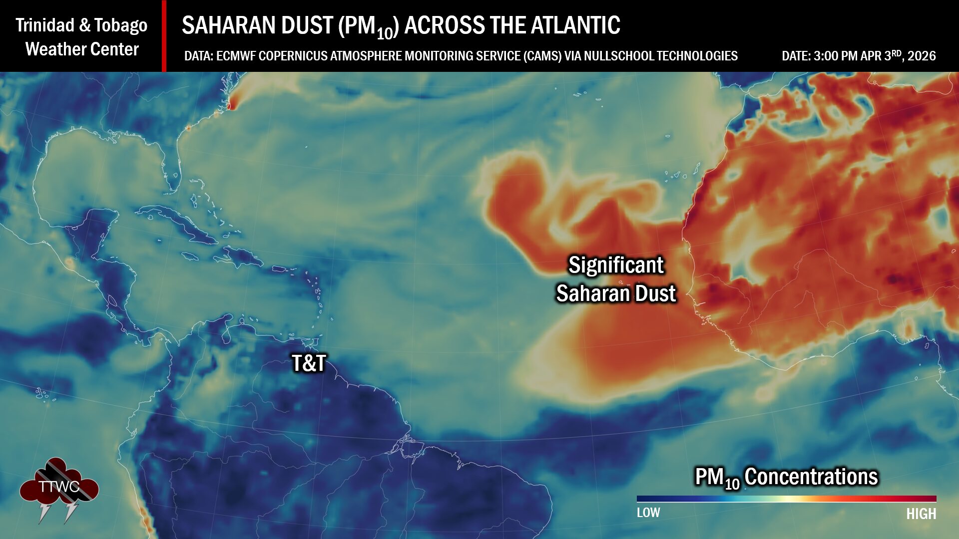
Forecast models continue to indicate Saharan Dust will increase significantly across Trinidad, Tobago, and the Eastern Caribbean from late Thursday, June 1st, 2023, though higher concentrations are forecast to remain north of Trinidad and Tobago.
What you need to know
— Saharan Dust Surges: A moderate to high-concentration surge of Saharan Dust is forecast to begin affecting Trinidad and Tobago from late Thursday, June 1st, 2023, with periodic surges through June 10th, 2023.
— Impacts: Through the next seven to ten days, air quality levels across Trinidad and Tobago are forecast to remain near moderate levels, with occasional improvement during the passages of tropical waves. From Friday, June 2nd, 2023, air quality could occasionally reach levels that are unhealthy for sensitive groups.
— What Should You Do: Sensitive groups may need to take the necessary precautions, particularly during high-traffic periods and in the vicinity of bushfires.
Current AQI Levels Across T&T
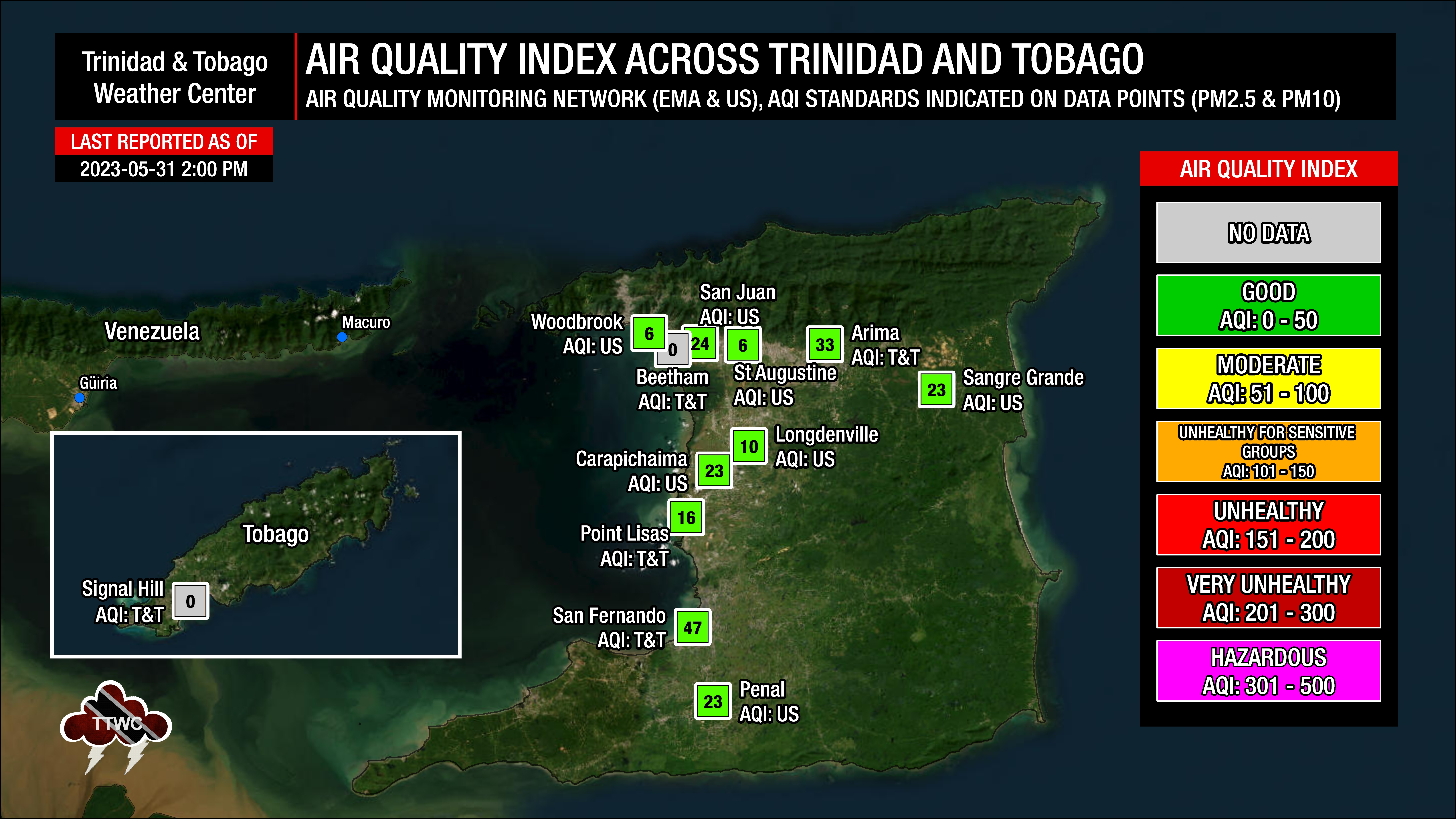
The official air quality monitoring stations from the Environmental Management Agency (EMA) at San Fernando, Point Lisas, and Arima are reporting good air quality levels, with no data being reported at Beetham, Port of Spain, and Signal Hill, Tobago, in line with current dust levels based on model data.
These measurements are based on PM2.5 (particulates the size of 2.5 micrometers and smaller, usually associated with increases in Saharan Dust, vehicle exhaust, and smoke) and PM10 particulates.
Over the last 24 hours, visibility remained unaffected by Saharan Dust and smoke at the A.N.R. Robinson International Airport at Crown Point, Tobago, and the Piarco International Airport, Trinidad.
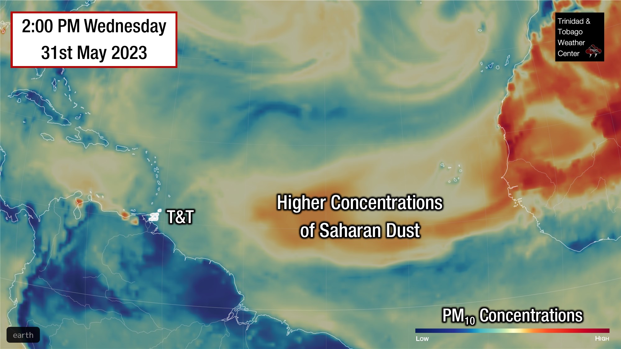
Saharan Dust Forecast
Next Surges of Saharan Dust
Throughout Thursday, June 1st, 2023, Saharan Dust levels are forecast to increase across the southern and central Windward islands, including Trinidad and Tobago. From Thursday evening, moderate to high concentrations of Saharan Dust is forecast to move across the area, with higher concentrations generally remaining north of Trinidad and Tobago.
Brief improvement is forecast on early Saturday, in tandem with the passage of a tropical wave, but moderate to high Saharan Dust levels are forecast to return across the Lesser Antilles.
A high-pressure system, anchored just northeast of the Leeward Islands, will keep a conveyor belt of Saharan Dust streaming towards the Lesser Antilles through the first two weeks of June.
Through the next seven to ten days, air quality levels across Trinidad and Tobago are forecast to remain near moderate levels, with occasional improvement during the passages of tropical waves. From Friday, June 2nd, 2023, air quality could occasionally reach levels that are unhealthy for sensitive groups.
What does this mean for you?
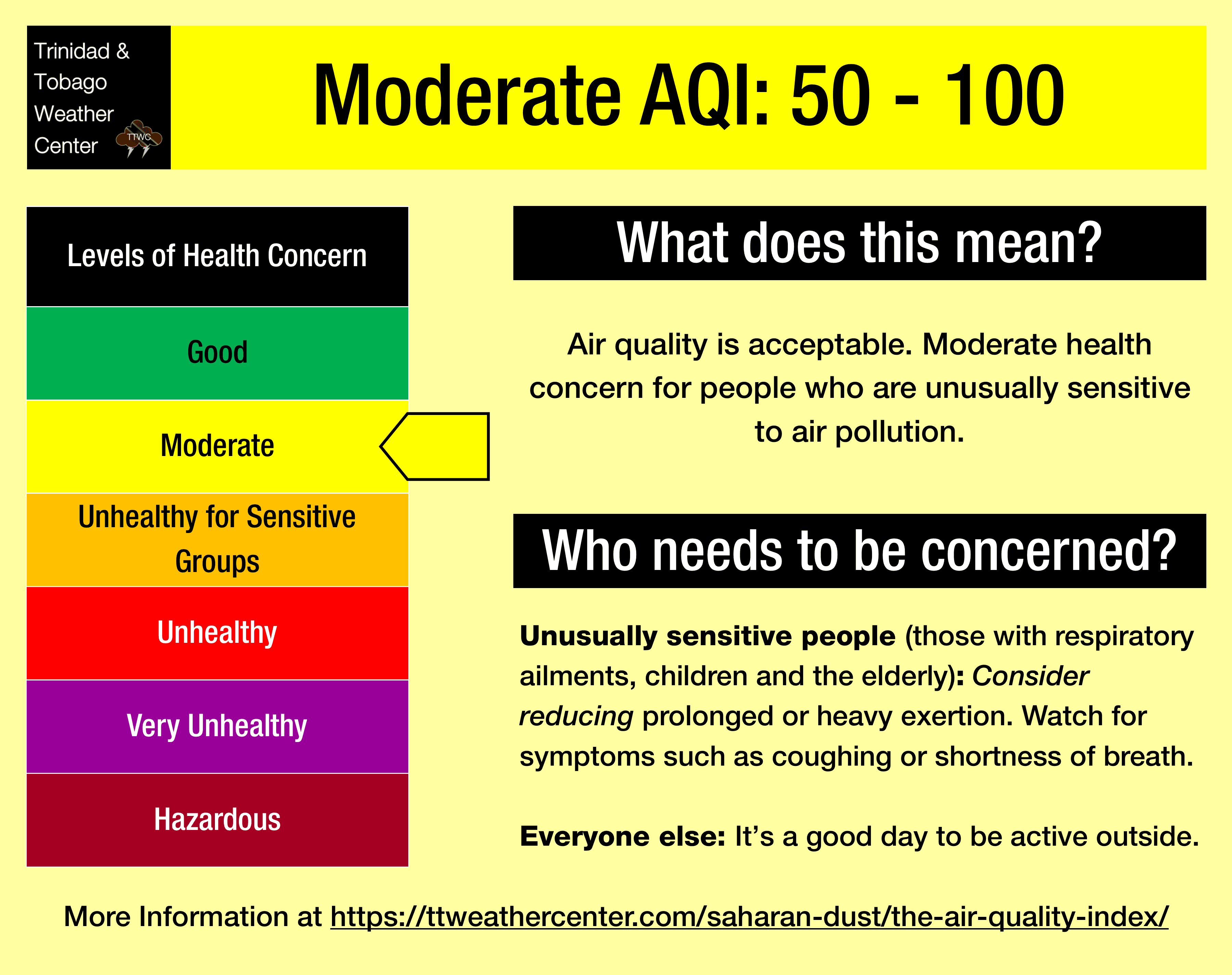
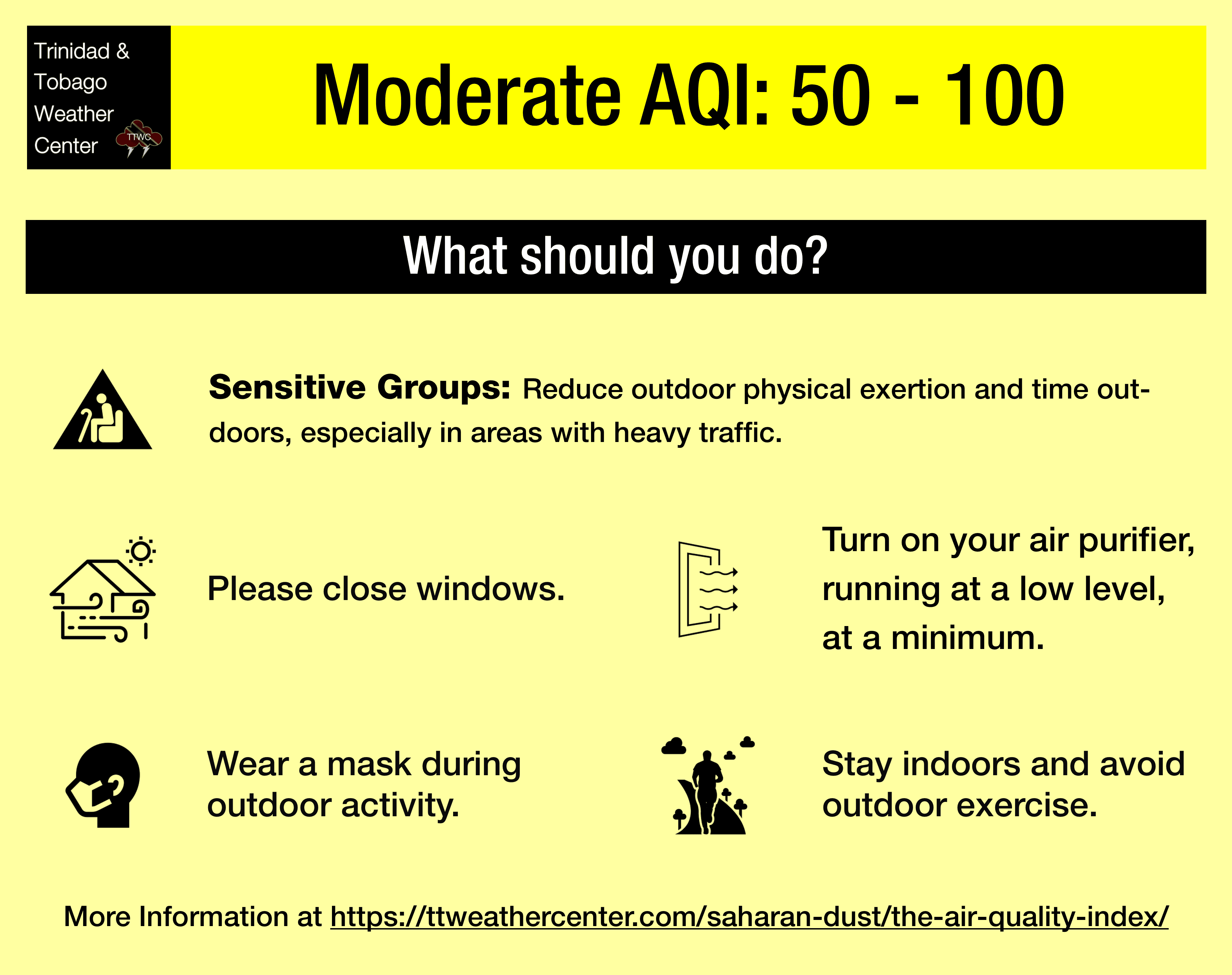
The air quality is forecast to be lowered primarily during high traffic periods, particularly between 6:00 AM and 9:00 AM and again from 3:00 PM through 6:30 PM, as well as during times of blowing smoke and dust from bushfires.
We’re in a period where the Intertropical Convergence Zone and tropical waves and occasional tropical cyclones may shield Trinidad and Tobago from the Saharan Dust events. While Tropical Waves play a notable role in moving dust across the Atlantic and the Eastern Caribbean, these periodic tropical waves also improve air quality.
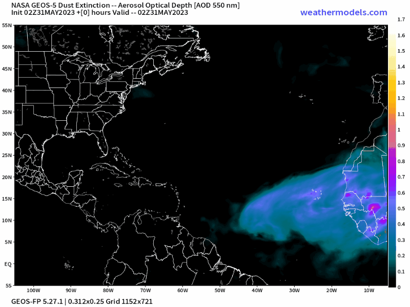
The concentration of the dust that follows the wave depends on its strength as it moves off the West African Coast. This is because of stronger thunderstorms across Central Africa. As strong winds move downward and outward from these thunderstorms, the wind kicks up dust as it moves across parts of the Saharan Desert and transports it into the upper atmosphere. This “plume” of dust follows the axis of the wave as it progresses westward into the Atlantic.
Dust that makes it into the upper levels of the atmosphere can then get transported across the Atlantic Ocean. The plumes of dust eventually affect the Eastern Caribbean.
Larger, more concentrated plumes of Saharan dust begin in April and continue through November.