


A cluster of showers and thunderstorms east of Trinidad is gradually drifting towards the island. While activity seems to be dissipating as it nears the island, there is still a high chance of impactful showers and thunderstorms affecting mainly Trinidad over the next few hours, causing additional flooding.
What you need to know
— Rainfall: Additional periods of rain, moderate to heavy showers, and isolated to scattered thunderstorms are forecast, interrupting overcast skies. Peak intense activity, including isolated heavy to violent showers and intense thunderstorms, is forecast through Thursday afternoon. Overall additional rainfall totals between 25 and 50 millimeters are forecast across both islands.
— Hazards: Street/flash flooding is expected. Riverine flooding will be exacerbated across the South Oropouche River Basin. Wind gusts in excess of 55 KM/H accompanying heavy showers or thunderstorms are likely. Lightning will accompany thunderstorms. Landslides are possible across both islands. Seas are forecast to become agitated.
— Alerts/Watches/Warnings: A Riverine Flood Alert (Yellow Level) went into effect for the South Oropouche River Basin from 9:00 AM Thursday, September 22nd, 2022, and remains in effect through 9:00 AM Saturday, September 24th, 2022, from the Trinidad and Tobago Meteorological Service. The Adverse Weather Alert (Yellow Level) went into effect for Trinidad and Tobago from 5:00 AM Wednesday, September 21st, 2022, and remains in effect through 8:00 PM Thursday, September 22nd, 2022, from the Trinidad and Tobago Meteorological Service. There are no tropical storm or hurricane watches or warnings in effect for T&T at this time.
The Adverse Weather Alert
The Trinidad and Tobago Meteorological Service updated the Adverse Weather Alert (Yellow Level) on Thursday morning. The alert initially went into effect for Trinidad and Tobago from 5:00 AM Wednesday, September 21st, 2022, and remains in effect through 8:00 PM Thursday, September 22nd, 2022.
Trinidad and Tobago is not under any tropical storm watch or warning at this time.
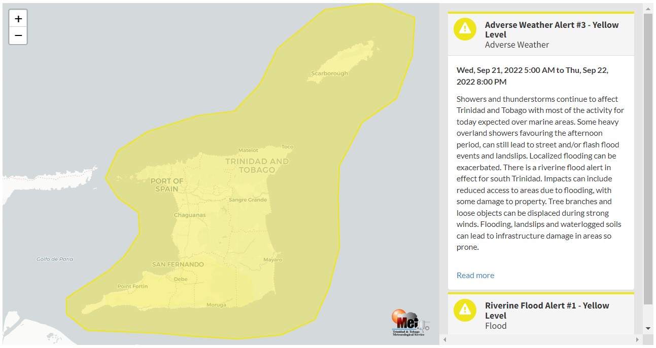
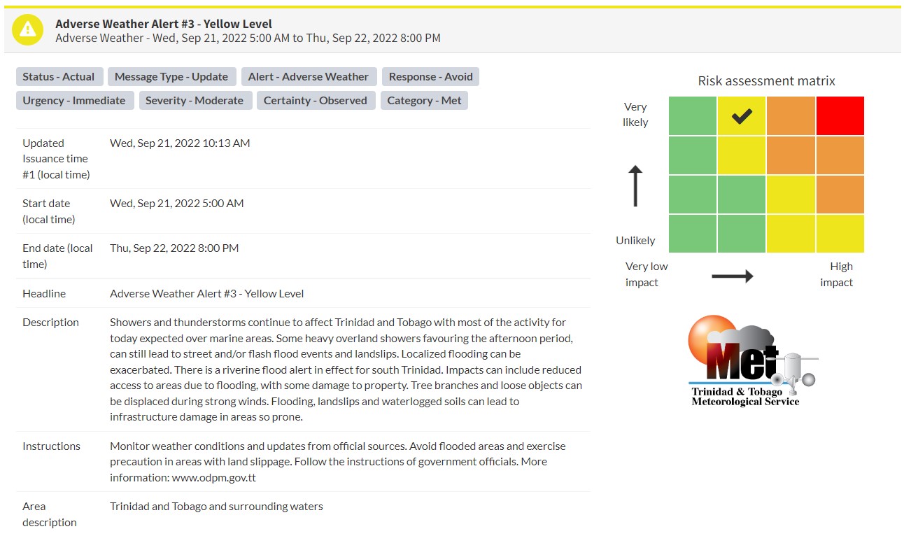
“Showers and thunderstorms continue to affect Trinidad and Tobago, with most of the activity for today expected over marine areas. Some heavy overland showers favouring the afternoon period, can still lead to street and/or flash flood events and landslips. Localized flooding can be exacerbated. There is a riverine flood alert in effect for south Trinidad. Impacts can include reduced access to areas due to flooding, with some damage to property. Tree branches and loose objects can be displaced during strong winds. Flooding, landslips, and waterlogged soils can lead to infrastructure damage in areas so prone.” according to the Trinidad and Tobago Meteorological Service. This “alert” status takes into account the possibility of the event occurring. This adverse weather event has been observed.

The color of the alert indicates the severity of the event and the probability of the event occurring. Currently, the alert level is Yellow. This means that the hazards have been observed, and the severity of the impacts is moderate for this particular alert. You should be aware of the hazards in your area associated mainly with gusty winds in excess of 55 KM/H, street and flash flooding, riverine flooding, landslides, as well as frequent lightning.
For a moderate Adverse Weather Alert, there is the potential for possible injuries, where behavioral changes are required to ensure safety. There may be minor damage to property, with income-earning temporarily disrupted and a couple of communities affected.
The Met Office is advising the public to monitor weather conditions and updates from official sources, plan safety measures and follow the instructions of government officials.


