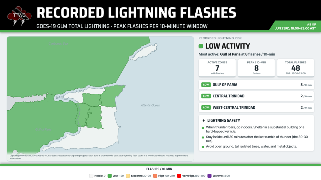
While the skies lit up on Tuesday night as thunderstorms moved across Trinidad, lights across the country dimmed briefly due to what the Trinidad and Tobago Electricity Commission (T&TEC) described as a “significant voltage dip” caused by lightning.
At 9:15 PM, according to T&TEC, adverse lightning activity in central Trinidad caused two circuits between the Brechin Castle and Debe 132 kV Substations to trip, and they were automatically reclosed by the built-in protection system. T&TEC assures that there was no interruption to the supply of residential customers.
They are also assuring the public that the national electricity grid remains stable following the significant voltage dip.
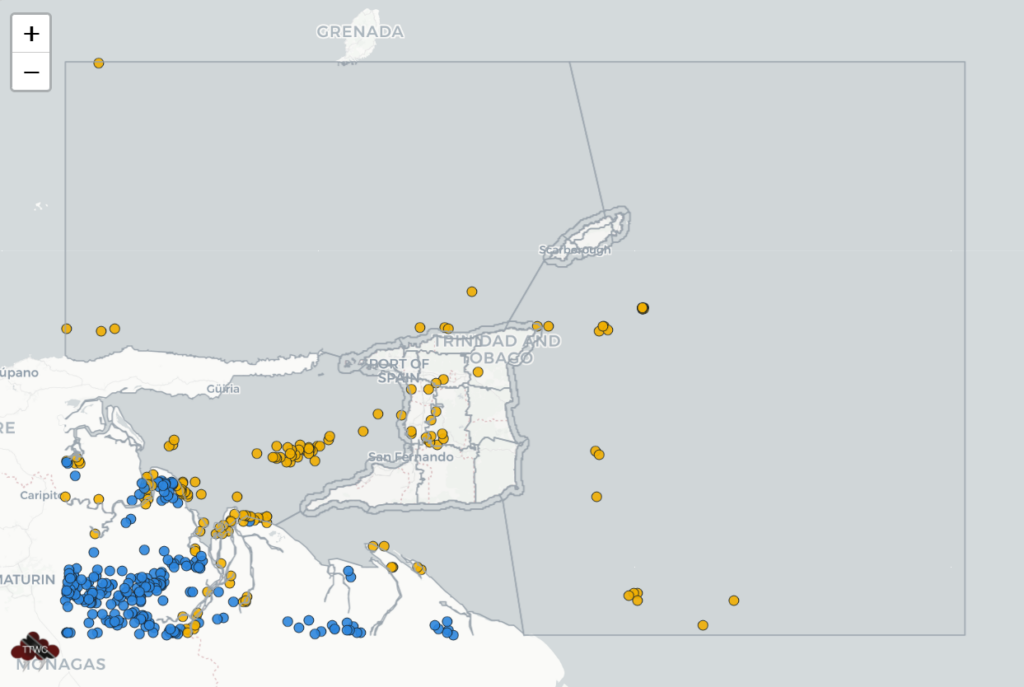
A tropical wave moved across Trinidad and Tobago on Tuesday, with trailing convergence now bringing scattered showers and thunderstorms, mainly across Trinidad, Tuesday night into Wednesday.
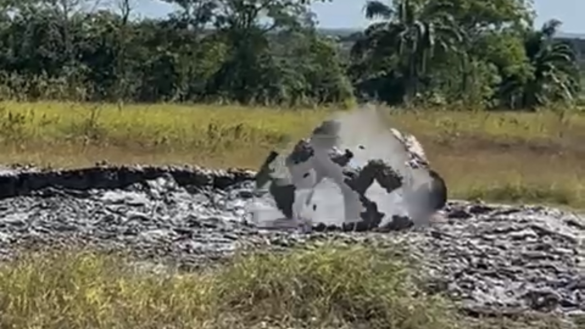
Gusty winds and locally heavy rainfall remain the primary hazards with this tropical wave. Already, trees have fallen in Port of Spain, damaging three vehicles at the Port of Spain General Hospital, two of which sustained significant damage, and another at Manicou Trace, Tableland, blocking the roadway and bringing down utility lines.
10:00 PM – Manicou Trace, Tableland is blocked due to a fallen tree and utility lines, approximately 190 meters off the Naparima Mayaro Road.
— TTWeatherCenter (@TTWeatherCenter) June 24, 2026
Gusty winds are likely to accompany heavy downpours and thunderstorms through tonight and Wednesday.
Forecast: https://t.co/GLXyTLjBKV pic.twitter.com/R5OsvQM2Px
Additional heavy showers and thunderstorms remain forecast for T&T through Wednesday afternoon. Then, a surge of moderate-to-high-concentration Saharan Dust is forecast to move in across the Lesser Antilles. Air quality is forecast to reach moderate by Thursday morning, and then unhealthy for sensitive groups by Thursday evening. Higher dust concentrations are forecast to remain north of T&T.