


Heavy showers and thunderstorms are forecast for Trinidad and Tobago through Thursday, associated with an approaching tropical wave that is being monitored for tropical cyclone development. In contrast to the previous alert, severe impacts are no longer forecast, with moderate impacts expected.
What you need to know
— Rainfall: Through Friday, periods of rain, moderate to heavy showers, and isolated to scattered thunderstorms are forecast, interrupting variably cloudy skies. Peak intense activity, including isolated heavy to violent showers and intense thunderstorms, is forecast on Wednesday evening through Thursday afternoon. Overall rainfall totals between 75 and 125 millimeters are forecast across both islands. Isolated totals may accumulate 150 millimeters across both islands.
— Hazards: Street/flash flooding is expected. Chances for riverine flooding will increase through the next 48 hours. Wind gusts in excess of 70 KM/H accompanying heavy showers or thunderstorms are likely, with wind gusts in excess of 55 KM/H expected. Stronger wind gusts are expected across Tobago and northern Trinidad. Lightning will accompany thunderstorms. Landslides are possible across both islands. Seas are forecast to become agitated.
— Alerts/Watches/Warnings: A Riverine Flood Alert (Yellow Level) went into effect for the South Oropouche River Basin from 9:00 AM Thursday, September 22nd, 2022, and remains in effect through 9:00 AM Saturday, September 24th, 2022, from the Trinidad and Tobago Meteorological Service. An Adverse Weather Alert (Yellow Level) went into effect for Trinidad and Tobago from 5:00 AM Wednesday, September 21st, 2022, and remains in effect through 8:00 PM Thursday, September 22nd, 2022, from the Trinidad and Tobago Meteorological Service. There are no tropical storm or hurricane watches or warnings in effect for T&T at this time.
The Adverse Weather Alert
The Trinidad and Tobago Meteorological Service updated the Adverse Weather Alert (Yellow Level) on Wednesday at 10:13 AM. The alert went into effect for Trinidad and Tobago from 5:00 AM Wednesday, September 21st, 2022, and remains in effect through 8:00 PM Thursday, September 22nd, 2022.
Trinidad and Tobago is not under any tropical storm watch or warning at this time.

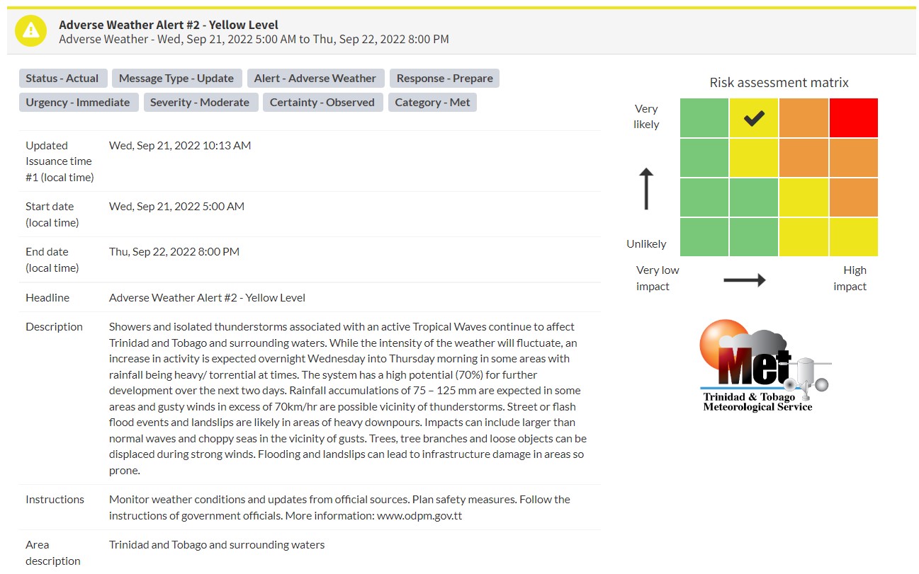
“Showers and isolated thunderstorms associated with an active Tropical Waves continue to affect Trinidad and Tobago and surrounding waters. While the intensity of the weather will fluctuate, an increase in activity is expected overnight Wednesday into Thursday morning in some areas with rainfall being heavy/ torrential at times. The system has a high potential (70%) for further development over the next two days. Rainfall accumulations of 75 – 125 mm are expected in some areas and gusty winds in excess of 70km/hr are possible vicinity of thunderstorms. Street or flash flood events and landslips are likely in areas of heavy downpours. Impacts can include larger than normal waves and choppy seas in the vicinity of gusts. Trees, tree branches and loose objects can be displaced during strong winds. Flooding and landslips can lead to infrastructure damage in areas so prone.” according to the Trinidad and Tobago Meteorological Service. This “alert” status takes into account the possibility of the event occurring. This adverse weather event has been observed.

The color of the alert indicates the severity of the event and the probability of the event occurring. Currently, the alert level is Yellow. This means that the hazards have been observed, and the severity of the impacts is moderate for this particular alert. You should be aware of the hazards in your area associated mainly with gusty winds in excess of 55 KM/H, street and flash flooding, landslides, as well as frequent lightning.
For a moderate Adverse Weather Alert, there is the potential for possible injuries, where behavioral changes are required to ensure safety. There may be minor damage to property, with income-earning temporarily disrupted and a couple of communities affected.
The Met Office is advising the public to monitor weather conditions and updates from official sources, plan safety measures and follow the instructions of government officials.


