


The South Oropouche River has overtopped its banks. Other rivers remain closely monitored but within their banks. Riverine flooding is ongoing across parts of Woodland, Barrackpore, and surrounding low-lying areas.
What you need to know
— What has happened: Over the last 24-36 hours, between 50 and 100 millimeters fell across Trinidad as forecast associated with Invest 98L, with additional rainfall accumulations between 25 and 50 millimeters through today (Thursday). While major rivers across Trinidad remain elevated but within its banks, the South Oropouche River and its tributaries have overtopped, leading to flooding in Woodland, Penal, and Barrackpore.
— What to expect: Riverine flooding is expected to continue through the next 48 hours across the South Oropouche River Basin, exacerbated by spring tides which are set to begin on Friday, September 23rd, 2022. Other major rivers like the Caroni River, North Oropouche River, and Ortoire River remain closely monitored.
— Alerts/Watches/Warnings: A Riverine Flood Alert (Yellow Level) went into effect for the South Oropouche River Basin from 9:00 AM Thursday, September 22nd, 2022, and remains in effect through 9:00 AM Saturday, September 24th, 2022. The Adverse Weather Alert (Yellow Level) was discontinued at 7:37 PM Thursday, September 22nd, 2022, from the Trinidad and Tobago Meteorological Service. There are no tropical storm or hurricane watches or warnings in effect for T&T at this time.
The Riverine Flood Alert
The Trinidad and Tobago Meteorological Service issued a Riverine Flood Alert (Yellow Level) on Thursday at 8:57 AM. The alert went into effect for the South Oropouche River Basin from 9:00 AM Thursday, September 22nd, 2022, and remains in effect through 9:00 AM Saturday, September 24th, 2022.
Trinidad and Tobago is not under any tropical storm watch or warning at this time.
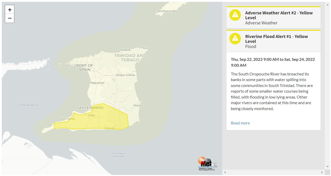
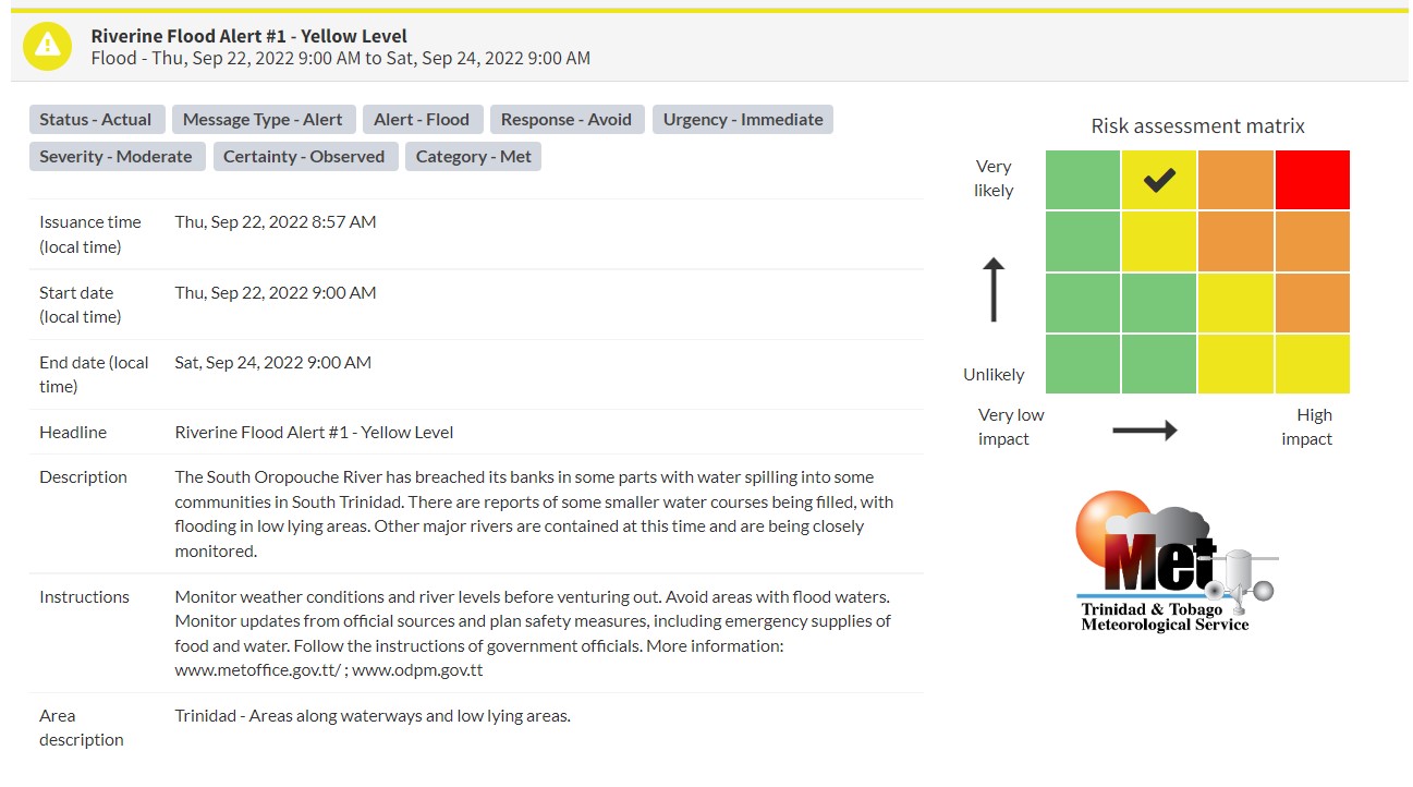
“The South Oropouche River has breached its banks in some parts with water spilling into some communities in South Trinidad. There are reports of some smaller water courses being filled, with flooding in low-lying areas. Other major rivers are contained at this time and are being closely monitored,” according to the Trinidad and Tobago Meteorological Service. This “alert” status takes into account the possibility of the event occurring. This riverine flood event has been observed.

The color of the alert indicates the severity of the event and the probability of the event occurring. Currently, the alert level is Yellow. This means that the hazard has been observed, and you need to be aware of the impacts of street, flash, and riverine flooding in your area. Moderate impacts are very likely.
For a moderate Riverine Flood Alert, there is the potential for possible injuries, with behavioral changes required to ensure safety. There may be minor damage to property, with income-earning temporarily disrupted. A couple of communities are affected.
Carefully monitor weather conditions and river/water levels. Monitor updates from official sources and plan safety measures, and do not take unnecessary risks. Avoid driving or wading through floodwaters. Follow the instructions of government officials.


