

What you need to know
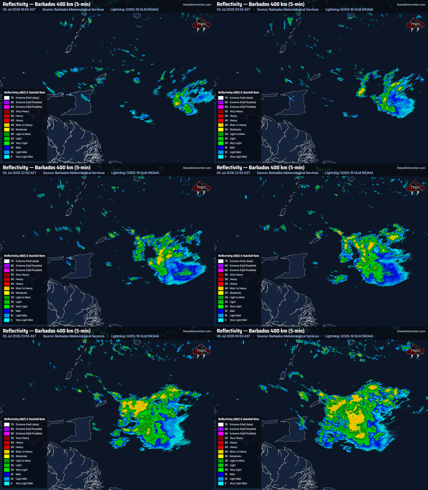
— What: A series of low-level troughs are interacting with the Intertropical Convergence Zone (ITCZ), producing scattered showers and thunderstorms.
— Where: Primarily through Monday, both islands are forecast to experience isolated to scattered rainfall, with minimum rainfall totals ranging between 12.5 and 25 millimeters across both islands. Higher rainfall totals are expected across the eastern half of Trinidad, potentially extending into central areas of Trinidad and across Tobago, with likely totals ranging from 25 to 45 millimeters and highly isolated totals peaking higher. Gusty winds (45-55 km/h) are likely to favor Tobago and northern Trinidad during and ahead of heavy showers/thunderstorms across both islands.
— When: The TTMS issued the late-notice Adverse Weather Alert at 12:26 AM and went into effect from 1:30 AM Monday, July 6th, 2026, through 12:00 PM (noon) Monday, July 6th, 2026. Additional rainfall is likely through the week due to back-to-back tropical waves, particularly on Wednesday into Thursday, when a strong tropical wave is likely to affect T&T.
— Impacts: Street/flash flooding and localized ponding are possible in heavy downpours, but chances are lower than usual given generally drier soils. Highest street/flash-flooding chances are across Tobago and flood-prone areas in the eastern half of Trinidad. Gusty winds are possible in heavy showers and thunderstorms, generally up to 55 km/h. These wind gusts, combined with heavy rainfall, may lead to fallen trees/utility poles/lines and lines, as well as landslides, as well as localized wind damage and agitated seas. Impactful flash flooding or short-lived riverine flooding is not expected.
— What Should You Do: Secure loose outdoor objects. Motorists and residents in areas prone to flooding or landslides should remain alert and exercise caution. Be aware of your surroundings and changing weather conditions. Take necessary precautions to mitigate potential impacts. If you encounter flood waters, turn around. If you hear thunder, head indoors.
Latest Alerts

Adverse Weather Alert Issued For T&T As ITCZ Affects Country
Trinidad and Tobago is NOT under any tropical storm or hurricane threat, watch, or warning at this time.
The Adverse Weather Alert
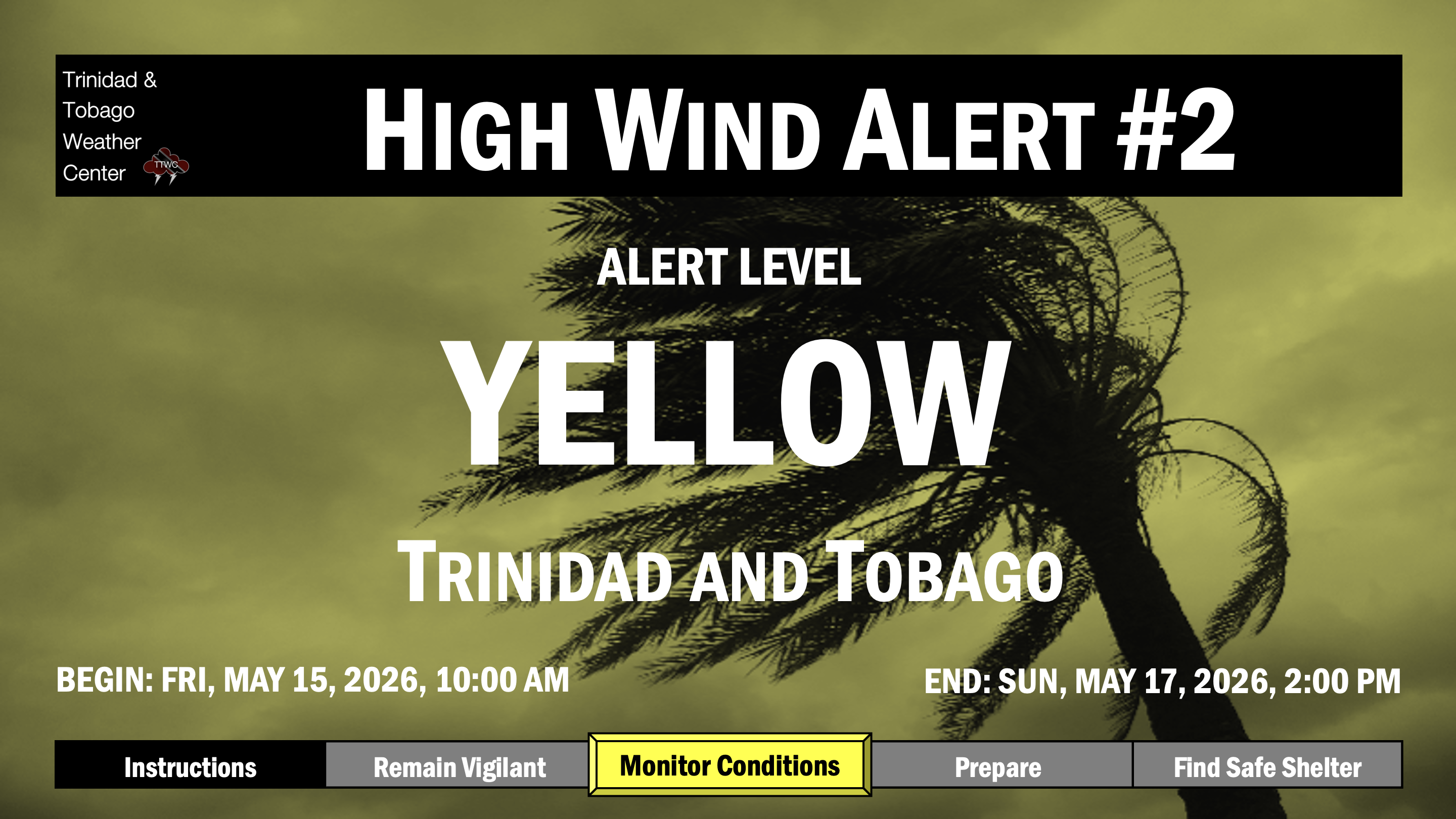
The Trinidad and Tobago Meteorological Service has issued the late-notice Adverse Weather Alert (Yellow Level) at 12:26 AM Monday, July 6th, 2026, and it went into effect from 1:30 AM Monday, July 6th, 2026, through 12:00 PM (noon) Monday, July 6th, 2026, for Trinidad, Tobago, and surrounding waters.
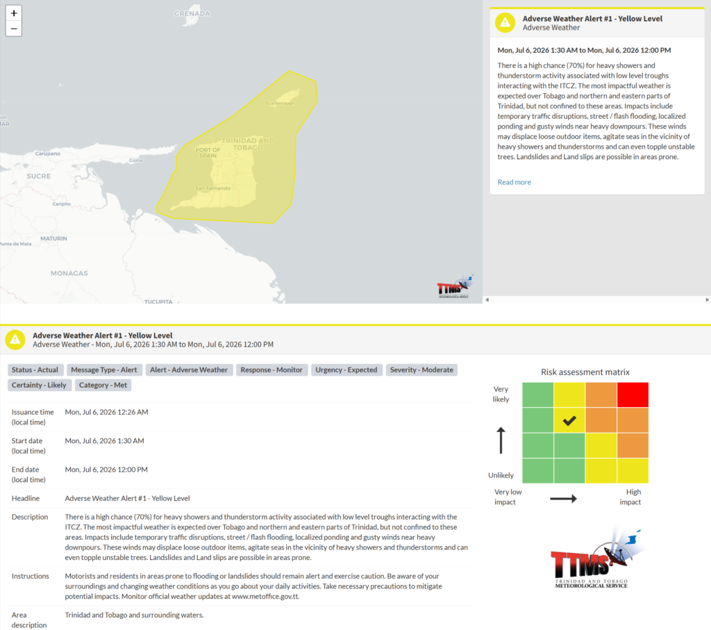
This adverse weather event is very likely, according to the TTMS:
- There is a high chance (70%) for heavy showers and thunderstorm activity associated with low-level troughs interacting with the ITCZ. The most impactful weather is expected over Tobago and the northern and eastern parts of Trinidad, but not confined to these areas.
- Impacts: Temporary traffic disruptions, street/flash flooding, localized ponding, and gusty winds near heavy downpours. These winds may displace loose outdoor items, agitate seas in the vicinity of heavy showers and thunderstorms, and can even topple unstable trees. Landslides and Land slips are possible in areas prone.
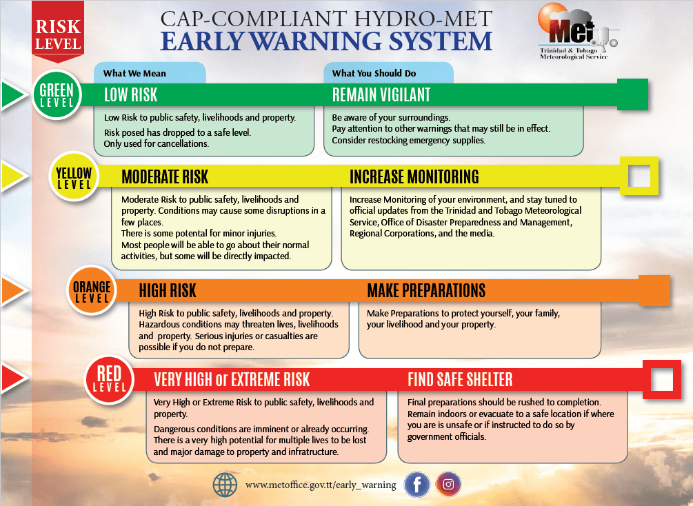
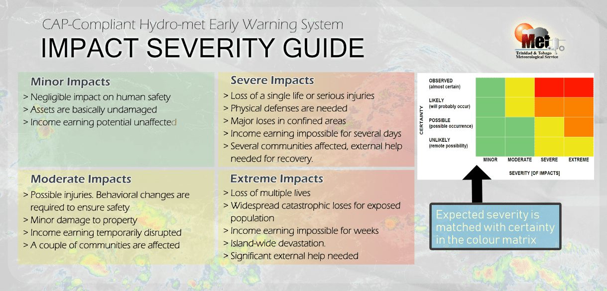
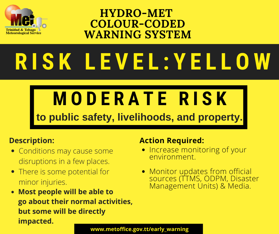
The alert’s color indicates the event’s severity and the likelihood of its occurrence. Currently, the alert level is Yellow. This means the hazards are very likely and the impacts are moderate for this particular alert. You should be aware of the hazards in your area, which include street or flash flooding, gusty winds exceeding 45 km/h to 55 km/h, falling trees, landslides, and agitated seas.
A moderate Adverse Weather Alert can result in possible injuries and behavioral changes, which are necessary to ensure safety. Minor property damage may also occur, temporarily disrupting income-earning activities and affecting several communities.
The Met Office advises the public to secure loose outdoor objects. Motorists and residents in areas prone to flooding or landslides should remain alert and exercise caution. Be aware of your surroundings and changing weather conditions. Take necessary precautions to mitigate potential impacts. Monitor official weather updates.