

The Trinidad and Tobago Meteorological Service has discontinued the Adverse Weather Alert for T&T as the Intertropical Convergence Zone becomes less active across the country. However, additional light to moderate rainfall, along with the odd isolated heavy shower or thunderstorm, remains possible through the evening.
What you need to know
— What: A surface to low-level trough interacted with the ITCZ across T&T overnight, coupled with favorable upper-level divergence and low-level convergence, leading to periods of rain, isolated to scattered showers, and thunderstorms that mostly remained offshore.
— Where: The heaviest rainfall generally affected the eastern and northern halves of Trinidad, where rainfall totals ranged from 15 to 55 millimeters, trending higher across northernmost and easternmost areas. Wind gusts were generally below severe levels (>63 km/h) across the country, with peak gusts of up to 44 km/h at Crown Point, Tobago.
— When: The TTMS has discontinued the Adverse Weather Alert at 11:06 AM on Monday, July 6th, 2026.
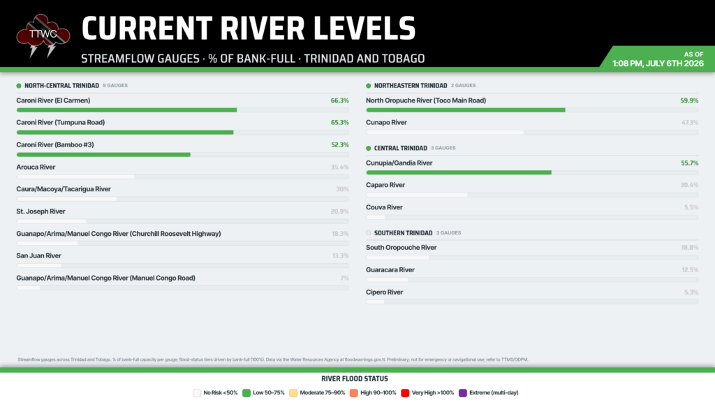
— Impacts: The potential for impactful rainfall has significantly decreased. However, the ITCZ remains present across T&T, with Tropical Wave 23 set to move across the country on Tuesday, with additional rain, showers, and thunderstorms likely overnight Monday into Tuesday morning. The primary hazards will be street/flash flooding due to increased soil saturation today, as well as gusty winds exceeding 45 km/h in locally heavy showers, leading to fallen trees/utility poles/lines, landslides, and agitated seas. Major river levels across northern Trinidad remain contained.
— What Should You Do: Remain vigilant and monitor weather conditions, assessing your surroundings before venturing out. Monitor weather updates.
Latest Alerts

Adverse Weather Alert Discontinued, Moderate Impacts Still Possible
Trinidad and Tobago is NOT under any tropical storm or hurricane threat, watch, or warning at this time.
The Adverse Weather Alert Discontinuation
The Trinidad and Tobago Meteorological Service discontinued the Adverse Weather Alert (Yellow Level) on Monday at 11:06 AM.
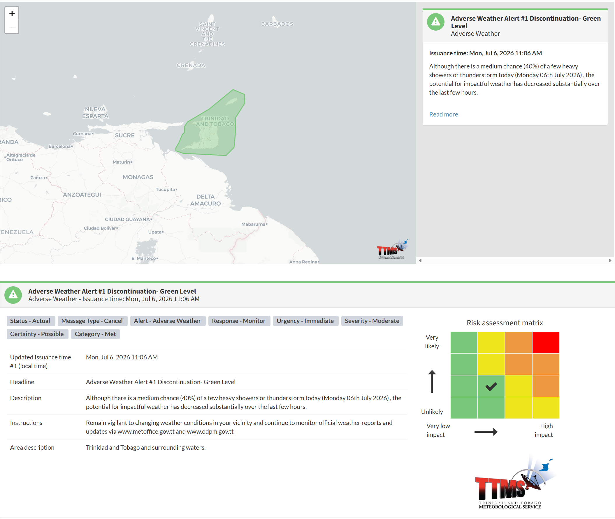
The TTMS states, “Although there is a medium chance (40%) of a few heavy showers or thunderstorms today (Monday 06th July 2026), the potential for impactful weather has decreased substantially over the last few hours.”
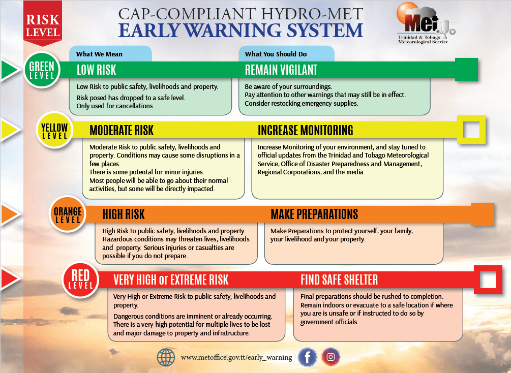
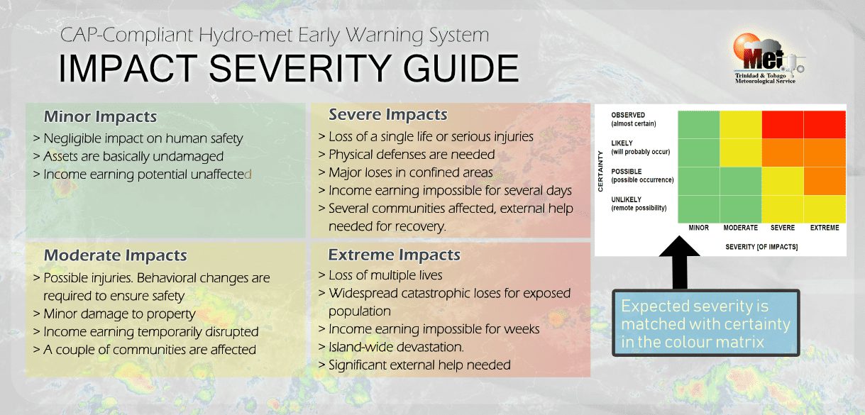
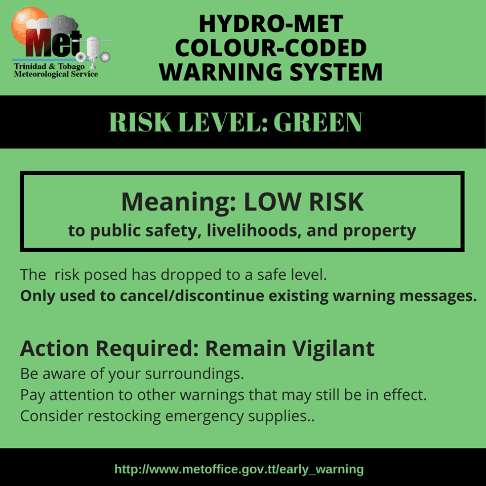
The alert’s color indicates the event’s severity and likelihood. Currently, the alert level is green. This alert status considers the possibility of the event ending, with certainty at its second-lowest level, at “possible,” and the severity is minor. Discontinuations and green-level alerts have historically been issued with a likelihood of ‘very likely/observed’ or ‘likely’.
This means that additional hazards (street/flash flooding, gusty winds, landslides) producing moderate impacts are still possible. A moderate Adverse Weather Alert can result in possible injuries and behavioral changes, which are necessary to ensure safety. Minor property damage may also occur, temporarily disrupting income-earning activities and affecting several communities.
The Met Office advises the public to remain vigilant and monitor weather conditions, assessing their surroundings before venturing out, and to monitor weather updates.