


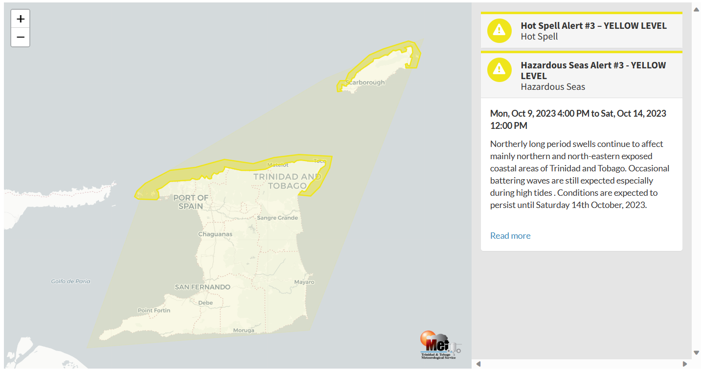
As forecast, long-period swells are impacting shores across the Lesser Antilles, including Trinidad and Tobago. These high-energy waves are affecting Trinidad and Tobago’s northern and eastern coastlines, as well as north-facing coasts in the Gulf of Paria, increasing the risk of rip currents and battering waves along select coastlines through the end of this week.
What you need to know
— What is happening: Swells with periods between 11 and 16 seconds have produced large, battering, high-energy waves along Trinidad and Tobago’s northern and eastern coastlines and, to a lesser extent, western coastlines. Through Saturday, swells are forecast to continue, with swell periods gradually decreasing through the week.
— What can we expect: Large, battering waves are possible along T&T’s northern and northeastern coastlines initially, with choppy conditions in sheltered areas along western areas. Minor to moderate coastal erosion is possible. There is a high risk of rip currents along the country’s northern coastlines.
Latest Alerts

Localized Flood Alert Discontinued For Trinidad
Trinidad and Tobago is NOT under any tropical storm or hurricane threat, watch, or warning at this time.
The Hazardous Seas Alert
The Trinidad and Tobago Meteorological Service updated the Hazardous Seas Alert (Yellow Level) on Thursday at 9:37 AM. The alert went into effect for northern and northeastern areas of Trinidad and Tobago from 4:00 PM Monday, October 9th, 2023, and has been extended through 12:00 PM (noon) Saturday, October 14th, 2023.
Trinidad and Tobago is not under any tropical storm watch or warning at this time.
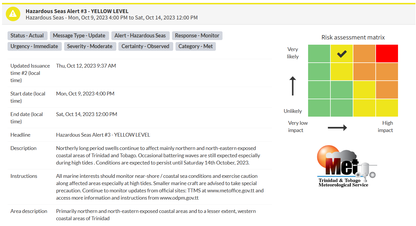
“Northerly long period swells continue to affect mainly northern and north-eastern exposed coastal areas of Trinidad and Tobago. Occasional battering waves are still expected, especially during high tides. Conditions are expected to persist until Saturday 14th October 2023,” according to the Trinidad and Tobago Meteorological Service. This “alert” status takes into account the possibility of the event occurring. This hazardous sea event has been observed.

The color of the alert indicates the severity of the event and the probability of the event occurring. Currently, the alert level is Yellow. This means that the hazards have been observed, and the severity of impacts is moderate for this particular alert. Large battering waves and a high risk of rip currents are the two main hazards associated with this swell event.
For a moderate Hazardous Seas Alert, there is the potential for possible injuries, where behavioral changes are required to ensure safety. There may be minor damage to property, with income-earning temporarily disrupted and a couple of communities affected.
The Met Office is advising all marine interests to monitor nearshore/coastal sea conditions and exercise caution along affected areas, especially at high tides.


