


As forecast, long-period swells are expected to impact shores across the Lesser Antilles from Monday, including Trinidad and Tobago. These high-energy waves are expected to impact Trinidad and Tobago’s northern and eastern coastlines after midday on Monday and western coastal areas by Tuesday morning, increasing the risk of rip currents and battering waves along select coastlines.
What you need to know
— What is happening: Swells with periods up to 17 seconds are forecast to produce large, battering, high-energy waves along Trinidad and Tobago’s northern and eastern coastlines. Over the next several days, swells are forecast to continue, with swell periods gradually decreasing through the week.
— What can we expect: Large, battering waves are possible along T&T’s northern and northeastern coastlines initially, with choppy conditions in sheltered areas along western areas as the week progresses. Minor to moderate coastal erosion is possible. There is a high risk of rip currents along the country’s northern coastlines.
Latest Alerts

Localized Flood Alert Discontinued For Trinidad
Localized Flood Alert Discontinued For Trinidad
Trinidad and Tobago is NOT under any tropical storm or hurricane threat, watch, or warning at this time.
The Hazardous Seas Alert
The Trinidad and Tobago Meteorological Service issued a Hazardous Seas Alert (Yellow Level) on Sunday at 12:23 PM. The alert goes into effect for northern and northeastern areas of Trinidad and Tobago from 4:00 PM Monday, October 9th, 2023, and remains in effect through 10:00 AM Thursday, October 12th, 2023.
Trinidad and Tobago is not under any tropical storm watch or warning at this time.
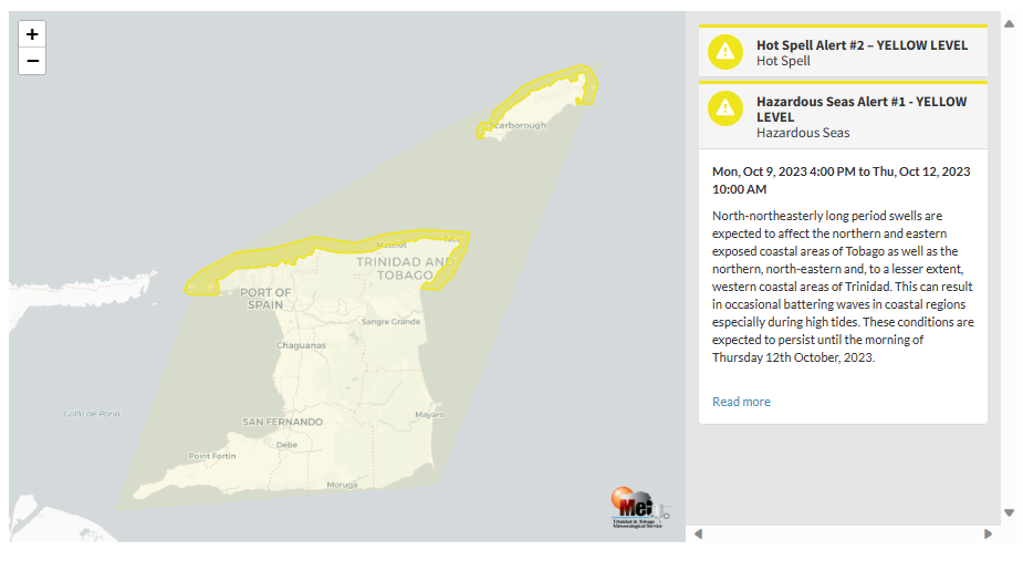
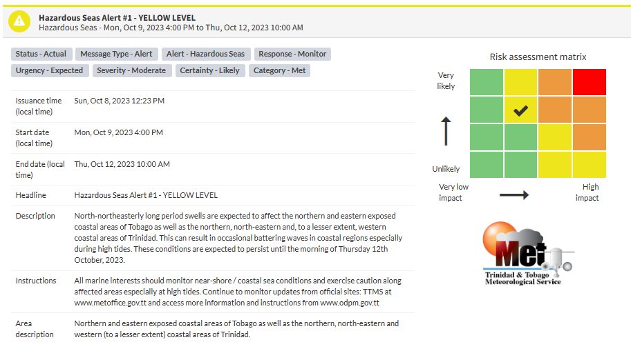
“North-northeasterly long period swells are expected to affect the northern and eastern exposed coastal areas of Tobago as well as the northern, northeastern, and, to a lesser extent, western coastal areas of Trinidad. This can result in occasional battering waves in coastal regions, especially during high tides. These conditions are expected to persist until the morning of Thursday 12th October 2023,” according to the Trinidad and Tobago Meteorological Service. This “alert” status takes into account the possibility of the event occurring. This hazardous sea event is likely.

The color of the alert indicates the severity of the event and the probability of the event occurring. Currently, the alert level is Yellow. This means that the hazards are likely, and the severity of impacts is moderate for this particular alert. Large battering waves and a high risk of rip currents are the two main hazards associated with this swell event.
For a moderate Hazardous Seas Alert, there is the potential for possible injuries, where behavioral changes are required to ensure safety. There may be minor damage to property, with income-earning temporarily disrupted and a couple of communities affected.
The Met Office is advising all marine interests to monitor nearshore/coastal sea conditions and exercise caution along affected areas, especially at high tides.


