


Trinidad and Tobago is bracing for periods of heavy rainfall over the next 24 to 36 hours as rain, showers and thunderstorms are forecast through Monday evening, with activity possibly continuing into Tuesday.
What you need to know
— Rainfall: Through the next 36 hours (2:00 AM Tuesday), periods of rain with isolated moderate to heavy showers and thunderstorms are forecast, with higher totals favoring eastern and southern areas of Trinidad, Tobago and isolated areas of western coastal Trinidad, interrupting cloudy skies. Rainfall totals between 15 and 25 millimeters are forecast across both islands, with totals nearing or exceeding 50 millimeters across eastern and southern areas of Trinidad, Tobago and isolated areas of western coastal Trinidad. In highly isolated areas, totals could reach as high as 100 millimeters. Peak intense activity is forecast from early morning through early afternoon on Monday.
— Hazards: Street and flash flooding is likely across both islands with wind gusts in excess of 45 KM/H accompanying heavy showers or thunderstorms likely and gusts in excess of 55 KM/H possible during and ahead of heavy showers or thunderstorms. Localized wind damage, such as fallen trees, is possible. Lightning will accompany thunderstorms. Landslides are also possible, mainly across northeastern Trinidad. Seas are forecast to become locally agitated during heavy showers or thunderstorms. Conditions are somewhat favorable for funnel cloud development on Monday.
Latest Alerts

Adverse Weather Alert Discontinued For T&T
Trinidad and Tobago is NOT under any tropical storm or hurricane threat, watch, or warning at this time.
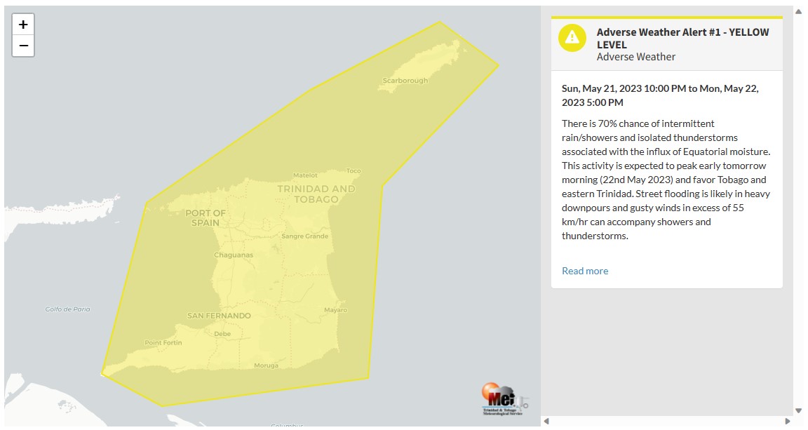
The Adverse Weather Alert
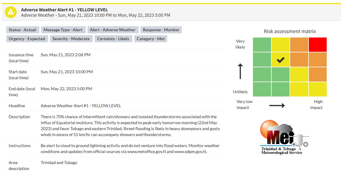
The Trinidad and Tobago Meteorological Service has issued an Adverse Weather Alert (Yellow Level) on Sunday at 2:06 PM. The alert goes into effect for Trinidad, Tobago, and surrounding marine areas from 10:00 PM Sunday, May 21st, 2023 and remains in effect through 5:00 PM Monday, May 22nd, 2023. Additional inclement weather is possible past the end of the alert period.
On Sunday, gusty winds caused localized power outages in Bamboo and street flooding was reported in St. Augustine and Barataria areas.
Trinidad and Tobago is not under any tropical storm watch or warning at this time.
According to the TTMS, the approaching inclement weather is associated with an influx of Equatorial moisture – not the Intertropical Convergence Zone nor a Tropical Wave.
This “alert” status takes into account the possibility of the event occurring. This adverse weather event is likely with the following impacts, according to the TTMS:
- 70% chance of intermittent rain/showers and isolated thunderstorms.
- Activity is expected to peak early tomorrow morning (May 22nd 2023) and favor Tobago and eastern Trinidad.
- Street flooding is likely in heavy downpours and gusty winds in excess of 55 km/hr can accompany showers and thunderstorms.

The color of the alert indicates the severity of the event and the probability of the event occurring. Currently, the alert level is Yellow. This means that the hazards are likely, and the severity of the impacts is moderate for this particular alert. You should be aware of the hazards in your area associated mainly with gusty winds in excess of 55 KM/H, street, and flash flooding, landslides, as well as frequent lightning.
For a moderate Adverse Weather Alert, there is the potential for possible injuries, where behavioral changes are required to ensure safety. There may be minor damage to property, with income-earning temporarily disrupted and a couple of communities affected.
The Met Office is advising the public to be alert to cloud-to-ground lightning activity and not venture into flood waters, as well as monitor weather conditions and updates from official sources


