


Trinidad and Tobago is forecast to experience slight to near-calm seas over the next seven days as the pressure gradient across the region slackens, allowing for light winds. Increased tidal fluctuations are forecast by the end of next week due to Spring Tides. Saharan Dust may also reduce horizontal visibility from late Sunday.
There are no sea-based alerts, watches, or warnings from the Trinidad and Tobago Meteorological Service for Trinidad and Tobago at this time.
Seas Forecast For Trinidad and Tobago
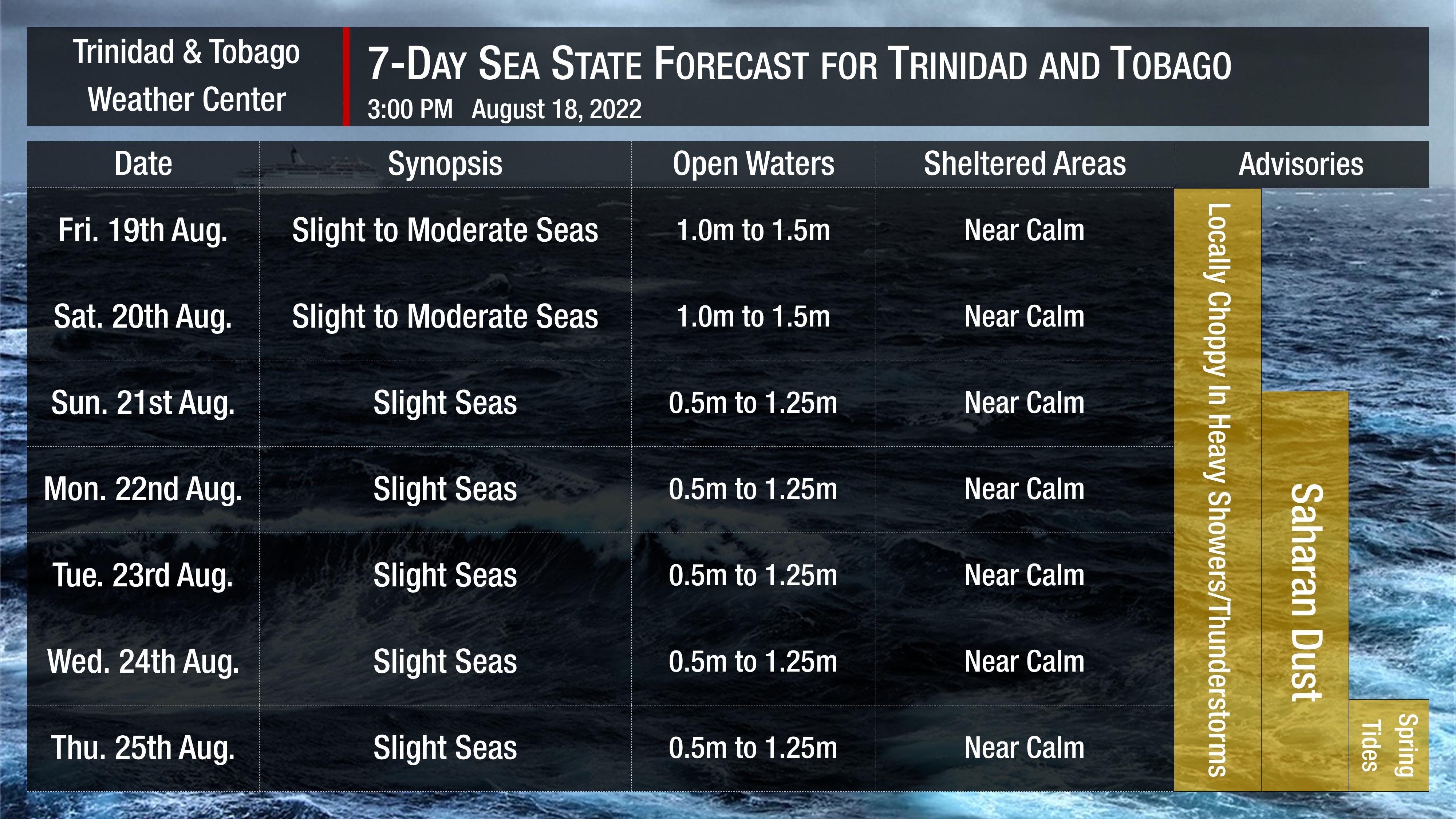
Seas are forecast to be slight to moderate through Saturday, becoming predominantly slight from Sunday into next week. Waves in open waters are forecast to be generally between 1.0 and 1.5 meters until mid-Saturday, when open water waves decrease to 0.5 meters. In sheltered areas, waves are forecast to be near calm, becoming occasionally choppy in heavy showers or thunderstorms, particularly within the Gulf of Paria.
Winds are forecast to be gentle to light through next week with sustained winds between 5 to 15 knots from generally the south to the northeast. Gusts during this period are forecast to reach 20 knots, particularly on Friday and Sunday, accompanying isolated heavy showers or thunderstorms.
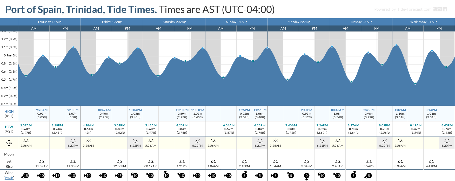
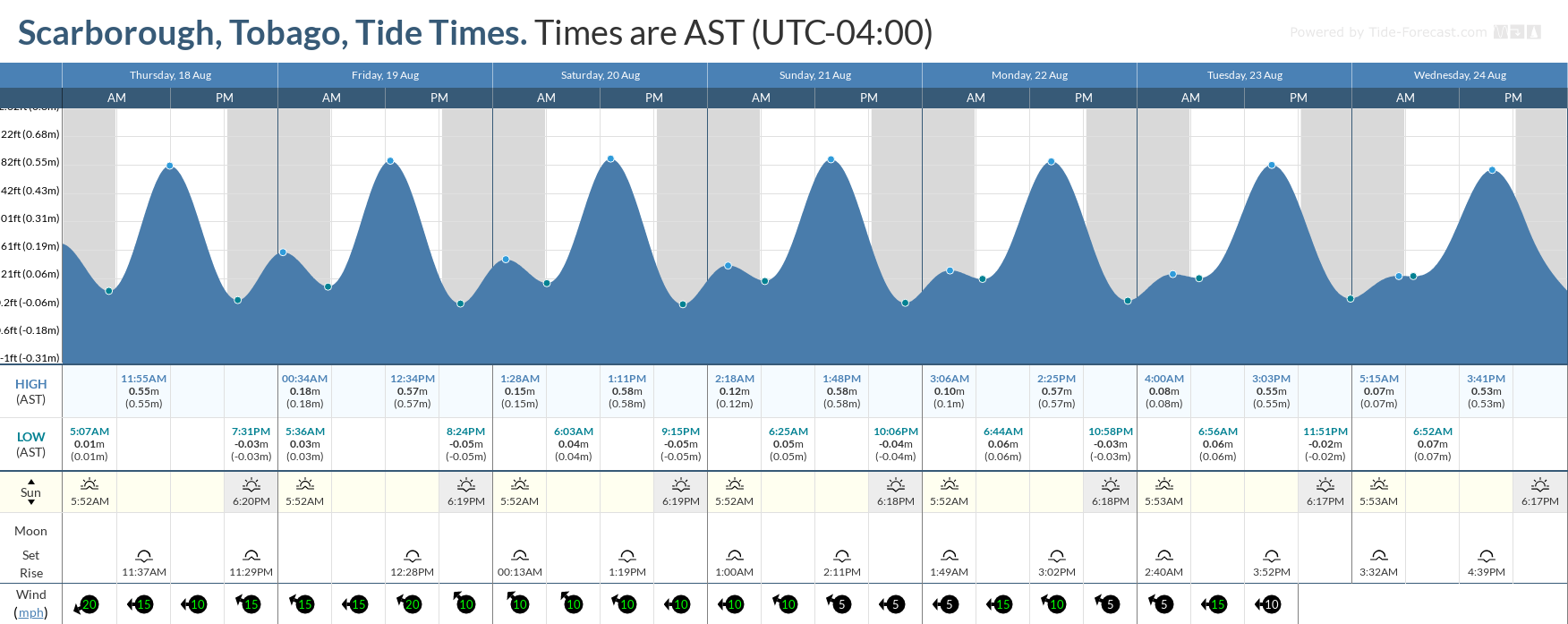
Spring tides are forecast to begin on August 25th, 2022, and are forecast to continue through August 30th, 2022. These are higher than usual high tides and lower than usual low tides which may increase the risk of rip currents.
How to spot a rip current

Rip Currents
Saharan Dust is also forecast to fluctuate at varying concentrations over the weekend, increasing from Monday. Increased dust haze may reduce horizontal visibility offshore.


