


A Tropical Storm Warning has been issued for Trinidad and Tobago as of 5:00 PM Monday, June 27th, 2022. This was issued ahead of Potential Tropical Cyclone Two (PTC2), forecast to move across T&T on Tuesday night into Wednesday. PTC2, based on the latest forecast from the National Hurricane Center, is expected to become Tropical Storm Bonnie on Tuesday afternoon before making landfall across northeastern Trinidad on Tuesday night.
What you need to know
— Alerts/Watches/Warnings: A Tropical Storm Warning (Orange Level) has been issued for Trinidad and Tobago. This warning will remain in effect until 5:00 PM Wednesday, June 29th, 2022.
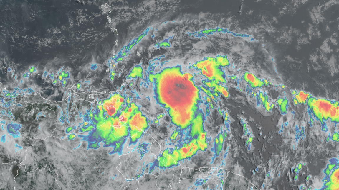
— Track: Latest forecast models and track from the National Hurricane Center show the possible center of circulation moving directly across northeastern Trinidad, southwest of Tobago. Given this system is lopsided and disorganized, impacts will not be concentrated near the center.
— Rainfall: The main hazard associated with this system is flooding rainfall. From Tuesday morning, periods of rain, heavy to violent showers, and scattered thunderstorms are forecast Peak intense rainfall and thunderstorms are forecast from after midday Tuesday through early Wednesday, with lingering showers, rain, and thunderstorms through early Thursday. Between 40 millimeters and 75 millimeters of rainfall is forecast through Thursday, with higher rainfall totals up to 150 millimeters across eastern and northern Trinidad, Tobago, as well as localized areas of southern and western Trinidad. Street/flash flooding is very likely, with riverine flooding possible by Wednesday.
— Wind: The strongest winds are forecast to remain north of T&T. Based on the latest forecast models and the National Hurricane Center forecast, Trinidad and Tobago is forecast to experience maximum sustained winds up to 74 KM/H, with gusts up to and in excess of 92 KM/H mainly accompanying heavy showers and thunderstorms. Stronger sustained winds and wind gusts are forecast particularly across Tobago and elevated areas of the Northern Range.
— Seas: Hazardous seas are forecast for exposed, northern and eastern coastlines of Trinidad and Tobago with waves in open waters on Tuesday into Wednesday between 2.5 meters and 3.5 meters. Hazardous seas are also forecast within the Gulf of Paria due to shifting prevailing winds as the system moves across T&T.
Live Updates
Be our eyes and ears on the ground and in the open as inclement weather affects the region! Let of know of your experience and if it is safe, capture a picture or video and send it to us on our social media platforms: Facebook, Twitter, Instagram, or WhatsApp. Live updates will be updated automatically.


