


What you need to know
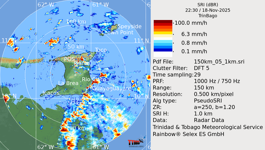
— What: Heavy rainfall over the last 48 hours as a result of back-to-back low-level troughs, enhanced by favorable mid- to upper-level conditions, is forecast to continue, with additional isolated to scattered showers, periods of rain, and thunderstorms through this afternoon.
— Where: On Thursday, both islands are forecast to experience isolated to scattered rainfall, with rainfall totals ranging between 10 and 25 millimeters, with isolated totals up to 75 millimeters. Parts of central and southern Trinidad have already recorded between 50 and 65 mm. Gusty winds (45-55 km/h) are possible, with higher gusts across Tobago and in heavy shower/thunderstorm activity across both islands.
— When: The TTMS has discontinued the Adverse Weather Alert, but unsettled weather is forecast to continue through tonight.
— Impacts: Street/flash flooding and localized ponding are likely in heavy downpours, accompanied by gusty winds exceeding 45 km/h. These wind gusts, combined with heavy rainfall, may lead to fallen trees/utility poles/lines and landslides, as well as localized wind damage and agitated seas. While all major rivers remain contained, the Caparo River has overtopped at Brasso Caparo Valley Road near Breeding Unit.
— What Should You Do: Motorists and residents in areas prone to flooding or landslides should remain alert and exercise caution. Remain vigilant and monitor weather conditions, assessing your surroundings before venturing out. If you encounter flood waters, turn around. If you hear thunder, head indoors.
Latest Alerts

Localized Flood Alert Discontinued For Trinidad
Trinidad and Tobago is NOT under any tropical storm or hurricane threat, watch, or warning at this time.
The Adverse Weather Alert Discontinuation
The Trinidad and Tobago Meteorological Service discontinued the Adverse Weather Alert (Yellow Level) on Thursday at 1:31 PM
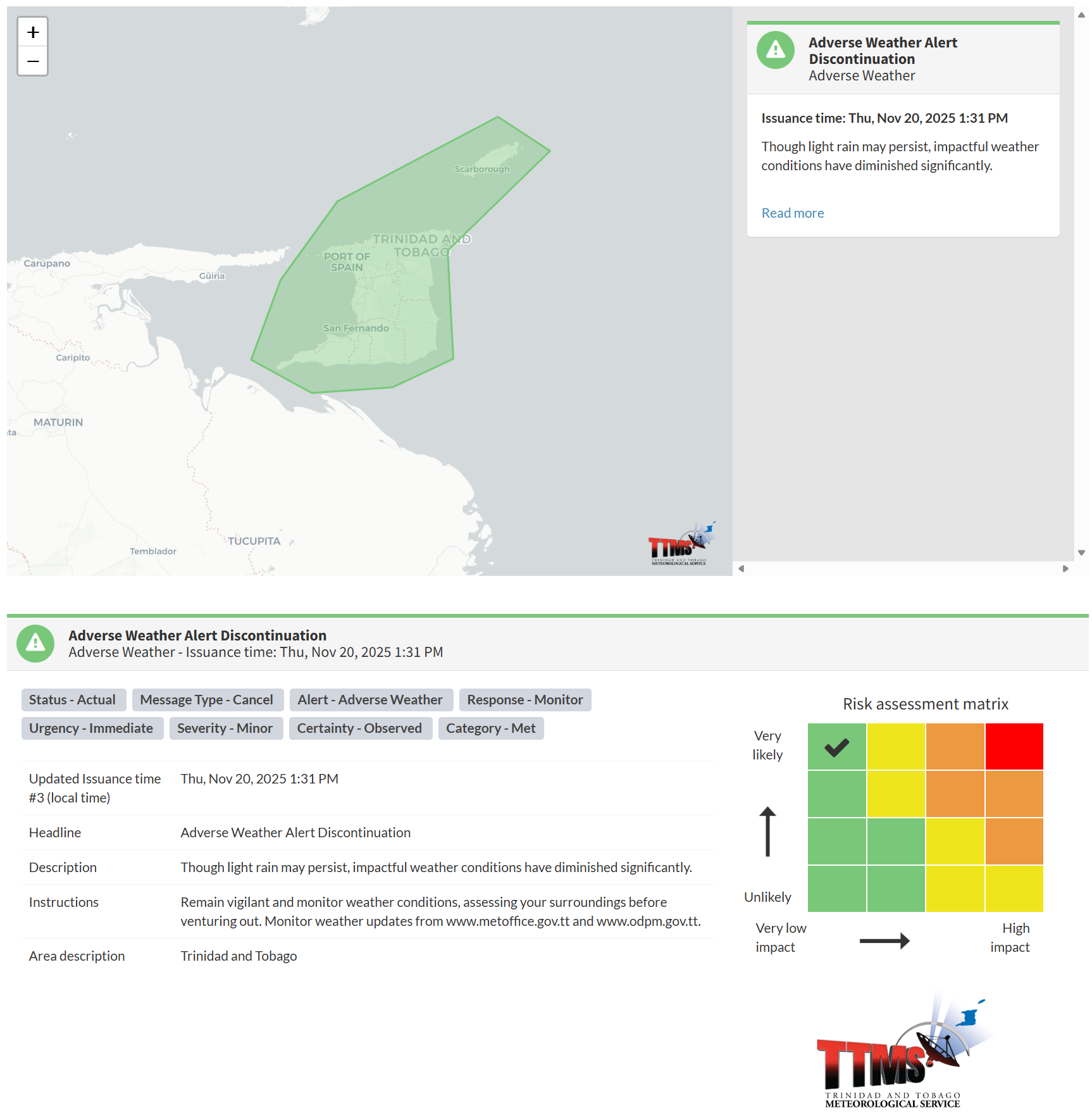
The TTMS states, “Though light rain may persist, impactful weather conditions have diminished significantly.”

The alert’s color indicates the event’s severity and the likelihood of its occurrence. Currently, the alert level is green. This alert status considers the possibility of the event ending, with certainty at its highest – “very likely/observed.”
This means that additional hazards (street/flash flooding, gusty winds, landslides) are still possible; the impacts are minor for this particular alert.
The Met Office advises you to remain vigilant and monitor weather conditions, and to assess your surroundings before venturing out. Monitor weather updates.


