


Although isolated to scattered showers and isolated thunderstorms remain in the forecast for T&T overnight, the risk of impactful weather has reduced according to the Trinidad and Tobago Meteorological Service.
Latest Alerts

Localized Flood Alert Discontinued For Trinidad
Trinidad and Tobago is NOT under any tropical storm or hurricane threat, watch, or warning at this time.
The Adverse Weather Alert Discontinuation
The Trinidad and Tobago Meteorological Service discontinued the Adverse Weather Alert (Yellow Level) on Monday at 4:46 PM.
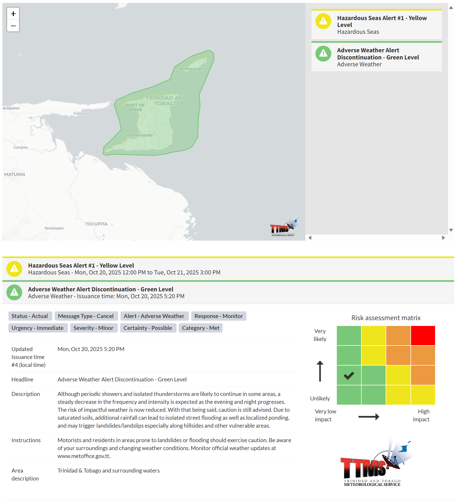
The TTMS states, “Although periodic showers and isolated thunderstorms are likely to continue in some areas, a steady decrease in the frequency and intensity is expected as the evening and night progresses. The risk of impactful weather is now reduced. With that being said, caution is still advised. Due to saturated soils, additional rainfall can lead to isolated street flooding as well as localized ponding, and may trigger landslides/landslips especially along hillsides and other vulnerable areas.”

The alert’s color indicates the severity of the event and the probability of its occurrence. Currently, the alert level is green. This alert status considers the possibility of the event ending, with certainty at its second-lowest level, at “possible”. Discontinuations and green-level alerts have historically been issued with a likelihood of ‘very likely/observed’ or ‘likely’.
This means that additional hazards (street/flash flooding, gusty winds, landslides) are still possible, the severity of the impacts are minor for this particular alert.
The Met Office advises motorists and residents in areas prone to landslides or flooding should exercise caution. Be aware of your surroundings and changing weather conditions.


