


Localized heavy showers and thunderstorms moved across mainly Trinidad on Tuesday, leading to isolated street and flash flooding.
Areas affected included various points along Saddle Road, Maraval and at Ellerslie Plaza, as well as within Diego Martin, including along Morne Coco Road, the Diego Martin Main Road, and within Goodwood Gardens and Victoria Gardens in the northwest. Heavy thunderstorms also affected southwestern Trinidad, leading to street flooding along Reid Road, Point Fortin. A landslide was also reported in southern Trinidad at Marac Main Road, Moruga.
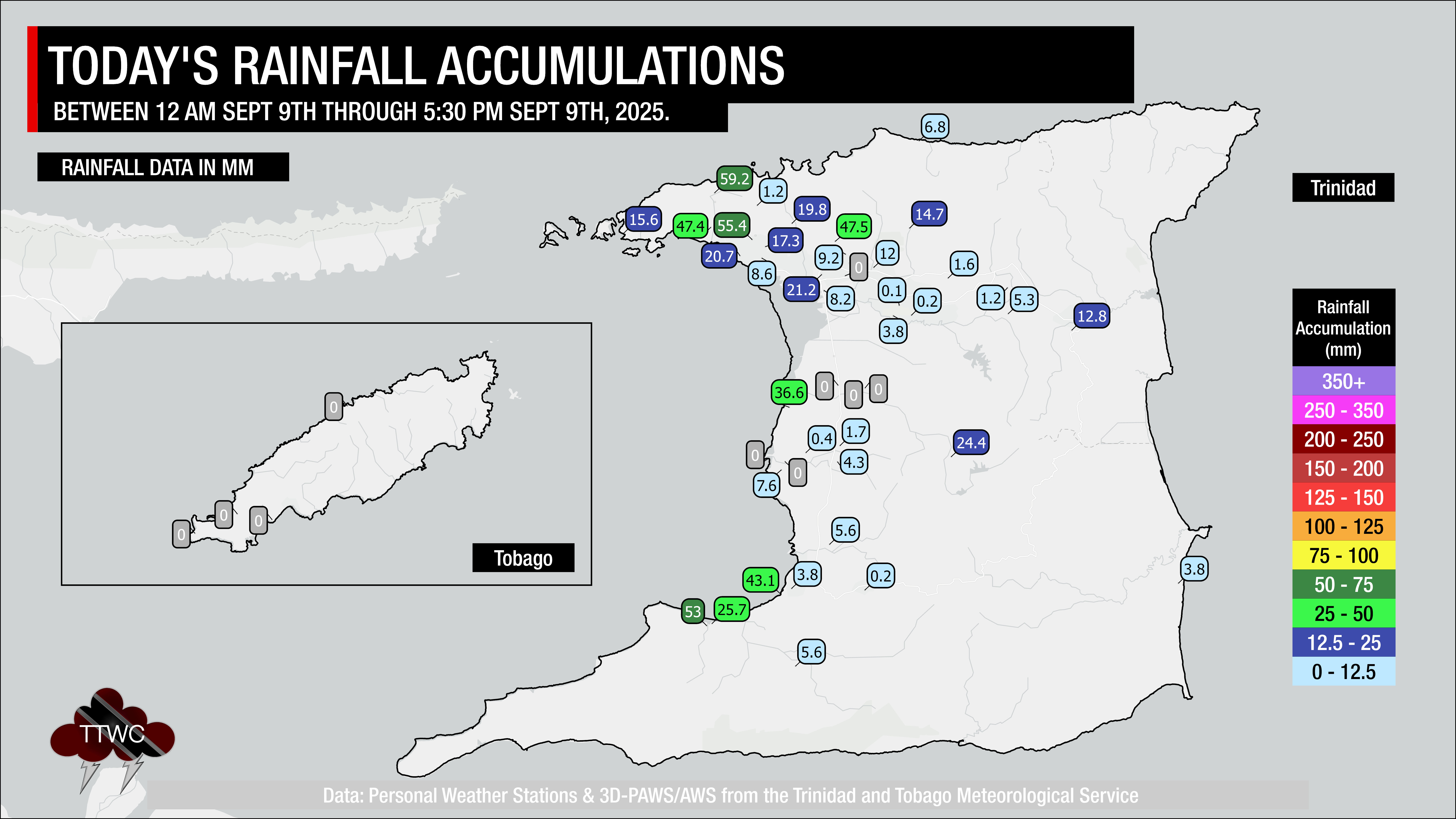
Rainfall accumulations across most of Trinidad and Tobago remained below 5 millimeters, with isolated totals between 0.5 and 1 inch (12.5-25 millimeters). Across northwestern and southwestern Trinidad, upwards of 2 inches (50 millimeters) of rainfall was recorded mainly between 11:00 AM and 1:00 PM, leading to short-lived street and flash flooding.
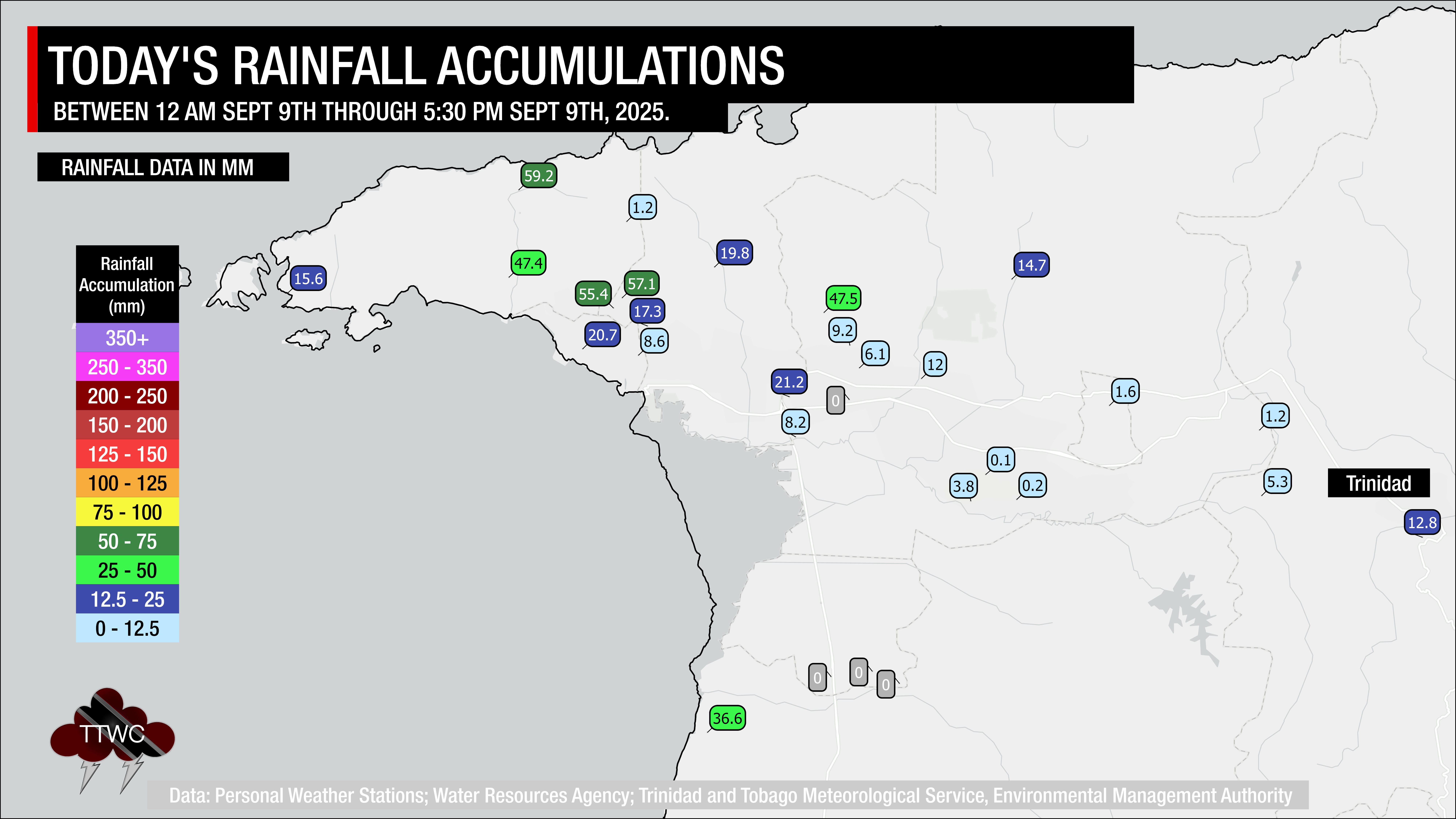
Today’s weather was due to a surface to low-level confluent pattern as a result of a high-pressure ridge located in the North Atlantic that resulted in a surface to low-level southeasterly wind flow. Across the western half of Trinidad, where the Adverse Weather Alert was in effect, light winds, daytime heating, sea breeze convergence, and orographic effects aided in the development of more intense activity. These features are typical for the local Wet Season.
Latest Alerts

Localized Flood Alert Discontinued For Trinidad
Trinidad and Tobago is NOT under any tropical storm or hurricane threat, watch, or warning at this time.
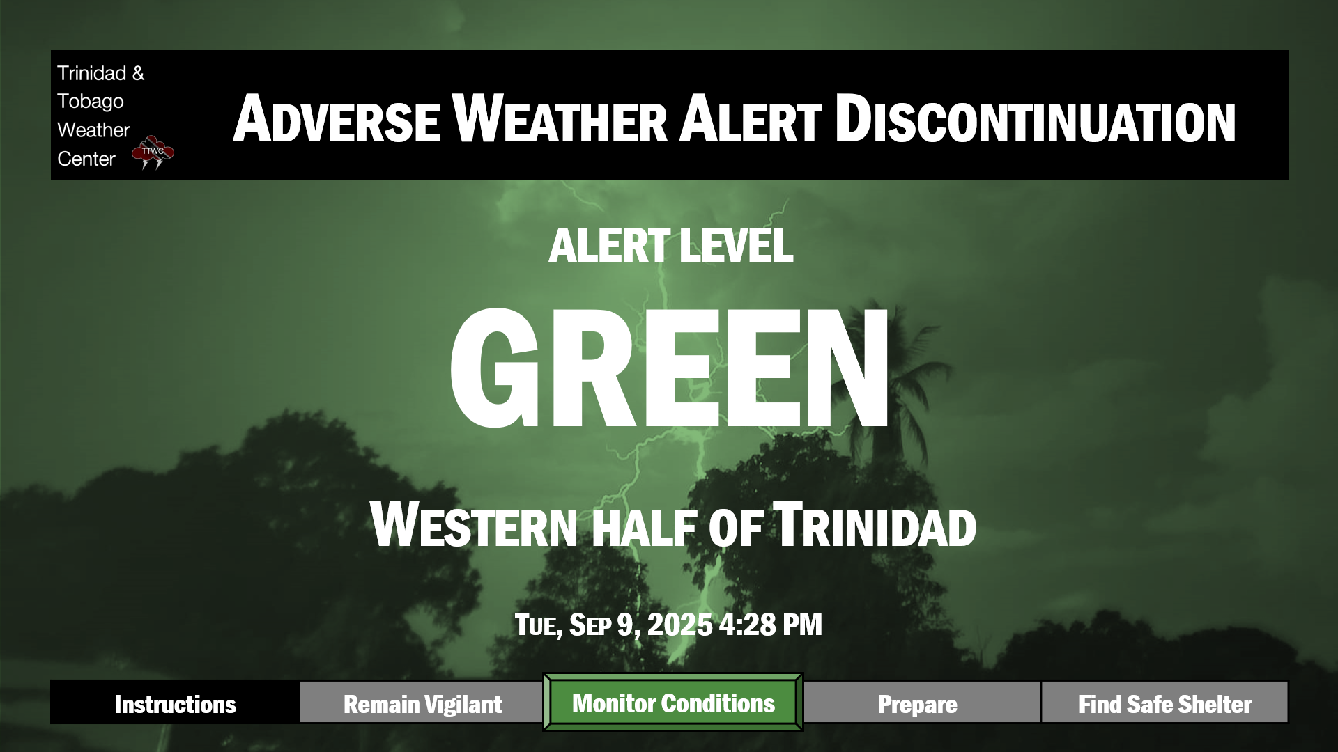
The Adverse Weather Alert Discontinuation
The Trinidad and Tobago Meteorological Service discontinued the Adverse Weather Alert (Yellow Level) on Tuesday at 4:28 PM.
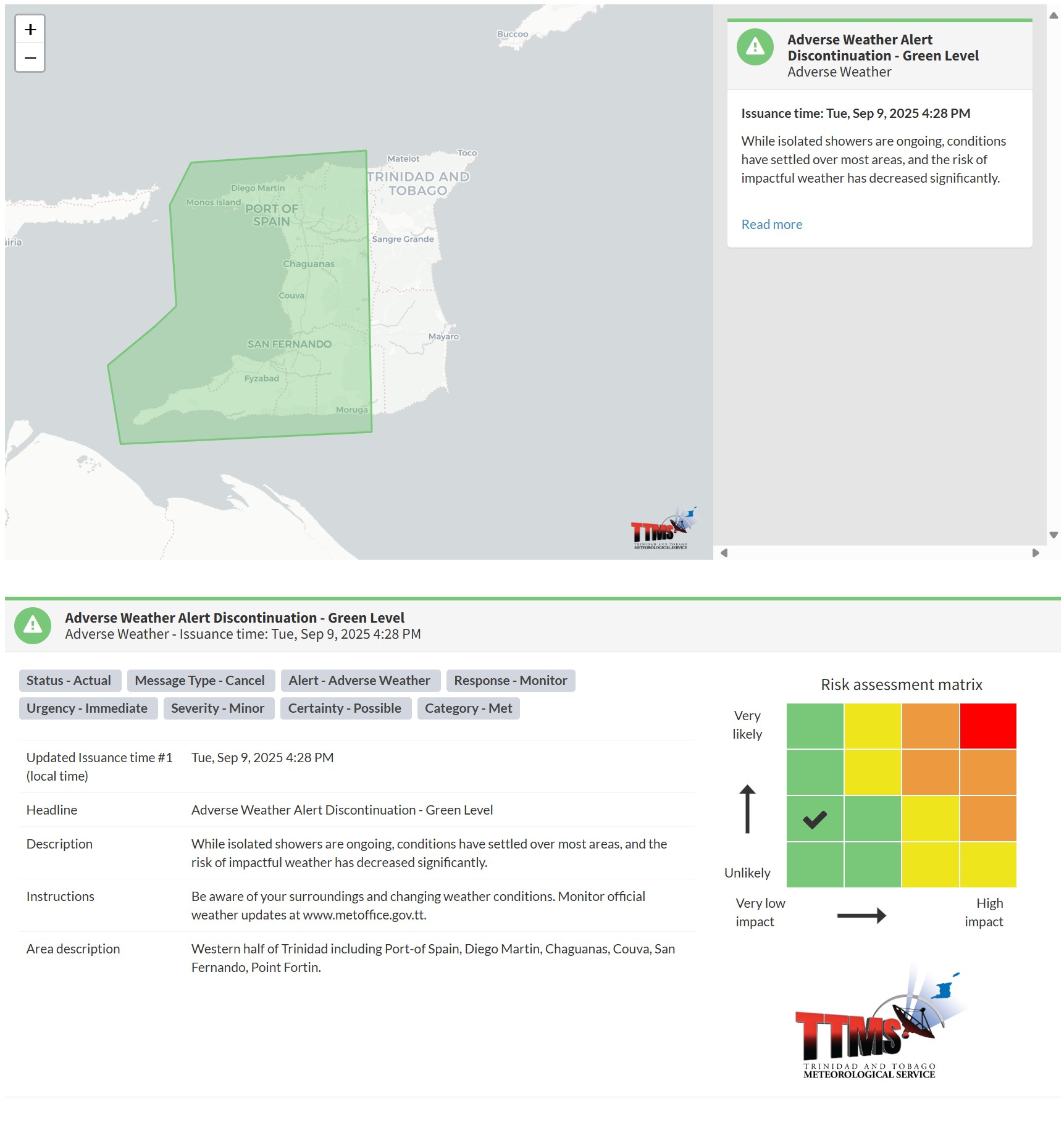
The TTMS states, “While isolated showers are ongoing, conditions have settled over most areas, and the risk of impactful weather has decreased significantly.”

The alert’s color indicates the severity of the event and the probability of its occurrence. Currently, the alert level is green. This alert status considers the possibility of the event ending, with certainty at its second-lowest level, at “possible”. Discontinuations and green-level alerts have historically been issued with a likelihood of ‘very likely/observed’ or ‘likely’.
This means that the hazards are still possible, but the severity of the impacts is minor for this particular alert.
The Met Office advises the population to be aware of your surroundings and changing weather conditions.


