Northerly long-period swells are set to affect T&T’s northern coastlines, prompting the Trinidad and Tobago Meteorological Service (TTMS) to issue a Hazardous Seas Alert through Friday.
What you need to know
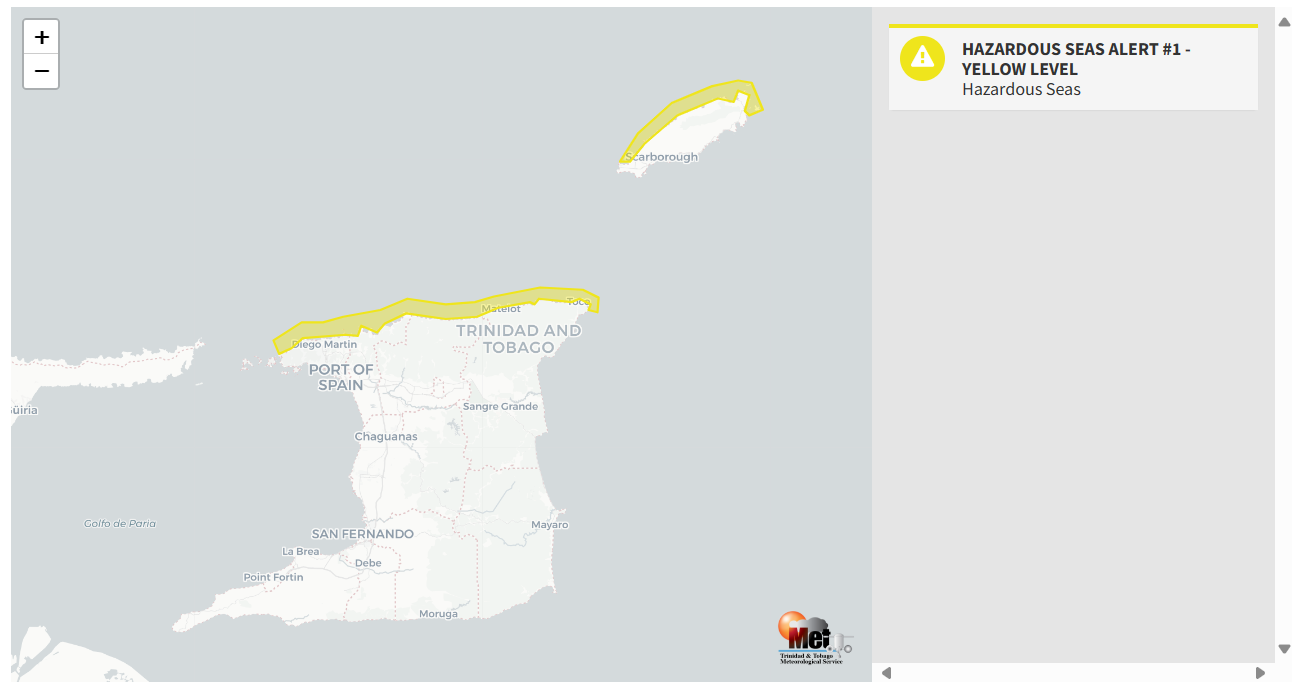
— What is happening: Long-period swells up to 16 seconds are forecast to affect northern coastlines, moving in from the north. These swells are set to peak on Tuesday afternoon through Thursday and are forecast to coincide with ongoing spring tides.
— What can we expect: Open water waves are forecast to remain up to 2.0 meters, while swells are forecast to produce occasional large, battering waves in nearshore areas through Friday. There is an increased risk of rip currents and potentially dangerous conditions for small craft operators.
Latest Alerts

Localized Flood Alert Discontinued For Trinidad
Trinidad and Tobago is NOT under any tropical storm or hurricane threat, watch, or warning at this time.
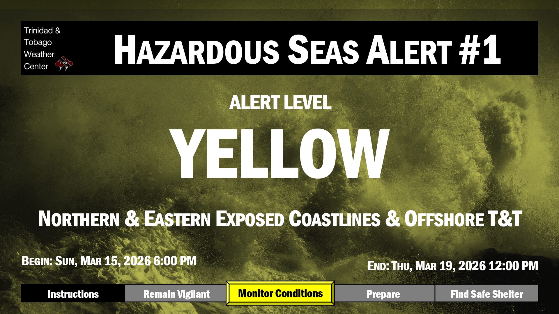
The Hazardous Seas Alert
The Trinidad and Tobago Meteorological Service issued a Hazardous Seas Alert (Yellow Level) on Monday at 3:12 PM. The alert goes into effect for northern exposed coastal areas of Trinidad and Tobago at 2:00 PM Tuesday, March 12th, 2024, through 8:30 AM Friday, March 15th, 2024.
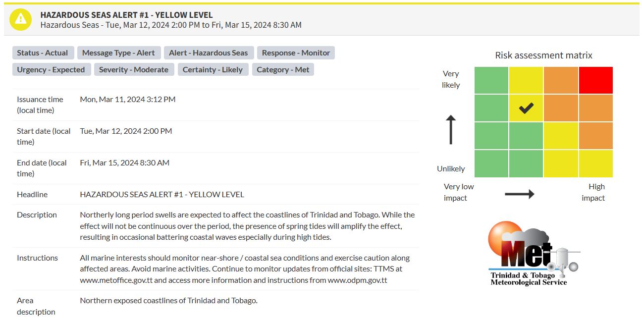
“Northerly long-period swells are expected to affect the coastlines of Trinidad and Tobago. While the effect will not be continuous over the period, the presence of spring tides will amplify the effect, resulting in occasional battering coastal waves, especially during high tides,” according to the Trinidad and Tobago Meteorological Service. This “alert” status considers the possibility of the event occurring. This hazardous sea event is likely.

The alert’s color indicates the event’s severity and probability of the event occurring. Currently, the alert level is Yellow. This means that the hazards are likely, and the severity of impacts is moderate for this particular alert.
There is an increased risk of strong rip currents, posing a serious hazard to swimmers and beachgoers. Rip currents can be life-threatening even for experienced swimmers. Agitated seas are likely to be particularly perilous for offshore activities. This includes fishing and other small craft marine interests. Due to the presence of spring tides, conditions at seawalls along affected coastlines can be exacerbated, especially at high tide.
For a moderate Hazardous Seas Alert, there is the potential for possible injuries, where behavioral changes are required to ensure safety. There may be minor damage to property, with income-earning temporarily disrupted and a couple of communities affected.
The Met Office is advising all marine interests to monitor near-shore and coastal sea conditions, exercise caution along affected areas, and avoid marine activities.