


Strong winds have been affecting offshore areas of T&T over the last few days, and winds and seas will further deteriorate over the next 48 hours, prompting the Trinidad and Tobago Meteorological Service (TTMS) to issue a Hazardous Seas Alert.
What you need to know
— What is happening: Strong winds up to 55 KM/H have been affecting T&T, particularly offshore areas, agitating marine conditions. Large open water waves and swells, up to 3.0 meters have been observed mainly in northeastern coastal waters.
— What can we expect: Wave heights up to 3.0 meters are forecast to continue in open waters, with sheltered areas having waves up to 1.5 meters. There is an increased risk of rip currents and potentially dangerous conditions for small craft operators.
Latest Alerts

Localized Flood Alert Discontinued For Trinidad
Trinidad and Tobago is NOT under any tropical storm or hurricane threat, watch, or warning at this time.
The Hazardous Seas Alert
The Trinidad and Tobago Meteorological Service issued the Hazardous Seas Alert (Yellow Level) on Wednesday at 3:00 PM. The alert goes into effect for Trinidad and Tobago’s northern and eastern coastal areas from 6:00 PM Wednesday, January 24th, 2024, through 4:00 PM Friday, January 26th, 2024.
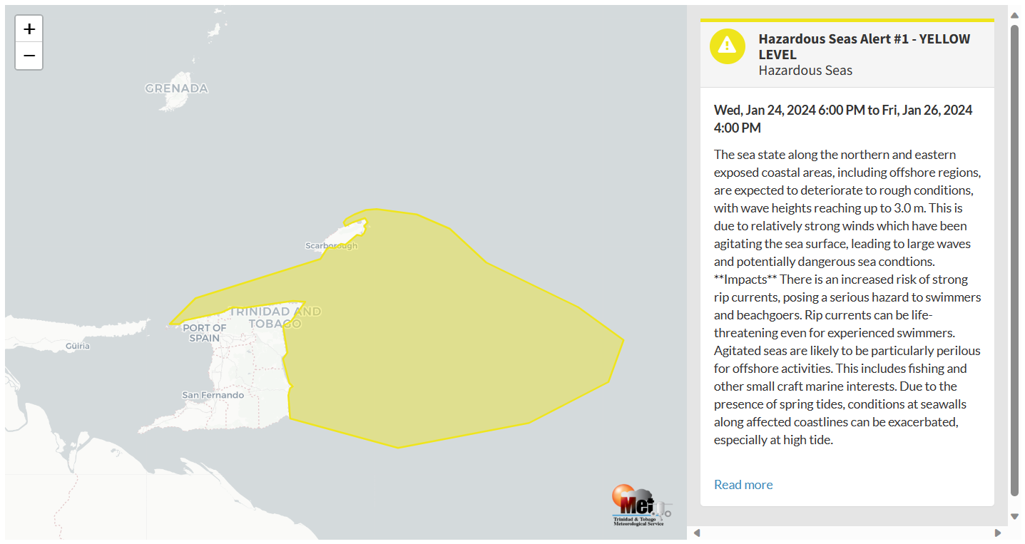
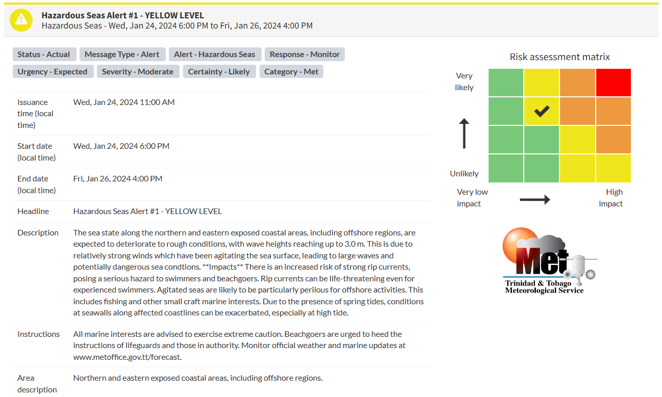
“The sea state along the northern and eastern exposed coastal areas, including offshore regions, is expected to deteriorate to rough conditions, with wave heights reaching up to 3.0 m. This is due to relatively strong winds which have been agitating the sea surface, leading to large waves and potentially dangerous sea conditions,” according to the Trinidad and Tobago Meteorological Service. This “alert” status considers the possibility of the event occurring. This hazardous sea event is likely.

The alert’s color indicates the event’s severity and probability of the event occurring. Currently, the alert level is Yellow. This means that the hazards are likely, and the severity of impacts is moderate for this particular alert.
There is an increased risk of strong rip currents, posing a serious hazard to swimmers and beachgoers. Rip currents can be life-threatening even for experienced swimmers. Agitated seas are likely to be particularly perilous for offshore activities. This includes fishing and other small craft marine interests. Due to the presence of spring tides, conditions at seawalls along affected coastlines can be exacerbated, especially at high tide.
For a moderate Hazardous Seas Alert, there is the potential for possible injuries, where behavioral changes are required to ensure safety. There may be minor damage to property, with income-earning temporarily disrupted and a couple of communities affected.
The Met Office is advising all marine interests to exercise extreme caution. Beachgoers are urged to heed the instructions of lifeguards and those in authority.


