


As forecast, a combination of elevated winds and long-period swells are expected to impact Trinidad and Tobago’s northern and eastern coastlines, with the most intense activity from Saturday morning through Monday at midday.
What you need to know
— What is happening: Swells with periods up to 16 seconds are forecast to produce large, battering, high-energy waves along Trinidad and Tobago’s northern and eastern coastlines through the weekend. Large waves will be more impactful during high tide periods, with open waters also agitated due to elevated winds.
— What can we expect: Large, battering waves are possible along T&T’s northern and eastern coastlines, with choppy conditions in sheltered areas throughout the weekend. Minor to moderate coastal erosion is possible. There is a high risk of rip currents along the country’s northern and eastern coastlines.
Latest Alerts

Localized Flood Alert Discontinued For Trinidad
Trinidad and Tobago is NOT under any tropical storm or hurricane threat, watch, or warning at this time.
The Hazardous Seas Alert
The Trinidad and Tobago Meteorological Service issued a Hazardous Seas Alert (Yellow Level) on Friday at 3:50 PM. The alert goes into effect for northern and eastern coastal areas of Trinidad and Tobago from 5:00 AM Saturday, November 18th, 2023, and remains in effect through 12:00 PM (noon) Monday, November 20th, 2023.
Trinidad and Tobago is not under any tropical storm watch or warning at this time.
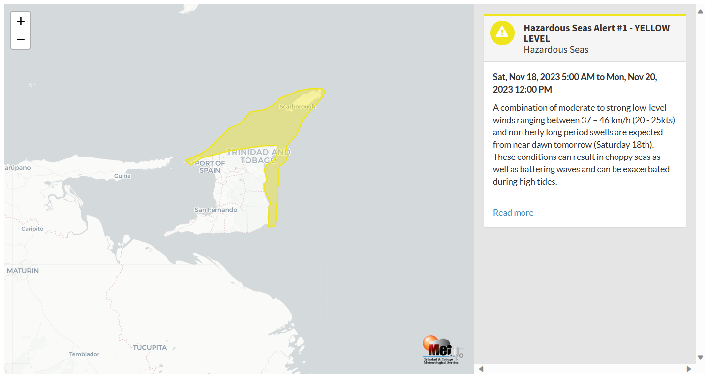
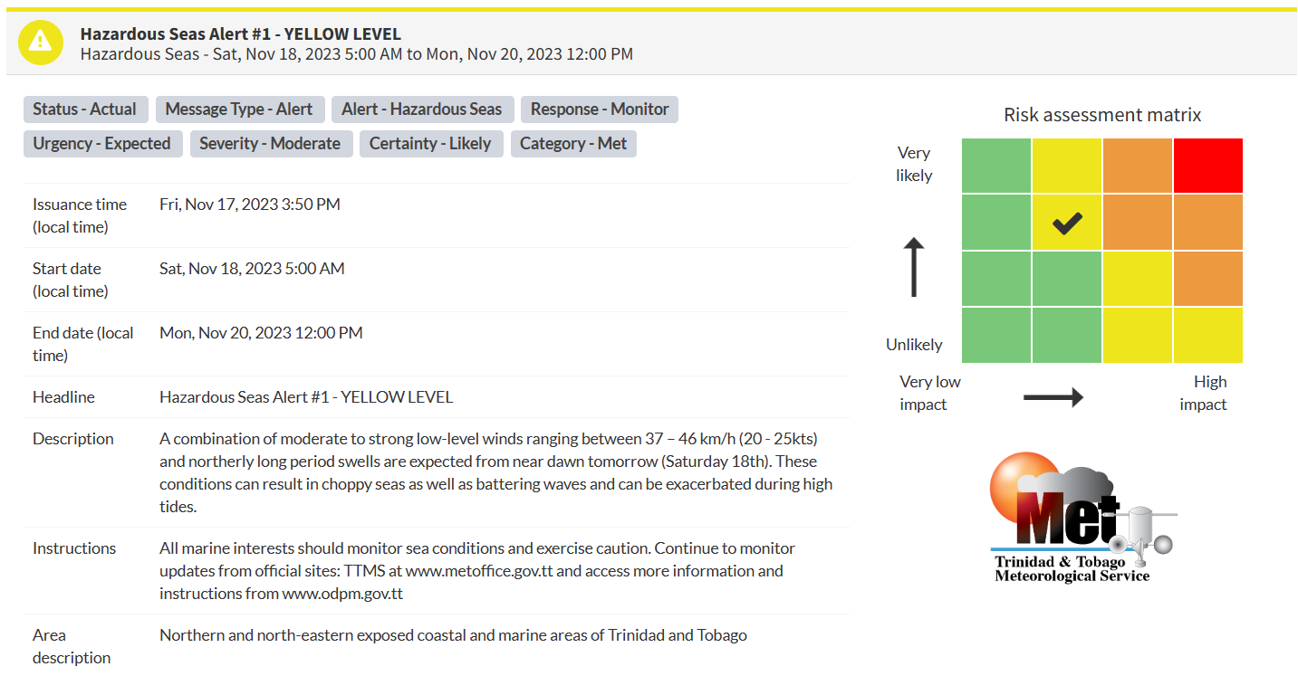
“A combination of moderate to strong low-level winds ranging between 37 – 46 km/h (20 – 25kts) and northerly long period swells are expected from near dawn tomorrow (Saturday 18th). These conditions can result in choppy seas as well as battering waves. They can be exacerbated during high tides.” according to the Trinidad and Tobago Meteorological Service. This “alert” status considers the possibility of the event occurring. This hazardous sea event is likely.

The color of the alert indicates the severity of the event and the probability of the event occurring. Currently, the alert level is Yellow. This means that the hazards are likely, and the severity of impacts is moderate for this particular alert. Large battering waves and a high risk of rip currents are the two main hazards associated with this swell event.
For a moderate Hazardous Seas Alert, there is the potential for possible injuries, where behavioral changes are required to ensure safety. There may be minor damage to property, with income-earning temporarily disrupted and a couple of communities affected.
The Met Office is advising all marine interests to monitor near-shore sea conditions and exercise caution along affected areas, especially at high tides and continue to monitor updates from official sites.


