


As forecast, long-period swells have begun to impact Trinidad and Tobago’s northern, northeastern and select western coastlines from early this (Friday) morning through the weekend.
What you need to know
— What is happening: Swells with periods up to 15 seconds are affecting Tobago’s northern coastlines, producing large, battering, high-energy waves. Large waves have been more impactful during high tide periods as a result of spring tides ongoing into next week as well.
— What can we expect: Large, battering waves are possible along T&T’s northern and northeastern coastlines initially, with choppy conditions in sheltered areas along western areas of Trinidad, particularly north-facing coastlines, as the weekend progresses. Minor to moderate coastal erosion and minor coastal flooding are possible. There is a high risk of rip currents along the country’s northern coastlines.
Latest Alerts

Localized Flood Alert Discontinued For Trinidad
Trinidad and Tobago is NOT under any tropical storm or hurricane threat, watch, or warning at this time.
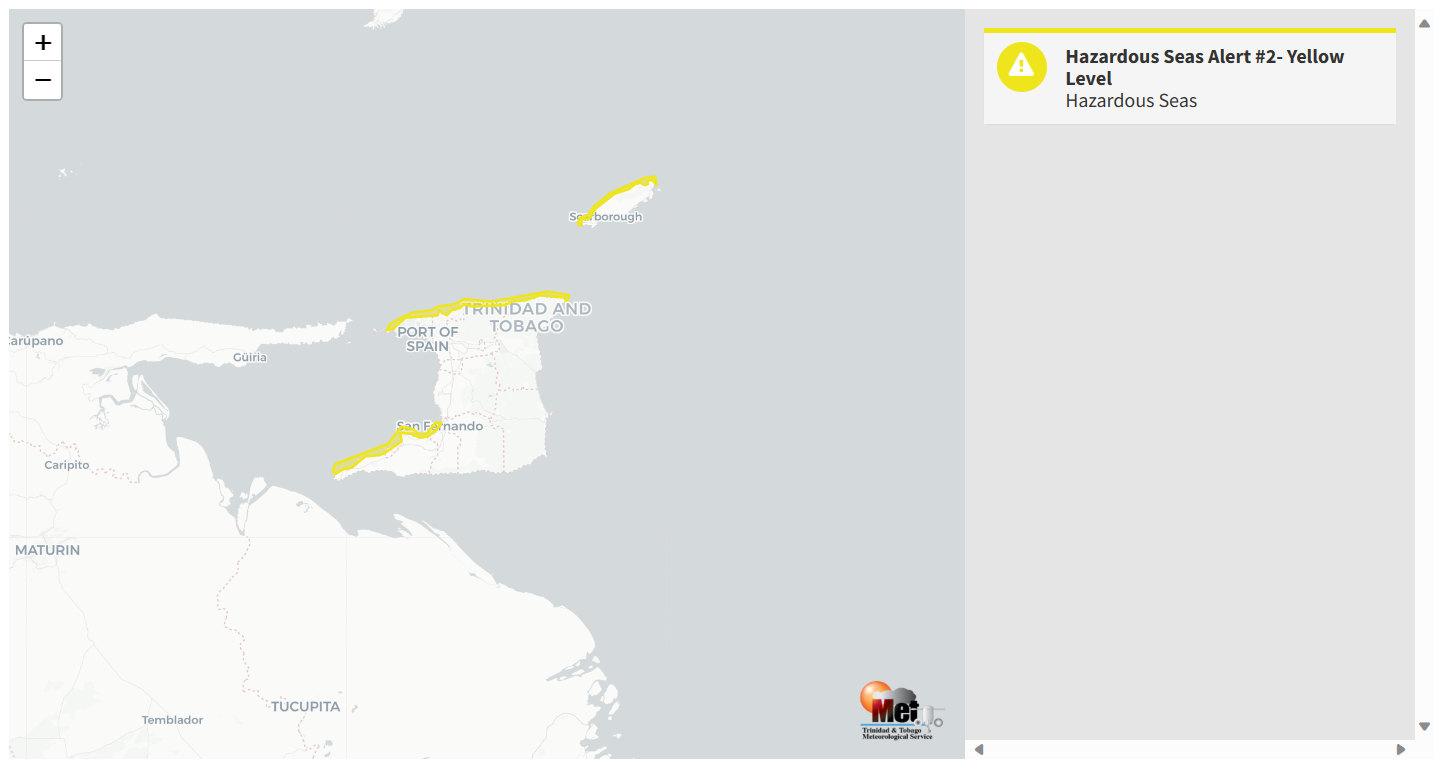
The Hazardous Seas Alert
The Trinidad and Tobago Meteorological Service updated the Hazardous Seas Alert (Yellow Level) on Friday at 12:29 PM. The alert went into effect for northern and northeastern exposed coastal areas of Trinidad and Tobago and, to a lesser extent – the north-facing shoreline in the Gulf of Paria from 5:00 AM Friday, October 27th, 2023, and remains in effect through 4:00 PM Monday, October 30th, 2023.
Today (Friday), swell periods of up to 15 seconds have been observed in nearshore areas of northern Tobago, with wave heights as high as 1.62 meters. The peak of this swell event is forecast for Saturday, gradually diminishing by Sunday.
Trinidad and Tobago is not under any tropical storm watch or warning at this time.
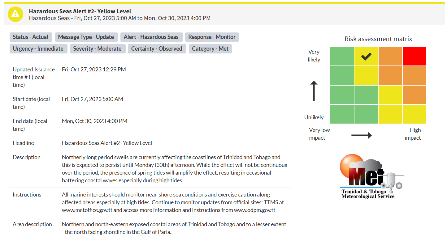
“Northerly long period swells are currently affecting the coastlines of Trinidad and Tobago and this is expected to persist until Monday (30th) afternoon. While the effect will not be continuous over the period, the presence of spring tides will amplify the effect, resulting in occasional battering coastal waves, especially during high tides,” according to the Trinidad and Tobago Meteorological Service. This “alert” status takes into account the possibility of the event occurring. This hazardous sea event is now observed.

The color of the alert indicates the severity of the event and the probability of the event occurring. Currently, the alert level is Yellow. This means that the hazards have been observed, and the severity of impacts is moderate for this particular alert. Large battering waves and a high risk of rip currents are the two main hazards associated with this swell event, and to a lesser extent, minor coastal flooding.
For a moderate Hazardous Seas Alert, there is the potential for possible injuries, where behavioral changes are required to ensure safety. There may be minor damage to property, with income-earning temporarily disrupted and a couple of communities affected.
The Met Office is advising all marine interests to monitor near-shore sea conditions and exercise caution along affected areas, especially at high tides and continue to monitor updates from official sites.


