


Showers and thunderstorms have begun to affect Trinidad and Tobago from early Thursday morning as Tropical Wave 49 moves across the Lesser Antilles. This activity is forecast to continue through Friday afternoon.
What you need to know
— Rainfall: Through Friday afternoon, periods of rain with isolated to scattered moderate to heavy showers and thunderstorms are forecast, interrupting cloudy skies. The most intense activity is forecast from the early morning of Thursday through the early afternoon hours of Friday. Generally, between 15 (western Trinidad) and 50 millimeters (eastern Trinidad, Tobago) of rainfall is forecast across the country. However, forecast models show sporadic areas of both Trinidad and Tobago receiving 48-hour rainfall totals up to 100 millimeters, generally favoring the eastern halves of both islands and northern coastal areas, with isolated higher amounts.
— Hazards: Street and flash flooding is likely in torrential rainfall, with wind gusts in excess of 55 KM/H accompanying heavy showers or thunderstorms. Localized wind damage, such as fallen trees, is possible. Lightning will be intense in thunderstorm activity. Landslides are also possible. Seas are forecast to become locally agitated during heavy showers or thunderstorms.
Latest Alerts

Adverse Weather Alert Discontinued, Moderate Impacts Still Possible
Trinidad and Tobago is NOT under any tropical storm or hurricane threat, watch, or warning at this time.
The Adverse Weather Alert
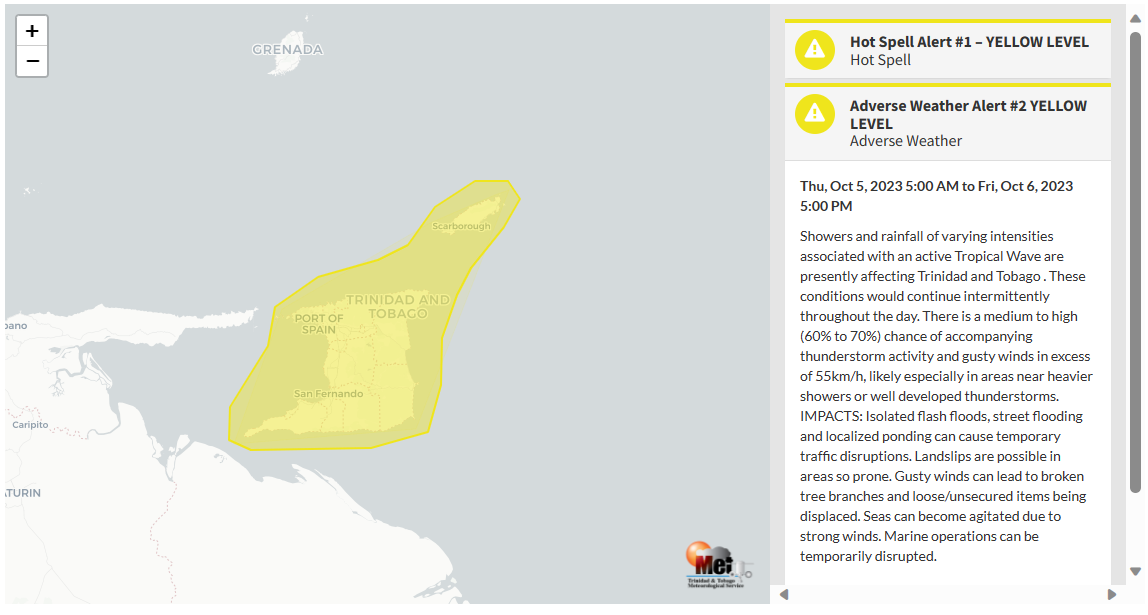
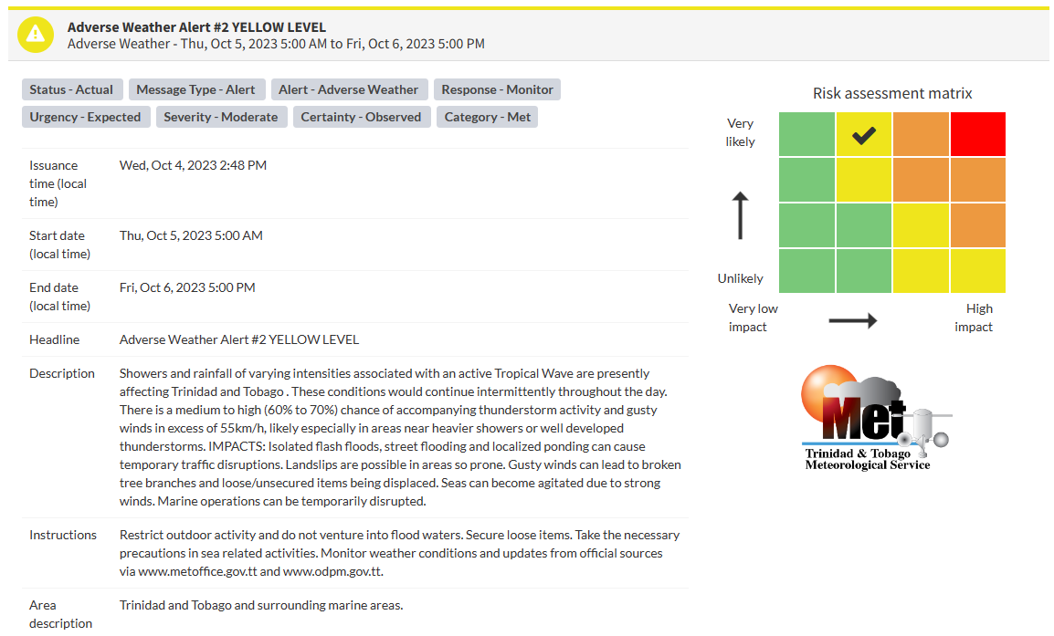
The Trinidad and Tobago Meteorological Service updated the Adverse Weather Alert (Yellow Level) on Thursday at 9:34 AM. The alert went into effect for Trinidad and Tobago from Thursday, October 5th, 2023, and remains in effect through 5:00 PM Friday, October 6th, 2023.
Trinidad and Tobago is not under any tropical storm watch or warning at this time.
The forecast inclement weather is due to abundant moisture and instability associated with Tropical Wave 49, coupled with a favorable atmospheric environment.
This “alert” status takes into account the possibility of the event occurring. This adverse weather event has been observed with the following impacts, according to the TTMS:
- Showers and rainfall of varying intensities associated with an active Tropical Wave are presently affecting Trinidad and Tobago. These conditions would continue intermittently throughout the day.
- There is a medium to high (60% to 70%) chance of accompanying thunderstorm activity.
- Gusty winds in excess of 55 KM/H are likely, especially near heavier showers or thunderstorms. Gusty winds can lead to broken tree branches and loose/unsecured items being displaced.
- Seas can become agitated due to strong winds. Marine operations can be temporarily disrupted.
- Isolated flash floods, localized street flooding, and ponding can cause temporary traffic disruptions, and landslips are possible in areas so prone.
So far, gusty winds have spared the country, but winds are forecast to increase through this afternoon. Selected rainfall totals as of 9:40 AM:
- Crown Point, Tobago: 10.0mm
- Sou Sou Lands, Tobago: 9.9mm
- North Oropouche, Trinidad: 6.6mm
- Coalmine, Sangre Grande, Trinidad: 30.8mm
- Piarco, Trinidad: Trace

The color of the alert indicates the severity of the event and the probability of the event occurring. Currently, the alert level is Yellow. This means that the hazards have been observed, and the severity of the impacts is moderate for this particular alert. You should be aware of the hazards in your area associated mainly with gusty winds in excess of 55 KM/H, street, and flash flooding, landslides, as well as frequent lightning.
For a moderate Adverse Weather Alert, there is the potential for possible injuries, where behavioral changes are required to ensure safety. There may be minor damage to property, with income-earning temporarily disrupted and a couple of communities affected.
The Met Office is advising the public to restrict outdoor activity and not venture into flood waters. Secure loose items. Take the necessary precautions in sea-related activities. Monitor weather conditions and updates from official sources.


