Moderate Seas Forecast, Saharan Dust Reducing Visibility

If you’re looking to head to the beach over the weekend, you’ll be met with near-optimal conditions – sunny (but hazy) skies, breezy conditions, and moderate seas.

There are no marine-specific alerts, watches, or warnings in effect from the Trinidad and Tobago Meteorological Service at this time.

Seas Forecast For Trinidad and Tobago

Sea state forecast through the next seven days, as slight to moderate seas are forecast. Note that sheltered areas include bays, beaches, and generally the Gulf of Paria and western areas of the Columbus Channel in Trinidad and the western coasts of Tobago. Open waters are the Atlantic Ocean (Eastern Trinidad and Tobago), the Eastern Columbus Channel (Southern Trinidad), and the Caribbean Sea (north of Trinidad, west of Tobago).

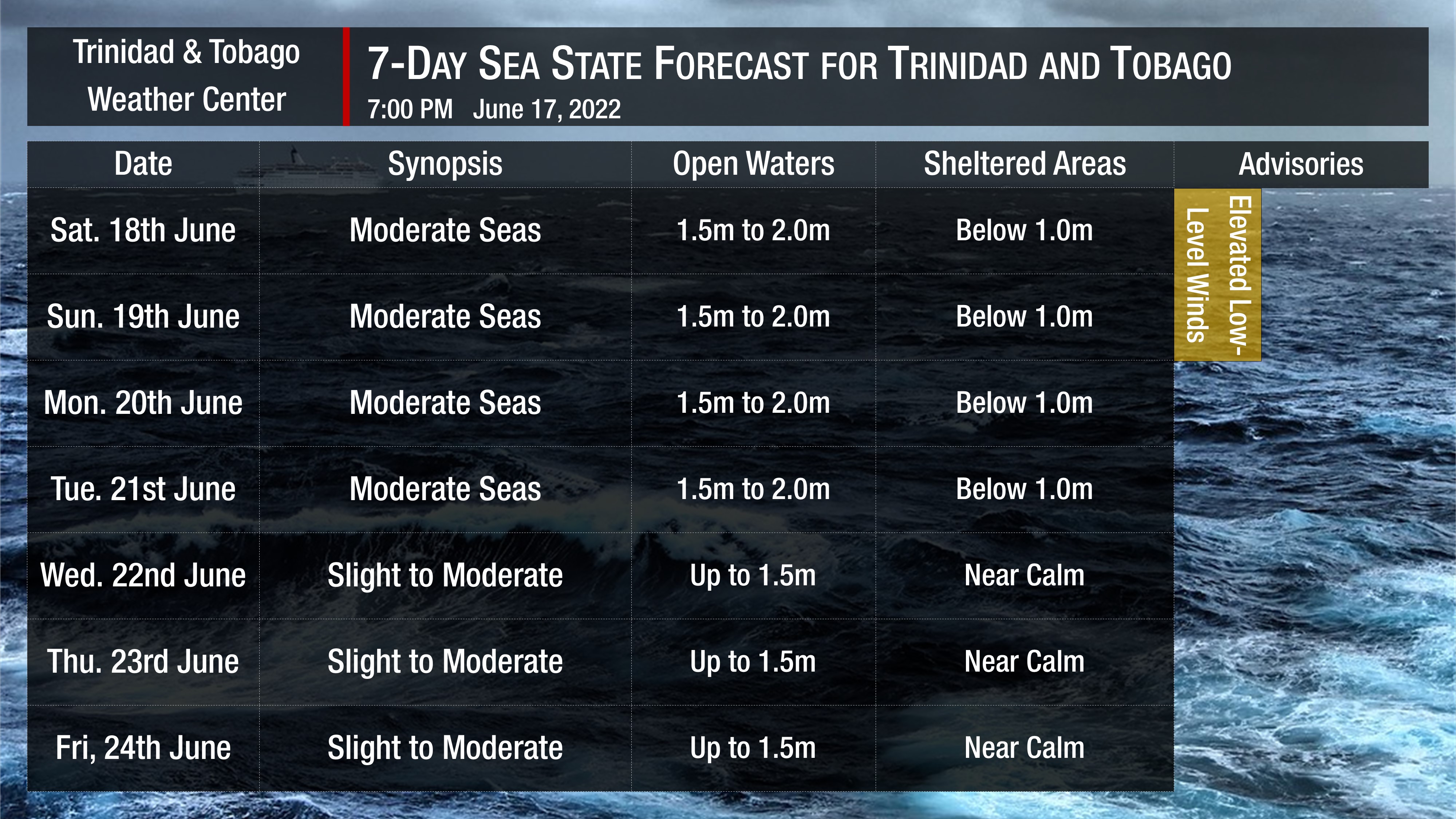
In sheltered areas, waves are forecast to be near or below 1.0 meters, becoming near calm by the middle of next week.

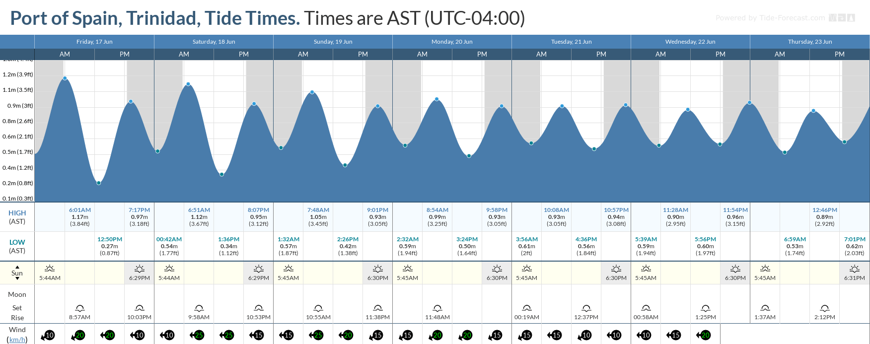
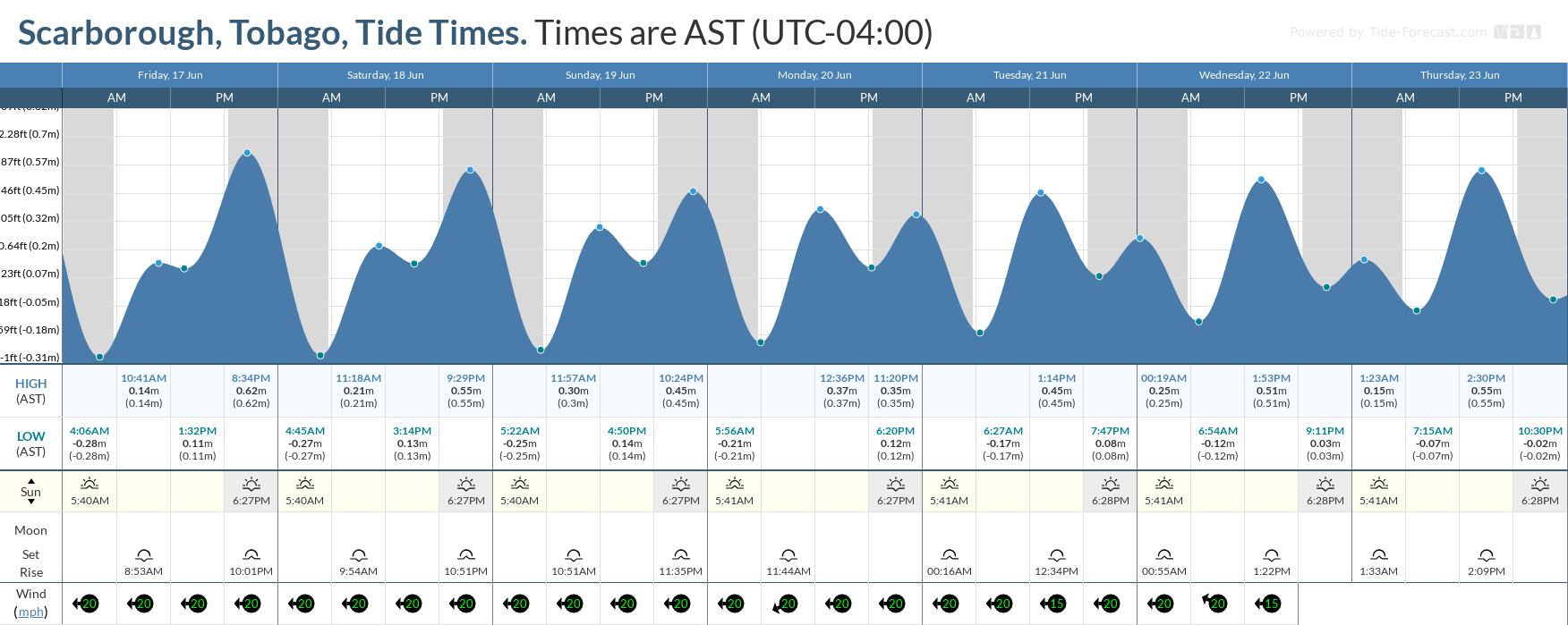
Winds are forecast to be moderate to fresh through the next several days, with sustained winds between 10 to 20 knots from the southeast to the northeast.

Generally, seas in open waters will remain moderate through the next seven days. In open waters, waves are forecast to generally be up to 2.0 meters through this week, becoming slight to moderate from Wednesday with open water waves up to 1.5 meters.

Tidal forecast for Port of Spain, Trinidad (above) and Scarborough, Tobago (below) courtesy Tide-Forecast.com

Saharan Dust will continue affecting T&T. Dust haze will gradually diminish through late Sunday, with another surge set to arrive by late Monday. Horizontal visibility may dip as low as 6 kilometers outside of shower or thunderstorm activity.

Total
0
Shares
Related Posts
Total
0
Share