


There are two tropical waves between Trinidad and Tobago and the African Coast, neither of which is forecast to move across the Lesser Antilles over the next seven days. The National Hurricane Center is monitoring the one closest to Africa for tropical cyclone development, with high chances of formation over the next week.
What you need to know
— Tropical Wave 50: The axis of this tropical wave is located near 46/47W, moving west at 10-15 knots (18-27 KM/H). This wave is forecast to lose its signature and dissipate before reaching the Lesser Antilles.
— Tropical Wave 51: The axis of this tropical wave is located at 19W, moving west at 10-15 knots (18-27 KM/H). This wave has a high chance of tropical cyclone formation over the next seven days and is forecast to move into the open North Atlantic Ocean next week.
— Hazards: For Trinidad and Tobago, no significant rainfall is forecast over the next week or so. Light to moderate winds under mostly sunny skies will lead to hot temperatures across the country, but strong daytime heating and the Intertropical Convergence Zone‘s proximity to T&T may trigger the odd heavy shower/thunderstorm along western and southern areas. See the forecast for more information.
Tropical Wave 50
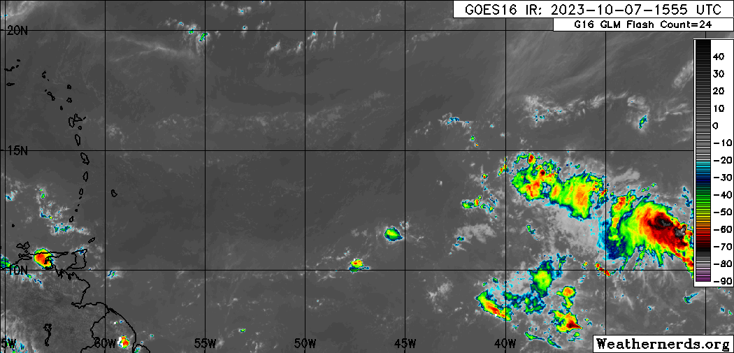
The 50th tropical wave for the 2023 Atlantic Hurricane season was analyzed between 46W and 77W, moving west at 10-15 knots (18-27 KM/H), generally south of 17N.
On Saturday afternoon, wind shear across the wave remained generally light to moderate but generally dry, dusty air limited convection associated with the wave. Based on the latest forecast model guidance, this tropical wave is forecast to lose its signature in the strengthening high-pressure system across the Atlantic.
As a result, this tropical wave is not forecast to move across the Lesser Antilles in the coming days, keeping the plume of moisture along 45W for the next week or so.
Tropical Wave 51
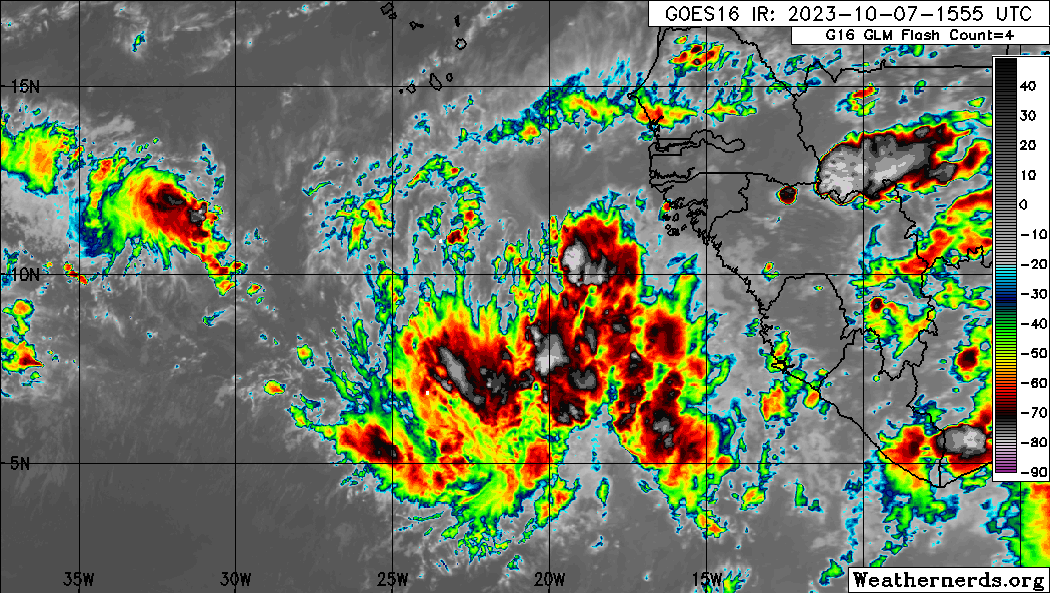
The 51st tropical wave for 2023 is located along 19W, moving west at 10-15 knots (18-27 KM/H). It currently has a high chance, 70%, of tropical cyclone formation over the next seven days, according to the National Hurricane Center (NHC).
In their 2:00 PM Tropical Update on October 7th, “A low-latitude tropical wave located near the west coast of Africa continues to produce a large area of disorganized showers and thunderstorms. Environmental conditions appear conducive for gradual development, and a tropical depression is likely to form by the middle of next week while it moves westward to west-northwestward across the eastern tropical Atlantic.”
Global models show a tropical depression or storm forming in the open Atlantic Ocean by the middle to end of next week, with no direct impacts on land. The next name on the list of names for the 2023 Atlantic Hurricane Season will be Ophelia. Based on the present track, this system is not forecast to pose any direct threat to Trinidad and Tobago, but will weaken the trade winds across the Lesser Antilles, which will lead to increased warm temperatures and higher chances of daytime showers/thunderstorms along western and hilly areas.
Not Every Tropical Wave Brings Severe Weather
Tropical waves vary in intensity as it travels westward across the Atlantic. This variability can be on the order of days to as short term as hours. Sometimes, you may see satellite imagery that shows heavy thunderstorms and deep convective activity east of Trinidad and Tobago during the late night and early morning, but by daybreak – nothing.
This is due to diurnal (daily) variations in convective showers whereby convection peaks overnight and wanes during the day for already occurring convective systems (i.e., not triggered by daytime heating).
Activity can be enhanced by its proximity to upper-level troughs and the ITCZ but can also be degraded by hostile upper-level conditions and Saharan Dust.
As we progress through October, tropical waves are forecast to gradually decrease in intensity and frequency, but low-level troughs interacting with the ITCZ and occasional tropical wave activity in the past have led to prolific rainfall events in the country.


