


As showers and thunderstorms descend on Trinidad and Tobago influenced by Tropical Storm Philippe’s proximity to the Lesser Antilles, located well northeast of the country, T&T has been placed under an Adverse Weather Alert.
What you need to know
— Rainfall: Through Monday night, periods of rain with isolated to scattered moderate to heavy showers and thunderstorms are forecast, interrupting cloudy skies. The most intense activity is forecast during the early morning through early afternoon hours of Monday. Rainfall totals between 20 to 50 millimeters are forecast in heavy showers and thunderstorms across both islands, with totals exceeding 75 millimeters likely in strong thunderstorm activity. On Sunday, up to 75 millimeters of rainfall accumulated across northeastern Trinidad.
— Hazards: Street and flash flooding is likely in torrential rainfall, with brief wind gusts in excess of 55 KM/H accompanying heavy showers or thunderstorms. Localized wind damage, such as fallen trees, is possible. Lightning will be intense in thunderstorm activity. Landslides are also possible. Seas are forecast to become locally agitated during heavy showers or thunderstorms.
Latest Alerts

Adverse Weather Alert Discontinued For T&T
Trinidad and Tobago is NOT under any tropical storm or hurricane threat, watch, or warning at this time.
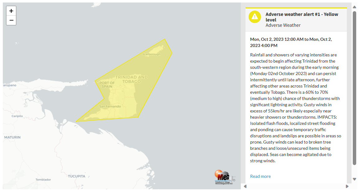
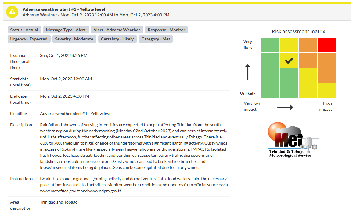
The Adverse Weather Alert
The Trinidad and Tobago Meteorological Service issued an Adverse Weather Alert (Yellow Level) on Sunday at 8:26 PM. The alert goes into effect for Trinidad, Tobago, and surrounding marine areas from midnight, 12:00 AM Monday, October 2nd, 2023, and remains in effect through 4:00 PM Monday, October 2nd, 2023.
Trinidad and Tobago is not under any tropical storm watch or warning at this time.
The current inclement weather and additional expected weather are a result of Tropical Storm Philippe’s proximity to the Lesser Antilles, creating bands of convergence across the region, with feeder band activity likely to develop across Trinidad and Tobago on Monday.
This “alert” status takes into account the possibility of the event occurring. This adverse weather event is likely with the following impacts, according to the TTMS:
- Rainfall and showers of varying intensities are expected to begin affecting Trinidad from the southwestern region during the early morning (Monday 02nd October 2023) and can persist intermittently until late afternoon, further affecting other areas across Trinidad and eventually Tobago.
- There is a 60% to 70% (medium to high) chance of thunderstorms with significant lightning activity.
- Gusty winds in excess of 55 KM/H are likely, especially near heavier showers or thunderstorms. Gusty winds can lead to broken tree branches and loose/unsecured items being displaced. Seas can become agitated due to strong winds.
- Isolated flash floods, localized street flooding, and ponding can cause temporary traffic disruptions, and landslips are possible in areas so prone.

The color of the alert indicates the severity of the event and the probability of the event occurring. Currently, the alert level is Yellow. This means that the hazards are likely, and the severity of the impacts is moderate for this particular alert. You should be aware of the hazards in your area associated mainly with gusty winds in excess of 55 KM/H, street, and flash flooding, landslides, as well as frequent lightning.
For a moderate Adverse Weather Alert, there is the potential for possible injuries, where behavioral changes are required to ensure safety. There may be minor damage to property, with income-earning temporarily disrupted and a couple of communities affected.
The Met Office is advising the public to be alert to cloud-to-ground lightning activity and not venture into flood waters, take the necessary precautions in sea-related activities, as well as monitor weather conditions and updates from official sources.


