


Hours after heavy rains associated with Tropical Wave 35, now tagged as tropical disturbance Invest 90L, began affecting Trinidad and Tobago, the Trinidad and Tobago Meteorological Service has issued an Adverse Weather Alert for the country. However, the alert does not officially begin until later on Saturday.
What you need to know
— Rainfall: Through Sunday night, periods of light to moderate rain with isolated to scattered moderate to heavy showers and thunderstorms are forecast, interrupting cloudy skies. The most intense activity is forecast to remain offshore northern and eastern T&T. Additional rainfall totals between 20 and 50 millimeters are forecast across both islands while across eastern and southern areas of Trinidad and across Tobago, rainfall totals between 50 and 75 millimeters are possible, with locally higher amounts. Peak intense activity is forecast overnight tonight through Sunday afternoon. Between 12.5 and 75 millimeters of rain has already fallen across parts of T&T through 2:00 PM Saturday.
— Hazards: Street and flash flooding is likely across both islands, with brief wind gusts in excess of 55 KM/H accompanying heavy showers or thunderstorms likely. Localized wind damage, such as fallen trees, is possible. Lightning will accompany thunderstorms. Landslides are also possible. Seas are forecast to become locally agitated during heavy showers or thunderstorms.
Latest Alerts

Adverse Weather Alert Discontinued For T&T
Trinidad and Tobago is NOT under any tropical storm or hurricane threat, watch, or warning at this time.
The Adverse Weather Alert
The Trinidad and Tobago Meteorological Service issued an Adverse Weather Alert (Yellow Level) on Saturday at 2:23 PM. The alert goes into effect for Trinidad, Tobago, and surrounding marine areas from 6:00 PM Saturday, August 19th, 2023, and remains in effect through 6:00 PM Sunday, August 20th, 2023.
Trinidad and Tobago is not under any tropical storm watch or warning at this time.
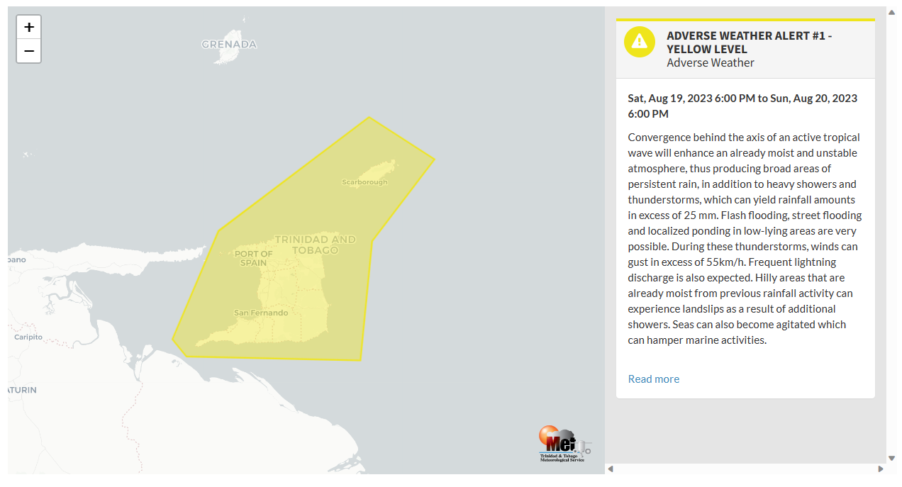
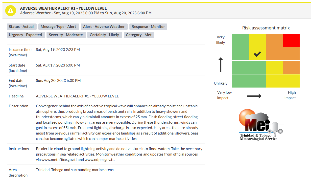
The current inclement weather and additional expected weather are a result of Tropical Wave 35/Invest 90L and its trailing convergence.
This “alert” status takes into account the possibility of the event occurring. This adverse weather event is likely with the following impacts, according to the TTMS:
- Broad areas of persistent rain, in addition to heavy showers and thunderstorms, can yield rainfall amounts exceeding 25 millimeters.
- Street flooding, flash flooding, and localized ponding in low-lying areas are very possible.
- Wind gusts in excess of 55 KM/H in thunderstorms.
- Frequent lightning.
- Landslides.
- Agitated seas.

The color of the alert indicates the severity of the event and the probability of the event occurring. Currently, the alert level is Yellow. This means that the hazards are likely, and the severity of the impacts is moderate for this particular alert. You should be aware of the hazards in your area associated mainly with gusty winds in excess of 55 KM/H, street, and flash flooding, landslides, as well as frequent lightning.
For a moderate Adverse Weather Alert, there is the potential for possible injuries, where behavioral changes are required to ensure safety. There may be minor damage to property, with income-earning temporarily disrupted and a couple of communities affected.
The Met Office is advising the public to be alert to cloud-to-ground lightning activity and not venture into flood waters, take the necessary precautions in sea-related activities, as well as monitor weather conditions and updates from official sources.


