


Two tropical waves between Trinidad and Tobago and the African Coast are forecast to move across the region this week, with the closest wave moving across the country on Tuesday night into Wednesday, July 11th into 12th, 2023.
Meanwhile, in the North Atlantic, the National Hurricane Center is monitoring an area of low pressure with medium chances of tropical cyclone formation.
What you need to know
— Tropical Wave 22: The axis of this tropical wave is located between 48W and 55W, moving west at 20 knots (37 KM/H). This wave is forecast to move across T&T and the Windwards on Tuesday night into Wednesday, July 11th into 12th, 2023, keeping the Intertropical Convergence Zone (ITCZ) across the country.
— Tropical Wave 23: The axis of this tropical wave is located at 20W, moving west at 10 knots (18 KM/H). This wave is forecast to move across T&T and the Windwards on Friday, July 14th, into Saturday, July 15th, 2023, interacting with the ITCZ.
— North Atlantic AOI: The NHC is monitoring an area of low pressure in the North Atlantic Ocean with medium chances of tropical cyclone formation. It poses no threat to T&T and the Lesser Antilles.
— Hazards: For Trinidad and Tobago, scattered showers and thunderstorms are all forecast through the week, with these tropical wave passages interacting with the ITCZ. Street/flash flooding and gusty winds are possible. Through Saturday, total rainfall accumulations are not forecast to be extreme, likely due to the concentrations of Saharan Dust that are forecast to be present. See the forecast for more information.
— Development Concerns: Elsewhere across the Atlantic, tropical cyclone development is not expected, according to the National Hurricane Center.
Tropical Wave 22
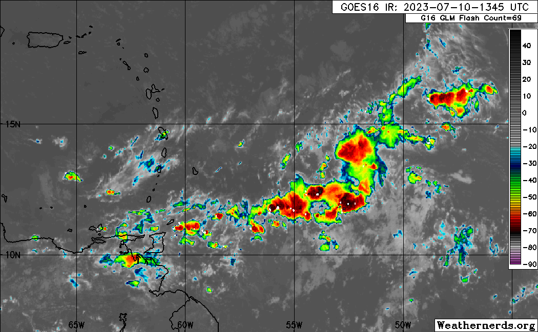
The 22nd tropical wave for the 2023 Atlantic Hurricane season was analyzed between 48W and 55W, moving west at 20 knots (37 KM/H), generally south of 16.5N.
On Monday afternoon, wind shear across the northern portion of the wave was moderate to strong, while across the southern half of the axis, wind shear was moderate to weak. This wave brings with it an abundant amount of deep tropical moisture, with a favorable upper-level environment mainly east of 55W.
A low-level trough interacting with the ITCZ is across Trinidad and Tobago on Monday afternoon, producing scattered showers and thunderstorms. As this wave moves west Wednesday, the ITCZ is forecast to remain nearby, with another low-level trough following.
Given this wave is moving the ITCZ across T&T, peak inclement weather conditions are likely during the predawn and early afternoon hours, associated with peak activity of the ITCZ.

Tropical Wave 23
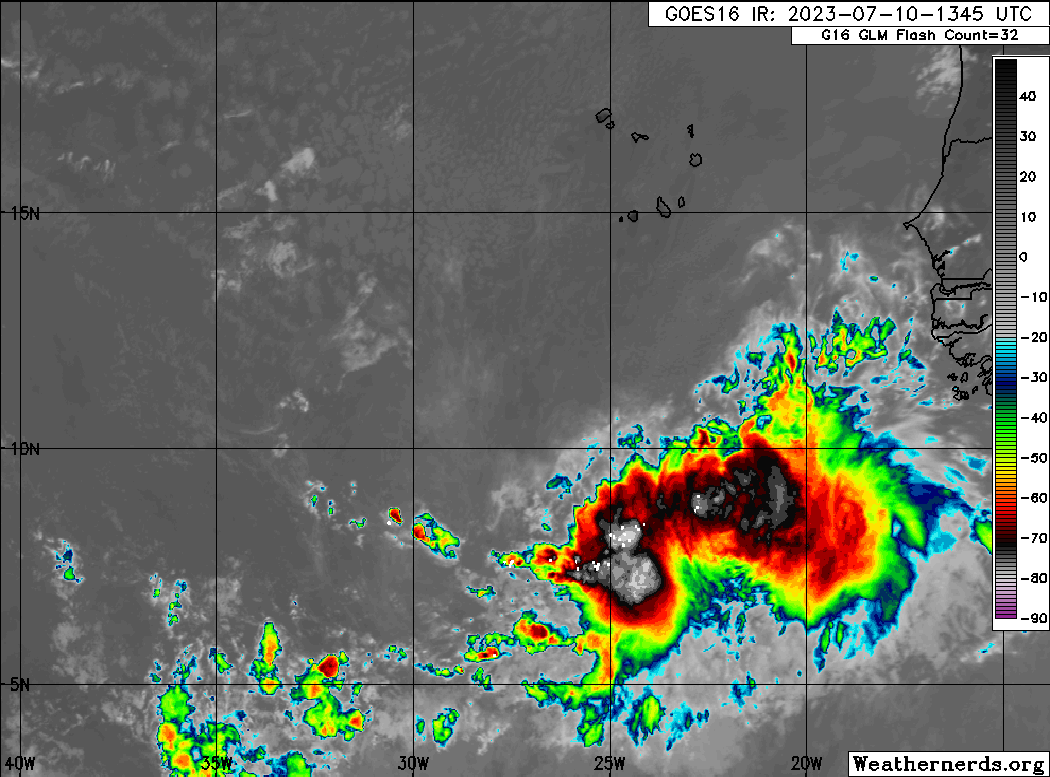
The 23rd tropical wave for 2023 has left the African coast with isolated strong convection ahead of the wave axis, mainly where it interacts with the ITCZ/Monsoon Trough. As of 3:00 PM Monday, the axis of this tropical wave is located along 20W, moving west at 10 knots (18 KM/H).
This tropical wave is forecast to move across the Atlantic over the next several days and begin to affect the Windward Islands from Friday, July 14th, 2023, into Saturday, July 15th, 2023.
Forecast models indicate this wave being fairly low-latitude and moving across T&T with a fairly favorable upper-level environment. Like the prior tropical wave, it will bring and interact with the ITCZ at the time of its passage, resulting in peak inclement weather during the predawn and early afternoon hours of Friday and Saturday. See the forecast for more information.
Area of Interest

The National Hurricane Center (NHC) is monitoring an area of low pressure that continues to produce disorganized showers and thunderstorms a few hundred miles east-northeast of Bermuda. In their 2:00 PM Monday Tropical Weather Outlook, they state that environmental conditions are expected to be marginally conducive for development, and the system could become a subtropical or tropical depression in the next few days while it moves generally eastward.
However, by the upcoming weekend, the area of low pressure will move northward into cooler waters, limiting further development.
The NHC gives it a low (10%) chance of development over the next 48 hours and a medium (40%) chance of development over the next seven days. Regardless of development, it poses no threat to Trinidad, Tobago, and the remainder of the Lesser Antilles.
Not Every Tropical Wave Brings Severe Weather
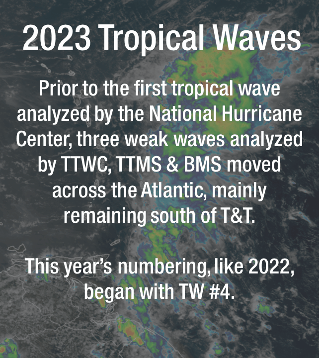
Tropical waves vary in intensity as it travels westward across the Atlantic. This variability can be on the order of days to as short term as hours. Sometimes, you may see satellite imagery that shows heavy thunderstorms and deep convective activity east of Trinidad and Tobago during the late night and early morning, but by daybreak – nothing.
This is due to diurnal (daily) variations in convective showers whereby convection peaks overnight and wanes during the day for already occurring convective systems (i.e., not triggered by daytime heating).
Activity can be enhanced by its proximity to upper-level troughs and the ITCZ but can also be degraded by hostile upper-level conditions and Saharan Dust.


