


Churning well northeast of Trinidad and Tobago, Tropical Storm Philippe and Tropical Storm Rina have proved to be quite a headache for forecasters at the National Hurricane Center.
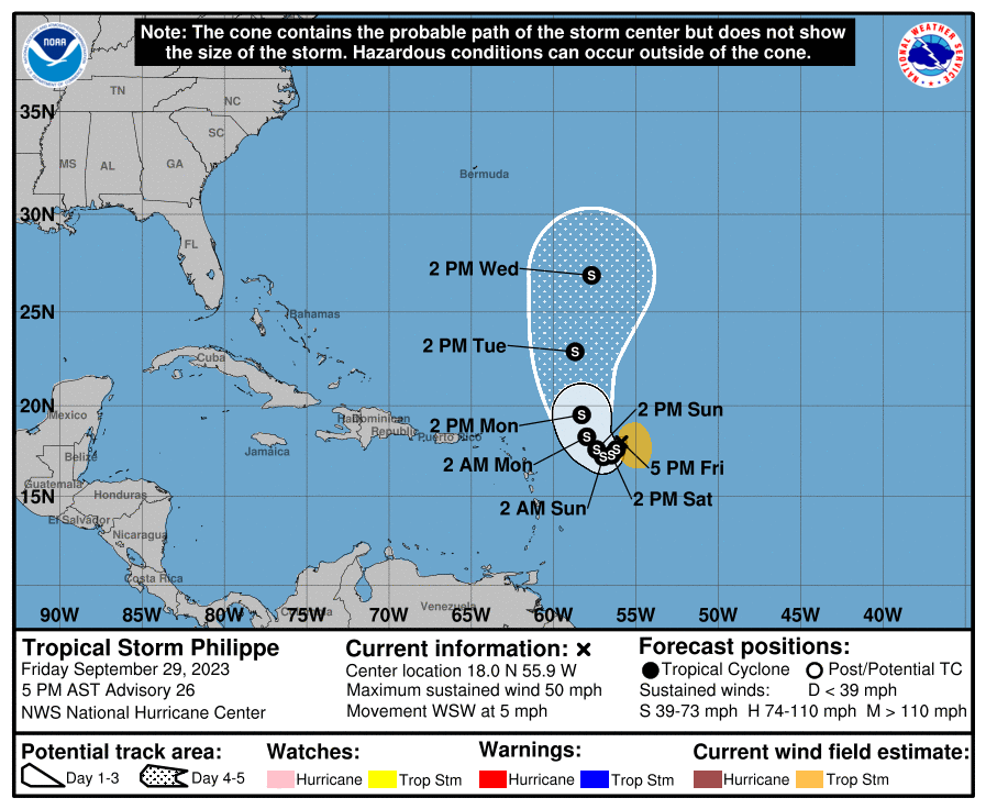
At 5:00 PM AST Friday, Tropical Storm Philippe was located approximately 760 kilometers east of the northern Leeward Islands, moving west-southwest at 7 KM/H, with maximum sustained winds of 85 and a central pressure of 1002 millibars. Meanwhile, Tropical Storm Rina’s center was located approximately 860 kilometers east of Philippe, moving northwest at 9 KM/H with maximum sustained winds of 75 KM/H and a central pressure of 1003 millibars.

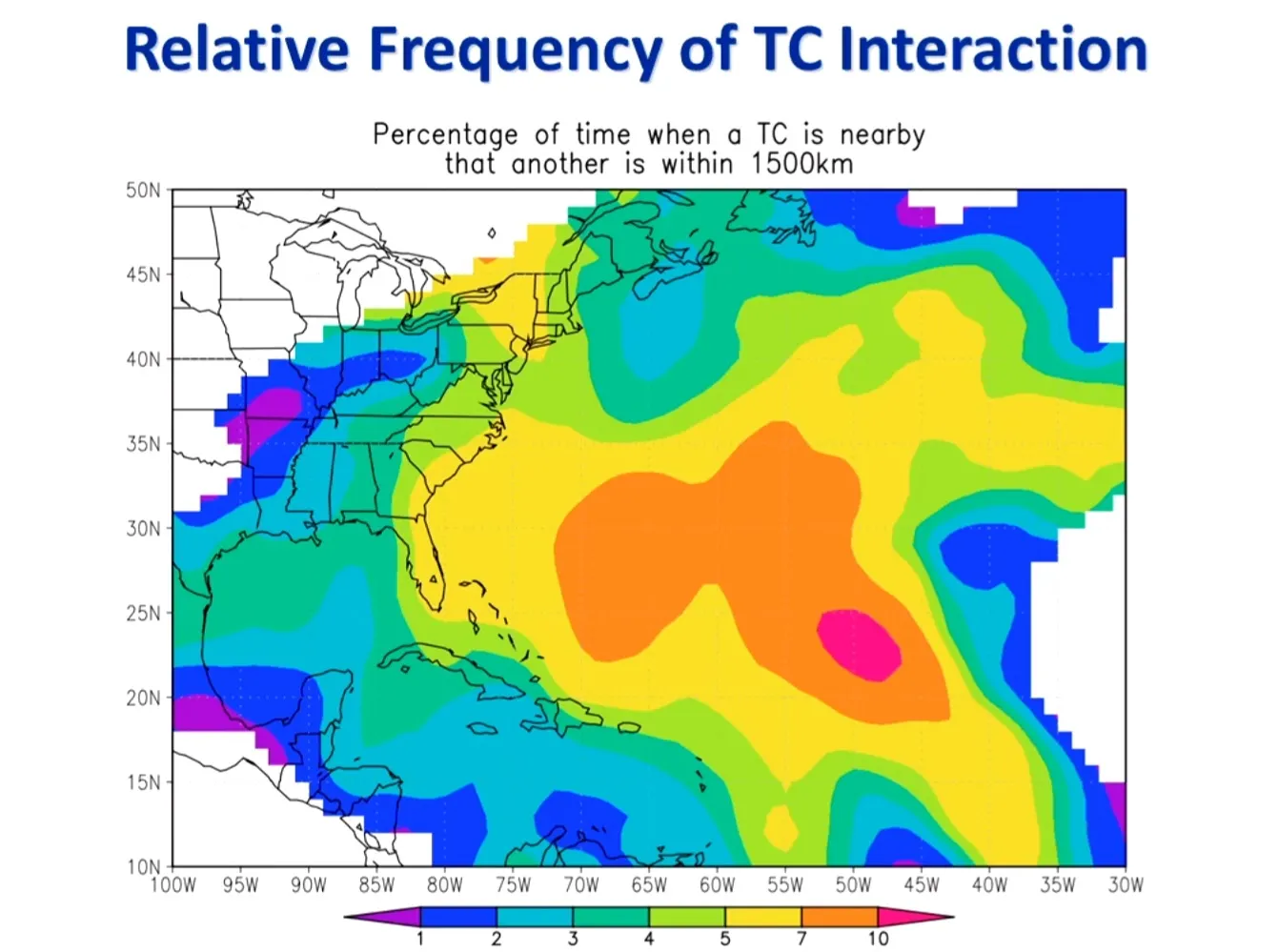
As both tropical storms were spinning in close proximity, this is where the complication arose – creating what is known as the Fujiwhara effect.
The Fujiwhara effect, so named for Japanese meteorologist Sakuhei Fujiwhara, who first described the phenomenon in a seminal 1921 paper, happens when the circulations of multiple low-pressure systems (in this case, two tropical storms) get close enough that they begin to rotate counterclockwise (in the northern hemisphere) around one another. In some cases, the two low-pressure systems may even get close enough to merge into one storm system. In most cases, however, one of the low-pressure systems is dominant, and the bigger/stronger storm disrupts the circulation of the weaker storm.
According to Hurricane Specialist and Storm Surge Expert Dr Michael Lowry, the Fujiwhara effect happens about 5% of the time in the Atlantic Basin.
Where is Philippe and Rina heading?
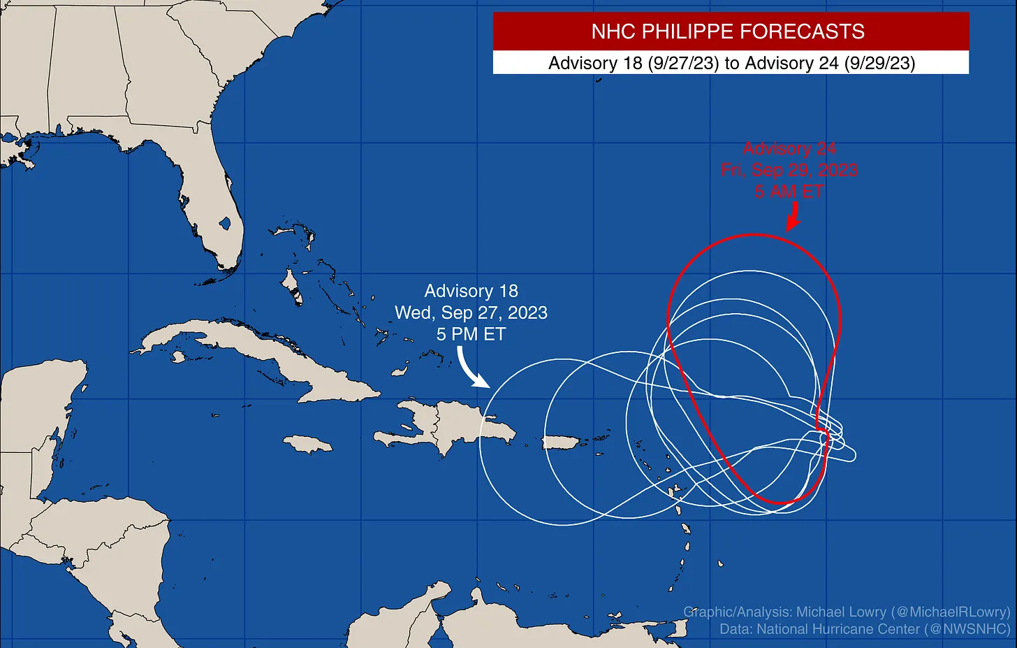
Though there have been some major changes to Philippe’s track over the last few days, both systems are not forecast to be direct threats to the Leewards and the remainder of the Lesser Antilles at this time.
In a case like Philippe and Rina, the Fujiwhara effect would tend to push Philippe more southwestward and Rina more northwestward, and this is pretty much what is being predicted by the National Hurricane Center.
Models indicate that Philippe will become the dominant storm over the coming days, and the outflow from its circulation will gradually weaken Rina as Philippe becomes better organized. Philippe will initially dip toward the islands due to Rina’s circulation pushing it southward.

Meanwhile, Rina will be slingshot northwestward courtesy of Philippe’s circulation. By the start of next week, Rina is expected to have weakened substantially, and a strengthening Philippe will move more quickly northward around the western periphery of the subtropical high, which will also rebuild across T&T by Tuesday into Wednesday.
What does this mean for T&T and the Eastern Caribbean?
For the Leeward Islands, which are closest to both tropical storms, a low-level to surface trough extended southwestward from Philippe will remain across the Leewards, extending to the northern Windwards as Philippe dips southwest this weekend.
As a result, winds across the Leewards and Windwards are forecast to remain light to near calm, leading to sweltering temperatures across the region. Antigua and Barbuda is under an Excessive Heat Warning until Friday, October 6th, 2023.
A High Surf Advisory is also in effect for several of the Leeward Islands, with an upgrade to a High Surf Warning possible this weekend as swells and increased winds offshore whip long-period swells. T&T will also experience long-period swells through the weekend, combined with spring tides, requiring caution from beachgoers and mariners.

Given the proximity to the Lesser Antilles, bands of convergence (also known as feeder bands) could form across the region, but whether these form, where they form, and how intense they could be, are all highly uncertain at this time. For the Leewards, the best chances for these outer feeder bands to affect the islands would be Friday night through Sunday.
For T&T and the Windwards, the best chances for one of these to form, based on the latest forecast models (which has been highly variable over the last few days, reducing forecast confidence), shows a band of moisture moving across the area on Monday. However, forecast models continue to show this area of convergence remaining quite weak, with no significant widespread rainfall.
Latest Forecast

Forecast: Isolated Showers, Thunderstorms Ahead of Significant Saharan Dust Surge
Trinidad and Tobago is NOT under any tropical storm or hurricane threat, watch, or warning at this time.


