


Gusty winds with heavy showers and thunderstorms moved across T&T, associated with Tropical Wave 19, and the Intertropical Convergence Zone, producing wind damage across the country.
What you need to know
— What has happened: A surge of low-level winds associated with Tropical Wave 19 has swept across Trinidad and Tobago, with wind gusts up to and exceeding 60 KM/H recorded across both islands, causing downed trees, roof, and structural damage.
— What to expect: The peak of this wind event has passed. However, in additional isolated showers and thunderstorms through the afternoon, wind gusts up to 55 KM/H are likely. Street/flash flooding is still possible in heavy rainfall.
Latest Alerts

T&T Placed Under High Wind Alert From 11 PM Tuesday
Trinidad and Tobago is NOT under any tropical storm or hurricane threat, watch, or warning at this time.
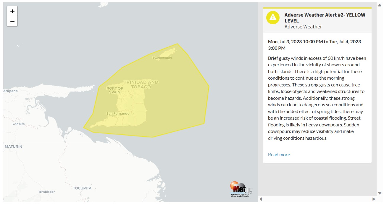
The Adverse Weather Alert
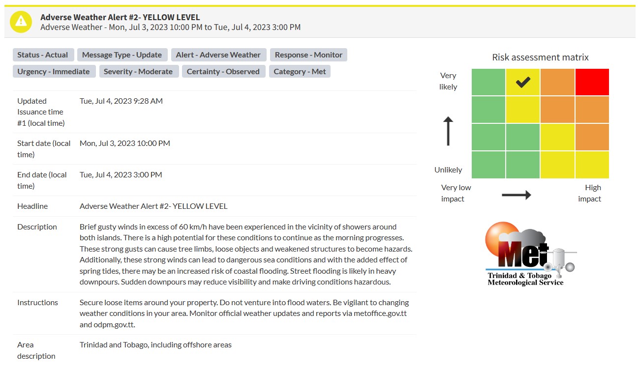
The Trinidad and Tobago Meteorological Service has updated the Adverse Weather Alert (Yellow Level) on Tuesday at 9:28 AM. The alert went into effect for Trinidad, Tobago, and surrounding marine areas from 10:00 PM Monday, July 3rd, 2023, and remains in effect through 3:00 PM Tuesday, July 4th, 2023.
A surge of Saharan Dust is forecast to bring increasingly settled conditions later tonight.
Trinidad and Tobago is not under any tropical storm watch or warning at this time.
According to the TTMS, the approaching inclement weather is associated with Tropical Wave #19.
This “alert” status takes into account the possibility of the event occurring. This adverse weather event is likely with the following impacts, according to the TTMS:
- Gusty winds in excess of 60 KM/H have been experienced, with a high potential for these conditions to continue through the morning.
- Strong winds can cause tree limbs, loose objects, and weakened structures to become hazards
- Strong winds can lead to dangerous sea conditions, and with spring tides, coastal flooding is possible.
- Street/flash flooding and localized ponding are also likely in heavy downpours, with sudden downpours causing hazardous driving conditions and reduce visibility.

The color of the alert indicates the severity of the event and the probability of the event occurring. Currently, the alert level is Yellow. This means that the hazards have been observed, and the severity of the impacts is moderate for this particular alert. You should be aware of the hazards in your area associated mainly with gusty winds in excess of 60 KM/H, street, and flash flooding, landslides, as well as frequent lightning.
For a moderate Adverse Weather Alert, there is the potential for possible injuries, where behavioral changes are required to ensure safety. There may be minor damage to property, with income-earning temporarily disrupted and a couple of communities affected.
The Met Office is advising the public to secure loose items around their property, not venture into flood waters, be vigilant to changing weather conditions, as well as monitor weather conditions and updates from official sources.


