


Trinidad and Tobago is bracing for additional heavy showers and thunderstorms overnight tonight through tomorrow (Tuesday) afternoon as activity associated with Tropical Wave 19 and the Intertropical Convergence Zone moves through the area.
What you need to know
— Rainfall: Through Tuesday afternoon, periods of rain with isolated moderate to heavy showers and thunderstorms are forecast, interrupting cloudy skies. The most intense activity is forecast to remain offshore northern and eastern T&T. Rainfall totals between 20 and 50 millimeters are forecast across both islands while across eastern and southern areas of Trinidad, rainfall totals between 50 and 70 millimeters are possible, with locally higher amounts. Peak intense activity is forecast overnight tonight into the early hours of Tuesday morning.
— Hazards: Street and flash flooding is likely across both islands, with brief wind gusts in excess of 60 KM/H accompanying heavy showers or thunderstorms likely. Localized wind damage, such as fallen trees, is possible. Lightning will accompany thunderstorms. Landslides are also possible, mainly across northeastern Trinidad and Tobago. Seas are forecast to become locally agitated during heavy showers or thunderstorms. With spring tides and strong winds, coastal flooding is possible with dangerous marine conditions.
Latest Alerts

T&T Placed Under High Wind Alert From 11 PM Tuesday
Trinidad and Tobago is NOT under any tropical storm or hurricane threat, watch, or warning at this time.
The Adverse Weather Alert
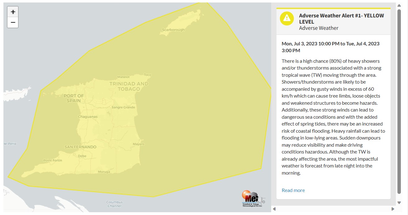
The Trinidad and Tobago Meteorological Service issued an Adverse Weather Alert (Yellow Level) on Monday at 2:20 PM. The alert goes into effect for Trinidad, Tobago, and surrounding marine areas from 10:00 PM Monday, July 3rd, 2023, and remains in effect through 3:00 PM Tuesday, July 4th, 2023.
A surge of Saharan Dust is forecast to bring increasingly settled conditions by late Tuesday.
Trinidad and Tobago is not under any tropical storm watch or warning at this time.
According to the TTMS, the approaching inclement weather is associated with Tropical Wave #19.
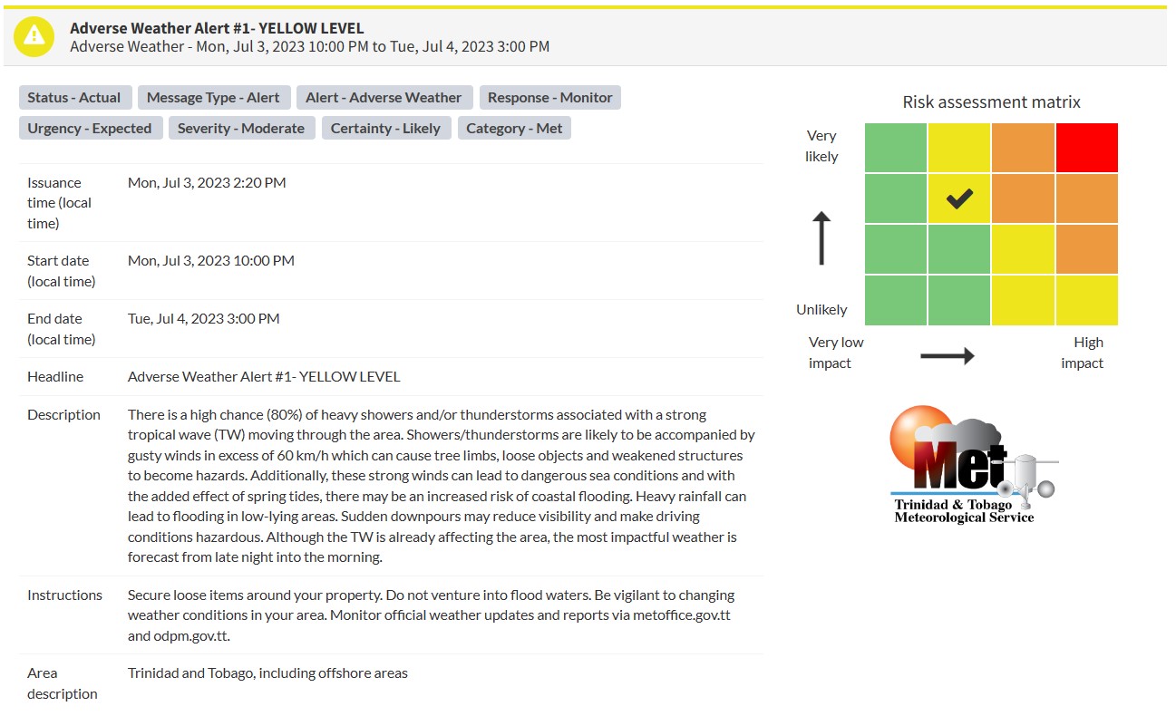
This “alert” status takes into account the possibility of the event occurring. This adverse weather event is likely with the following impacts, according to the TTMS:
- High chance (80%) of heavy showers/thunderstorms affecting Trinidad, Tobago, and surrounding marine areas.
- Gusty winds in excess of 60 KM/H, leading to fallen trees, agitating seas, and displacing unsecured items.
- Strong winds can lead to dangerous sea conditions, and with spring tides, coastal flooding is possible.
- Street/flash flooding and localized ponding are also likely in heavy downpours, with sudden downpours causing hazardous driving conditions and reduce visibility.

The color of the alert indicates the severity of the event and the probability of the event occurring. Currently, the alert level is Yellow. This means that the hazards are likely, and the severity of the impacts is moderate for this particular alert. You should be aware of the hazards in your area associated mainly with gusty winds in excess of 60 KM/H, street, and flash flooding, landslides, as well as frequent lightning.
For a moderate Adverse Weather Alert, there is the potential for possible injuries, where behavioral changes are required to ensure safety. There may be minor damage to property, with income-earning temporarily disrupted and a couple of communities affected.
The Met Office is advising the public to secure loose items around their property, not venture into flood waters, be vigilant to changing weather conditions, as well as monitor weather conditions and updates from official sources.


