The 2023 Atlantic Hurricane Season is off to a racing start, with the formation of a tropical depression on the first official day of the season on Thursday afternoon.
The National Hurricane Center (NHC) has been monitoring an area of low pressure in the Gulf of Mexico over the last few days. The disturbance, earlier dubbed Invest 91L, has been meandering over the warm waters of the Gulf of Mexico several hundred miles south of the Florida Panhandle.
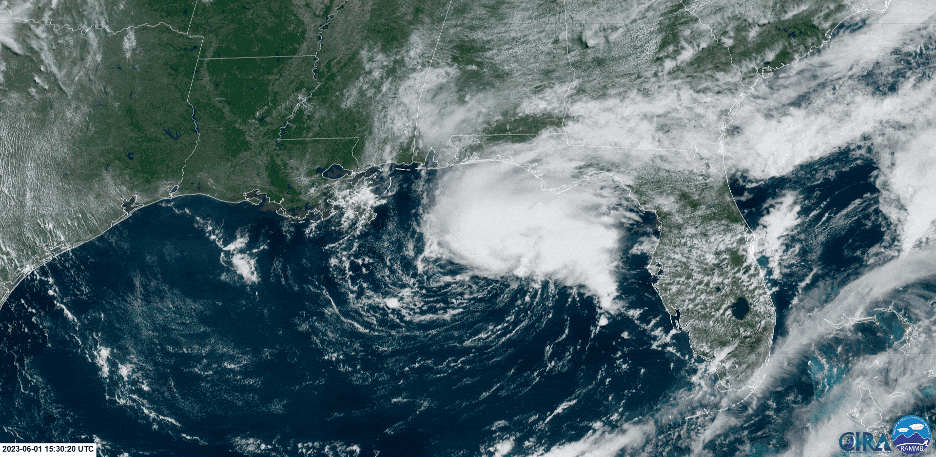
A Hurricane Hunter aircraft reconnaissance flight was investigating the system on Thursday evening, finding winds up to 74 KM/H associated with this area of low pressure, while a nearby Buoy 42039, located in the area of heavy thunderstorms, recorded sustained east-northeast winds of 47 KM/H, gusting to 82 KM/H, at 7:30 AM AST Thursday.
This system poses no threat to Trinidad, Tobago, and the Eastern Caribbean region.
The Latest
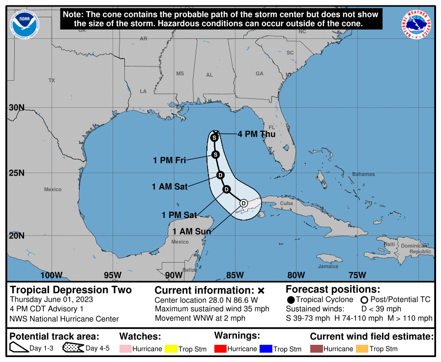
According to the National Hurricane Center, at 4:00 PM CDT (5:00 PM AST), the center of Tropical Depression Two was located near latitude 28.0 North, longitude 86.6 West. The
depression is moving toward the west-northwest near 4 KM/H. A motion to the south is expected to begin by Friday with gradually increasing forward speed.
Maximum sustained winds are near 55 KM/H with higher gusts. Some modest intensification is forecast, and the depression could become a tropical storm tonight or tomorrow. However, the system should begin to weaken by Friday night and degenerate into a remnant low by Saturday.
The estimated minimum central pressure is 1007 millibars. NOAA buoy 42039 recently reported sustained winds of 57 KM/H with a gust of 65 KM/H.
While there are no coastal watches or warnings in effect, the NHC notes that rainfall amounts of 1 to 3 inches (25 to 75 millimeters) with localized higher amounts up to 6 inches (150 millimeters) are possible through Saturday across portions of the central and southern Florida Peninsula. However, this rainfall is not directly related to Tropical Depression Two. Regardless, this rainfall could lead to isolated flash, urban, and small stream flooding impacts across Florida.
Why Tropical Depression Two?
Earlier this year, in mid-January, the National Hurricane Center determined that a subtropical storm developed off the United States’ east coast. While this system was not named, it was the first tropical cyclone for 2023 in the Atlantic and took the name Subtropical Storm One.
As a result, the next tropical cyclone would become Subtropical or Tropical Depression Two, but if it develops into a Subtropical or Tropical Storm, it will be called Arlene.
Read More

NHC: First Storm For 2023 Hurricane Season Formed In January
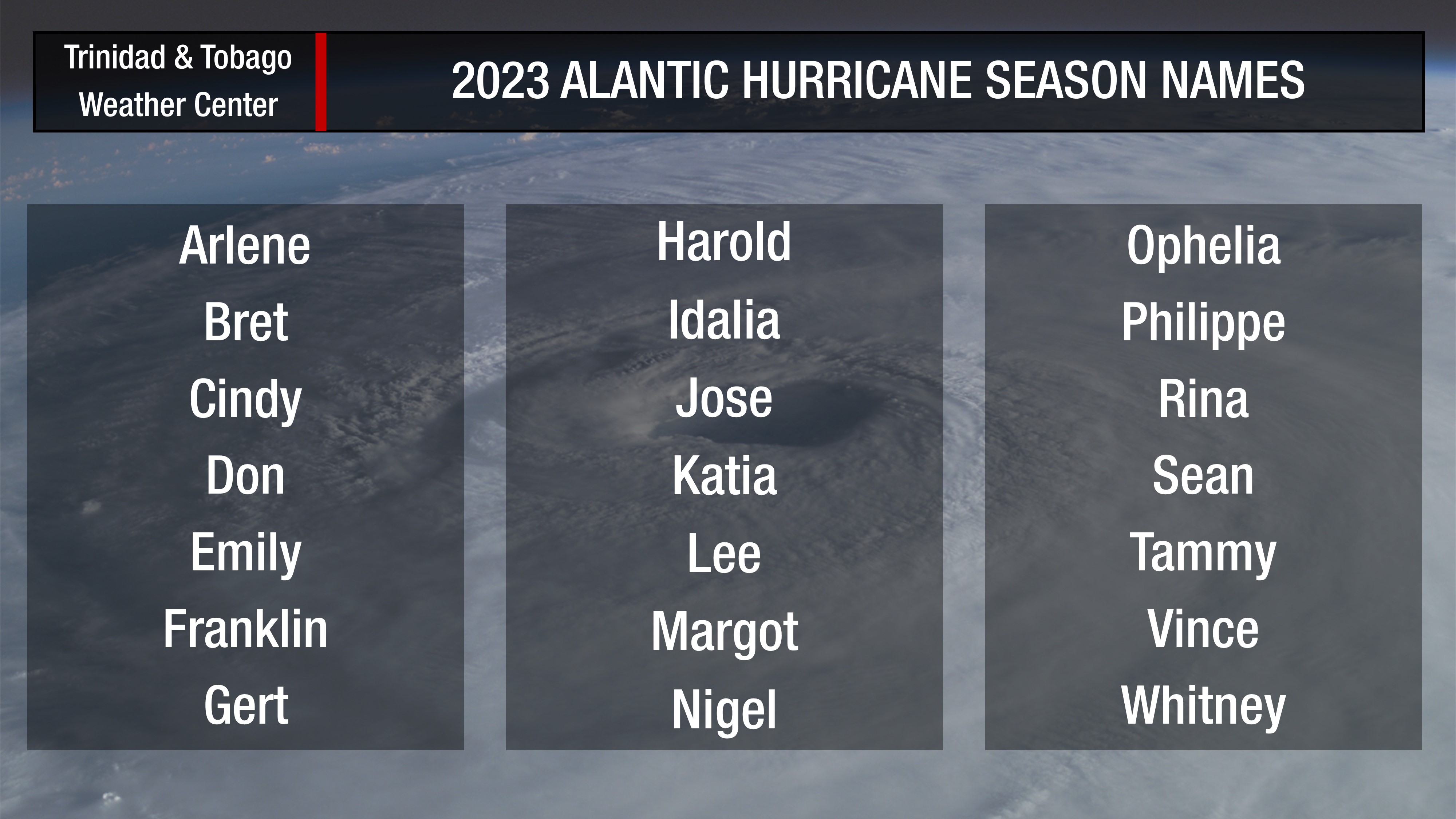
2023 Atlantic Hurricane Season Names