


With Tropical Wave 11 yet to move across T&T and thunderstorms still ongoing on Sunday afternoon, the Trinidad and Tobago Meteorological Service has discontinued the Adverse Weather Alert for the country.
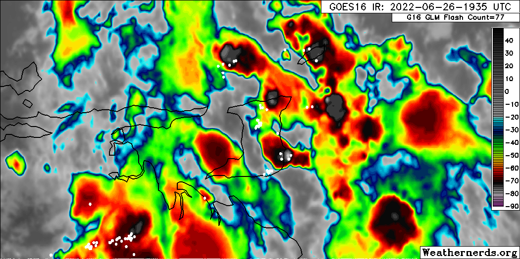
Additional rainfall is forecast with isolated to scattered thunderstorms possible over the next 12-18 hours as Tropical Wave 11 moves over T&T, bringing the Intertropical Convergence Zone across the country.
What you need to know
— Rainfall: Showers and thunderstorms remain in the forecast through Monday, as favorable upper-level conditions with abundant moisture remain in place across T&T. Higher rainfall chances will exist across Trinidad. Over the next 18-36 hours, with lingering showers and thunderstorms, rainfall totals between 15 to 40 millimeters are forecast across the country, with isolated rainfall totals up to 50 millimeters.
— Hazards: Street/flash flooding is likely in heavier showers or thunderstorms. Chances for riverine flooding remain low across most river basins. Gusty winds may accompany lingering heavy showers or thunderstorms. Lightning will accompany thunderstorms.
— Alerts/Watches/Warnings: The Adverse Weather Alert has been discontinued by the Trinidad and Tobago Meteorological Service. There are no tropical cyclone watches or warnings in effect for T&T at this time.
Alert Discontinued
The Trinidad and Tobago Meteorological Service has discontinued the Adverse Weather Alert (Yellow Level) on Sunday afternoon at 3:39 PM.
Trinidad and Tobago is not under any tropical storm watch or warning at this time.
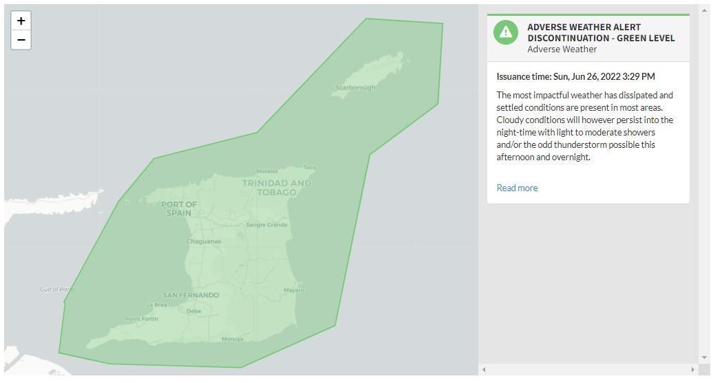

“The most impactful weather has dissipated and settled conditions are present in most areas. Cloudy conditions will however persist into the nighttime with light to moderate showers and/or the odd thunderstorm possible this afternoon and overnight.” according to the Trinidad and Tobago Meteorological Service.

The color of the alert indicates the severity of the event and the probability of the event occurring. Currently, the alert level is at Green, as the discontinuation was issued and the certainty is very likely.
At this level, according to the TTMS, there is a low risk to public safety, livelihoods, and property.
The Met Office is advising the public to monitor weather conditions and official updates.


