


Low-level winds have picked up slightly, leading to moderate seas to kick off this week, returning to slight conditions by the weekend in open waters. In heavy showers and thunderstorms, seas can get occasionally choppy. Spring tides are now ongoing through next Sunday, requiring caution from beachgoers and all marine interests.
Latest Alerts

Hazardous Seas Alert Discontinued For T&T
Trinidad and Tobago is NOT under any tropical storm or hurricane threat, watch, or warning at this time.
Seas Forecast For Trinidad and Tobago

Through Wednesday, winds are forecast to be relatively elevated, between 10 to 20 knots from the east-southeast to east-northeast, resulting in open water conditions remaining moderate with waves up to 2.0 meters, while in sheltered areas, waves are forecast to reach up to 1.0 meter.
For the remainder of the forecast period, winds vary between 5 to 15 knots, generally from the southeast to the east-northeast. Seas during this period are forecast to remain slight to moderate in open waters with waves up to 1.5 meters and near calm in sheltered areas.
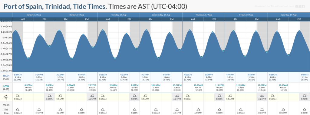
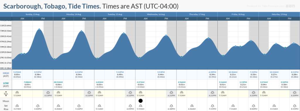
Through the next seven days, no significant long-period swells are expected, with swell periods forecast to remain between six and eleven seconds. However, spring tides are expected to begin toward the end of the forecast period on Monday, and continue through Sunday.
Possible Impacts
Saharan Dust concentrations are forecast to increase significantly, particularly from August 14th, across T&T and remain at elevated levels and fluctuating levels through the forecast period resulting in reduced visibility, particularly at dusk and dawn.
Additionally, higher-than-usual high tides and lower-than-usual low tides are forecast from August 14th. Mariners will need to exercise caution, particularly during the high tide periods, and beachgoers will need to exercise caution due to an elevated rip current threat.


