


Conditions remain favorable for additional showers and thunderstorms through Wednesday afternoon, but forecast models aren’t enthusiastic about another day of high rainfall accumulations across the country.
Still, given the potential for thunderstorms near T&T remains high, the Adverse Weather Alert has been extended for the country through noon on Wednesday.
What you need to know
— Rainfall: Through the next 24 hours (12:00 PM Wednesday), isolated to scattered showers and isolated thunderstorms are forecast, with the next round of activity occurring mainly after midnight tonight, interrupting cloudy skies. The most intense activity is forecast to remain offshore northern and eastern T&T. Overall additional rainfall totals between 15 and 25 millimeters are forecast, with isolated totals nearing or exceeding 25 millimeters, particularly across the northern half of Trinidad and Tobago.
— Hazards: Street and flash flooding is likely across both islands, with brief wind gusts in excess of 55 KM/H accompanying heavy showers or thunderstorms likely. Localized wind damage, such as fallen trees, is possible. Lightning will accompany thunderstorms. Landslides are also possible, mainly across northeastern Trinidad and Tobago. Seas are forecast to become locally agitated during heavy showers or thunderstorms. Conditions are favorable for funnel cloud development, with winds moving from the south to the southeast.
Latest Alerts

T&T Placed Under High Wind Alert From 11 PM Tuesday
Trinidad and Tobago is NOT under any tropical storm or hurricane threat, watch, or warning at this time.
The Adverse Weather Alert
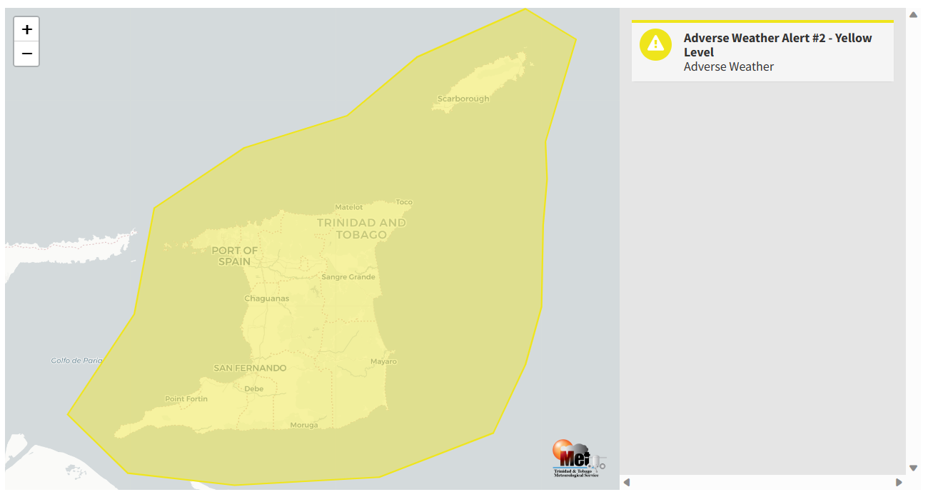
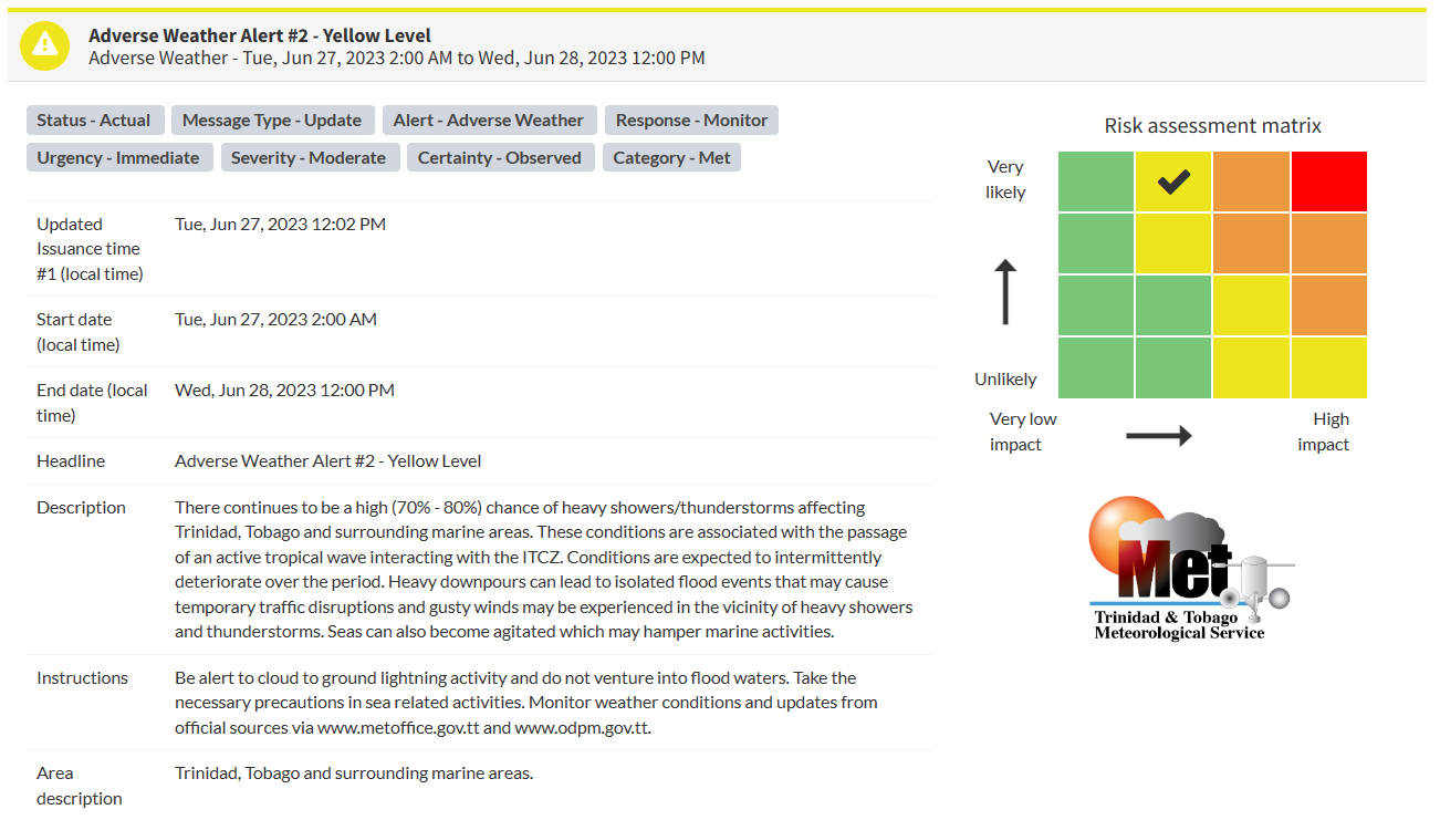
The Trinidad and Tobago Meteorological Service updated the Adverse Weather Alert (Yellow Level) on Tuesday at 12:02 PM. The alert went into effect for Trinidad, Tobago, and surrounding marine areas from 2:00 AM Tuesday, June 27th, 2023, and now remains in effect through 12:00 PM (noon) Wednesday, June 28th, 2023.
Periodic rainfall is forecast through the week following Tropical Wave 17, with the ITCZ bringing more heavy rainfall towards the end of the week.
Trinidad and Tobago is not under any tropical storm watch or warning at this time.
According to the TTMS, the approaching inclement weather is associated with Tropical Wave #17 interacting with the Intertropical Convergence Zone.
This “alert” status takes into account the possibility of the event occurring. This adverse weather event has been observed with the following impacts, according to the TTMS:
- High chance (70-80%) of heavy showers/thunderstorms affecting Trinidad, Tobago, and surrounding marine areas.
- Heavy downpours can lead to isolated flood events that may cause temporary traffic disruptions
- Brief gusty winds.
- Seas can become additionally agitated in heavy showers/thunderstorms.

The color of the alert indicates the severity of the event and the probability of the event occurring. Currently, the alert level is Yellow. This means that the hazards have been observed, and the severity of the impacts is moderate for this particular alert. You should be aware of the hazards in your area associated mainly with gusty winds in excess of 55 KM/H, street, and flash flooding, landslides, as well as frequent lightning.
For a moderate Adverse Weather Alert, there is the potential for possible injuries, where behavioral changes are required to ensure safety. There may be minor damage to property, with income-earning temporarily disrupted and a couple of communities affected.
The Met Office is advising the public to be alert to cloud-to-ground lightning activity, not venture into flood waters, monitor river levels, as well as monitor weather conditions and updates from official sources.


