


Heavy showers and thunderstorms are forecast for Trinidad and Tobago through Thursday, associated with an approaching tropical wave (Tropical Wave 41/Invest 91L) that is being monitored for tropical cyclone development. The forward speed of Invest 91L has increased, with moderate impacts likely to begin from midnight tonight.
What you need to know
— Rainfall: Through Friday, periods of rain, moderate to heavy showers, and isolated to scattered thunderstorms are forecast, interrupting variably cloudy skies. Peak intense activity, including isolated heavy to violent showers and intense thunderstorms, is forecast for Wednesday through Thursday afternoon. (Updated as of 2:00 AM Wednesday) Overall rainfall totals of up to 150 millimeters are forecast across both islands over the next five days. Isolated totals of up to 200 millimeters are forecast across the southern and eastern areas of both islands.
— Hazards: Street/flash flooding and localized ponding is expected. Chances for riverine flooding will increase by Thursday, though the risk is low to medium. Wind gusts in excess of 55 KM/H accompanying heavy showers or thunderstorms are likely, with wind gusts in excess of 45 KM/H expected. Stronger winds are forecast to remain well north of Trinidad and Tobago. Lightning will accompany thunderstorms. Landslides are possible across both islands. Seas are forecast to become agitated.
— Alerts/Watches/Warnings: The Trinidad and Tobago Meteorological Service updated the Adverse Weather Alert (Yellow Level) for Trinidad and Tobago from 12:00 AM Wednesday, October 5th, 2022, and remains in effect through 12:00 PM Friday, October 7th, 2022. There are no tropical storm or hurricane watches or warnings in effect for T&T at this time.
The Adverse Weather Alert
The Trinidad and Tobago Meteorological Service updated the Adverse Weather Alert (Yellow Level) on Tuesday at 6:44 PM. The alert now goes into effect for Trinidad and Tobago from midnight tonight, 12:00 AM Wednesday, October 5th, 2022, and remains in effect through 12:00 PM Friday, October 7th, 2022. The alert was initially forecast to go into effect from 5:00 AM Wednesday.
Trinidad and Tobago is not under any tropical storm watch or warning at this time.
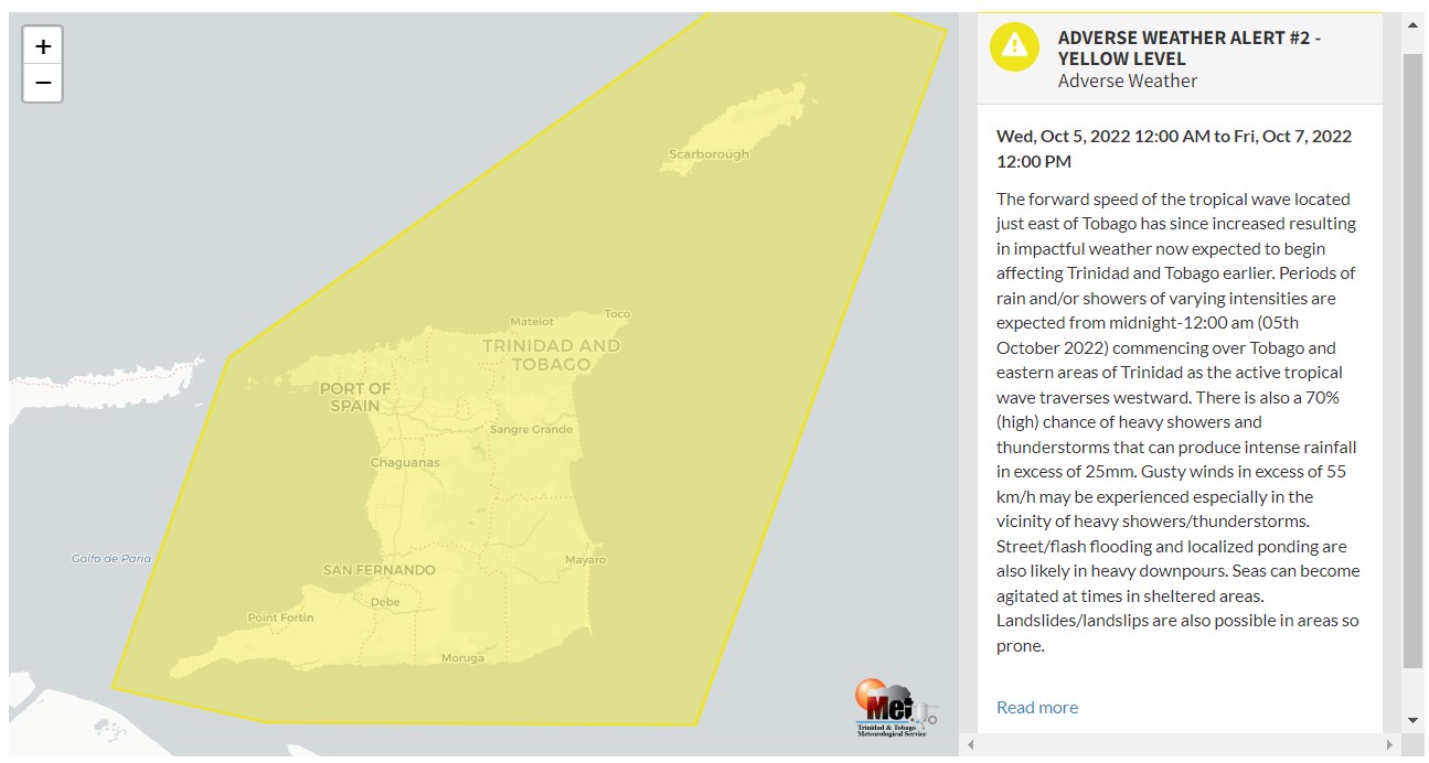
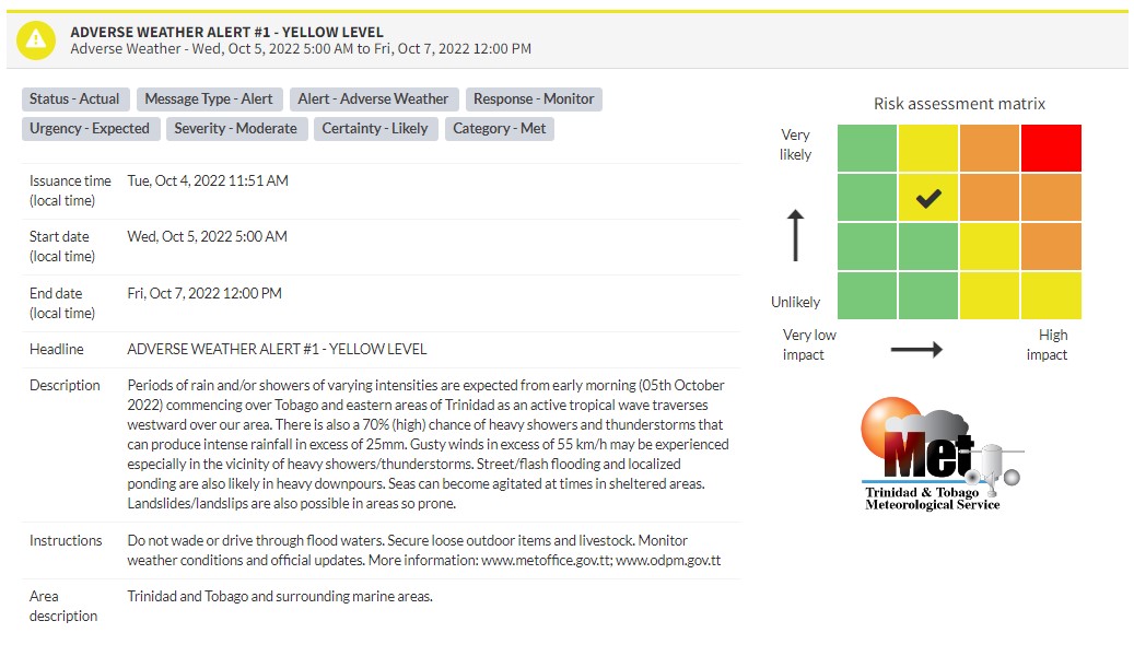
“The forward speed of the tropical wave located just east of Tobago has since increased, resulting in impactful weather now expected to begin affecting Trinidad and Tobago earlier. Periods of rain and/or showers of varying intensities are expected from midnight-12:00 am (05th October 2022), commencing over Tobago and eastern areas of Trinidad as the active tropical wave traverses westward. There is also a 70% (high) chance of heavy showers and thunderstorms that can produce intense rainfall in excess of 25mm. Gusty winds in excess of 55 km/h may be experienced, especially in the vicinity of heavy showers/thunderstorms. Street/flash flooding and localized ponding are also likely in heavy downpours. Seas can become agitated at times in sheltered areas. Landslides/landslips are also possible in areas so prone.” according to the Trinidad and Tobago Meteorological Service. This “alert” status takes into account the possibility of the event occurring. This adverse weather event is likely.

The color of the alert indicates the severity of the event and the probability of the event occurring. Currently, the alert level is Yellow. This means that the hazards have been observed, and the severity of the impacts is moderate for this particular alert. You should be aware of the hazards in your area associated mainly with gusty winds in excess of 55 KM/H, street and flash flooding, landslides, as well as frequent lightning.
For a moderate Adverse Weather Alert, there is the potential for possible injuries, where behavioral changes are required to ensure safety. There may be minor damage to property, with income-earning temporarily disrupted and a couple of communities affected.
The Met Office is advising the public to monitor weather conditions and updates from official sources, do not wade or drive through flood waters and secure loose outdoor items and livestock.


