


We’re monitoring several weather features east of Trinidad and Tobago, all forecast to bring rainfall to the country beginning this afternoon.

First, a low-level trough interacting with the Intertropical Convergence Zone is set to move across the country and southern Windwards on Monday. Increased cloudiness, showers and isolated thunderstorms are forecast from this afternoon ahead of the trough with its axis approximately less than 500 kilometers east of T&T. peak activity from this system on Monday. Favorable upper-level conditions will support heavier showers and thunderstorms.
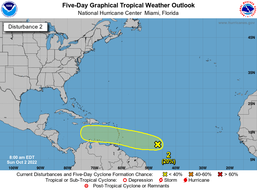
Secondly, an active tropical wave interacting with the Intertropical Convergence Zone is set to begin affecting T&T and the Windwards from Tuesday through Thursday. The leading edge of showers, thunderstorms and cloudiness is just over 900 kilometers east of Trinidad and Tobago. This tropical wave is also being monitored for tropical cyclone development, with the National Hurricane Center giving it a low chance of development over the next 48 hours and 5 days as of 8:00 AM Sunday. Regardless of development, it is forecast to bring between 50-125 millimeters of rainfall across the Windwards through Thursday, with gusty winds up to 60 KM/H mainly north of T&T.
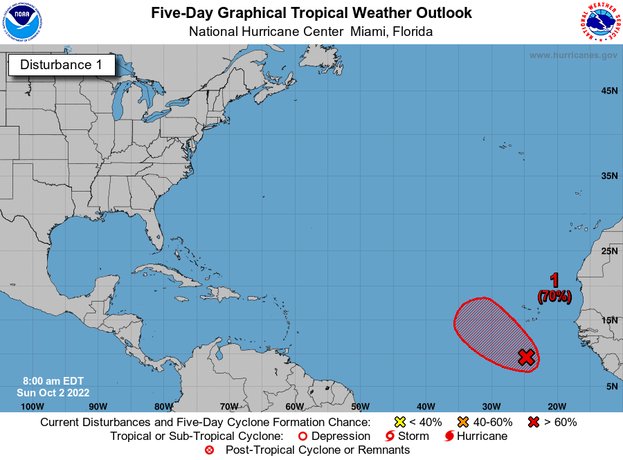
Another tropical wave in the far Eastern Atlantic Ocean has high chances of tropical cyclone development over the next 5 days according to the National Hurricane Center. However, given the current path of this system, it is not forecast to directly impact the Lesser Antilles at this time.
There are no alerts, watches, or warnings in effect for Trinidad and Tobago at this time from the Trinidad and Tobago Meteorological Service. Trinidad, Tobago and the Lesser Antilles are NOT under any tropical storm or hurricane watches or warnings.
A full tropical update and 5-day forecast will be issued later today.


