


While no hazardous marine events are forecast over the next seven days, marine interests, particularly small craft operators, will need to exercise caution this weekend due to a combination of choppy seas in heavy showers or thunderstorms, long-period swells, and spring tides. A moderate to high-concentration Saharan Dust surge is forecast to arrive across T&T from early Sunday.
Latest Alert
There are no alerts, watches, or warnings in effect for T&T at this time. The last alert issued:

Adverse Weather Alert Discontinued
Trinidad and Tobago is NOT under any tropical storm or hurricane threat, watch, or warning at this time.
Seas Forecast For Trinidad and Tobago

Saturday to Sunday: Winds are forecast to notably decrease across T&T due to the presence of a tropical wave over the area. As a result, seas are forecast to be slight to moderate in open waters, with waves up to 1.5 meters. In sheltered areas, waves are forecast to be between 0.5 and 1 meter, but conditions may become locally rough and/or choppy in the vicinity of heavy showers or thunderstorms. On Saturday, winds are forecast to range between 5 knots and 15 knots from east to east northeast, gusting to 20 knots. By Saturday afternoon through Sunday, winds are forecast to increase between 10 knots and 20 knots, from the east to southeast, gusting to 25 knots, mainly in the vicinity of showers or evening/nighttime thunderstorms. Swell periods are forecast to range initially between 8 and 10 seconds, then between 8 and 12 seconds from Sunday. Note that by late Sunday, Saharan Dust concentrations will increase, reducing horizontal visibility, particularly by dusk. Spring tides are forecast to end on Sunday.
Monday through Tuesday: Seas are forecast to be moderate open waters, with waves up to 2.0 meters. In sheltered areas, waves are forecast to be below 1 meter. Swell periods are forecast to range between 8 and 12 seconds. Winds are forecast to be between 10 knots and 15 knots from east-southeast to northeast, with gusts up to 20 knots. A moderate to high concentration of Saharan Dust is forecast to be present, reducing horizontal visibility.
Wednesday through Friday: Seas are forecast to be moderate in open waters, with waves up to 2.0 meters. In sheltered areas, waves are forecast to be near 1.0 meter. Swell periods are forecast to range between 8 and 11 seconds. Winds are forecast to range between 10 and 20 knots from the east-southeast to east-northeast, gusting to 25 knots. Moderate to high Saharan Dust concentrations are forecast to be present, still reducing horizontal visibility, particularly at dawn and dusk.
Possible Impacts
Through the forecast period, small craft operators particularly will need to exercise caution due to reduced visibility as Saharan Dust concentrations increase.
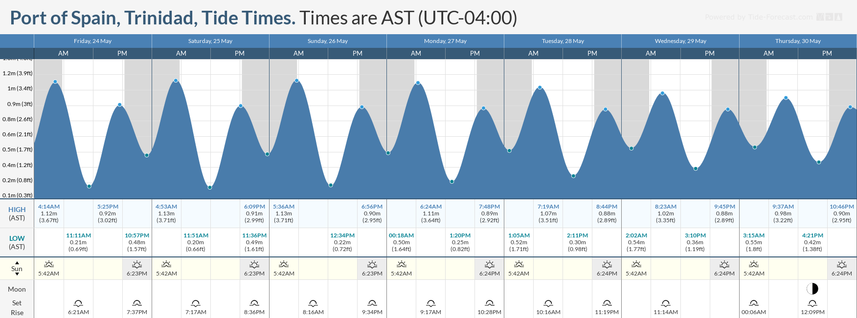
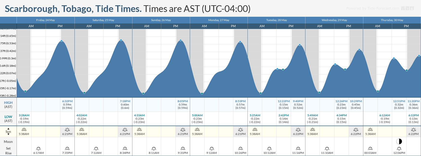
Spring tides, which are higher-than-usual high tides and lower-than-usual low tides, are forecast to end on May 26th. Mariners and beachgoers will need to exercise caution at both low and high tide levels.
There will be an elevated risk of rip currents through the weekend. If caught in a rip current, swim perpendicular to the current (parallel to the shore). Mariners, especially small craft operators, should ensure their vessels are securely anchored or docked, as choppy/breaking wave conditions may drag the vessel onto the ocean floor or reefs in shallow waters or even break anchorage/mooring.


