


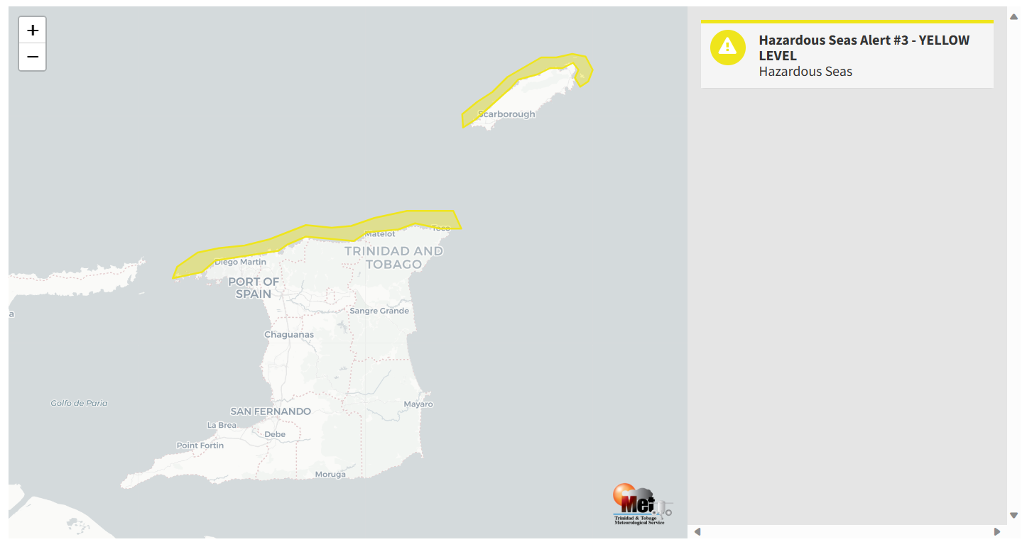
As forecast, a combination of elevated winds and long-period swells have impacted Trinidad and Tobago’s northern and eastern coastlines. Though the peak of this hazardous seas event passed on Sunday, occasional longer-period swells are still ongoing, which can produce the odd battering wave primarily affecting nearshore areas of northern T&T.
What you need to know
— What is happening: Swell periods up to 17 seconds have been observed, producing large, battering, high-energy waves along Trinidad and Tobago’s northern and eastern coastlines. Large waves have been more impactful during high tide periods, with open waters also agitated due to elevated winds, with waves occasionally reaching 3.0 meters. Swell periods and wave heights are on the decline.
— What can we expect: Occasional large, battering waves will continue along T&T’s northern and eastern coastlines. Minor coastal erosion is possible. There is a high risk of rip currents along these shores.
Latest Alerts

Localized Flood Alert Discontinued For Trinidad
Trinidad and Tobago is NOT under any tropical storm or hurricane threat, watch, or warning at this time.
The Hazardous Seas Alert
The Trinidad and Tobago Meteorological Service updated the Hazardous Seas Alert (Yellow Level) on Tuesday at 9:36 AM. The alert went into effect for Trinidad and Tobago’s northern and eastern coastal areas at 5:00 AM on Saturday, November 18th, 2023, and has now been extended once again through 10:00 AM on Wednesday, November 22nd, 2023.
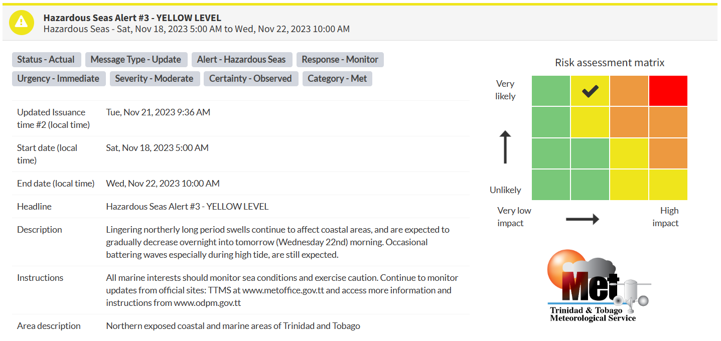
“Lingering northerly long period swells continue to affect coastal areas and are expected to gradually decrease overnight into tomorrow (Wednesday 22nd) morning. Occasional battering waves, especially during high tide, are still expected,” according to the Trinidad and Tobago Meteorological Service. This “alert” status considers the possibility of the event occurring. This hazardous sea event has been observed.

The alert’s color indicates the event’s severity and probability of the event occurring. Currently, the alert level is Yellow. This means that the hazards have been observed, and the severity of impacts is moderate for this particular alert. Large battering waves and a high risk of rip currents are the two main hazards of this swell event.
For a moderate Hazardous Seas Alert, there is the potential for possible injuries, where behavioral changes are required to ensure safety. There may be minor damage to property, with income-earning temporarily disrupted and a couple of communities affected.
The Met Office is advising all marine interests to monitor near-shore sea conditions and exercise caution along affected areas, especially at high tides and continue to monitor updates from official sites.


