


Long-period swells are affecting the southern Windward islands, including Trinidad and Tobago. These high-energy waves have been moving onshore since Wednesday, increasing the risk of rip currents and battering waves along select coastlines. Spring Tides are amplifying hazardous impacts during high tide periods.
What you need to know
— What is happening: Swells with periods up to 14 seconds are ongoing along Trinidad and Tobago’s northern coastlines. Over the next several days, swells are forecast to continue, with swell periods gradually decreasing into the weekend. Large battering waves are likely.
— What can we expect: Large, battering waves are possible along T&T’s northern coastlines, with choppy conditions in sheltered areas. Minor to moderate coastal erosion is possible. There is a high risk of rip currents along the country’s northern coastlines. Spring Tides continue through Monday, with the overall sea state in open waters moderate through the alert period.
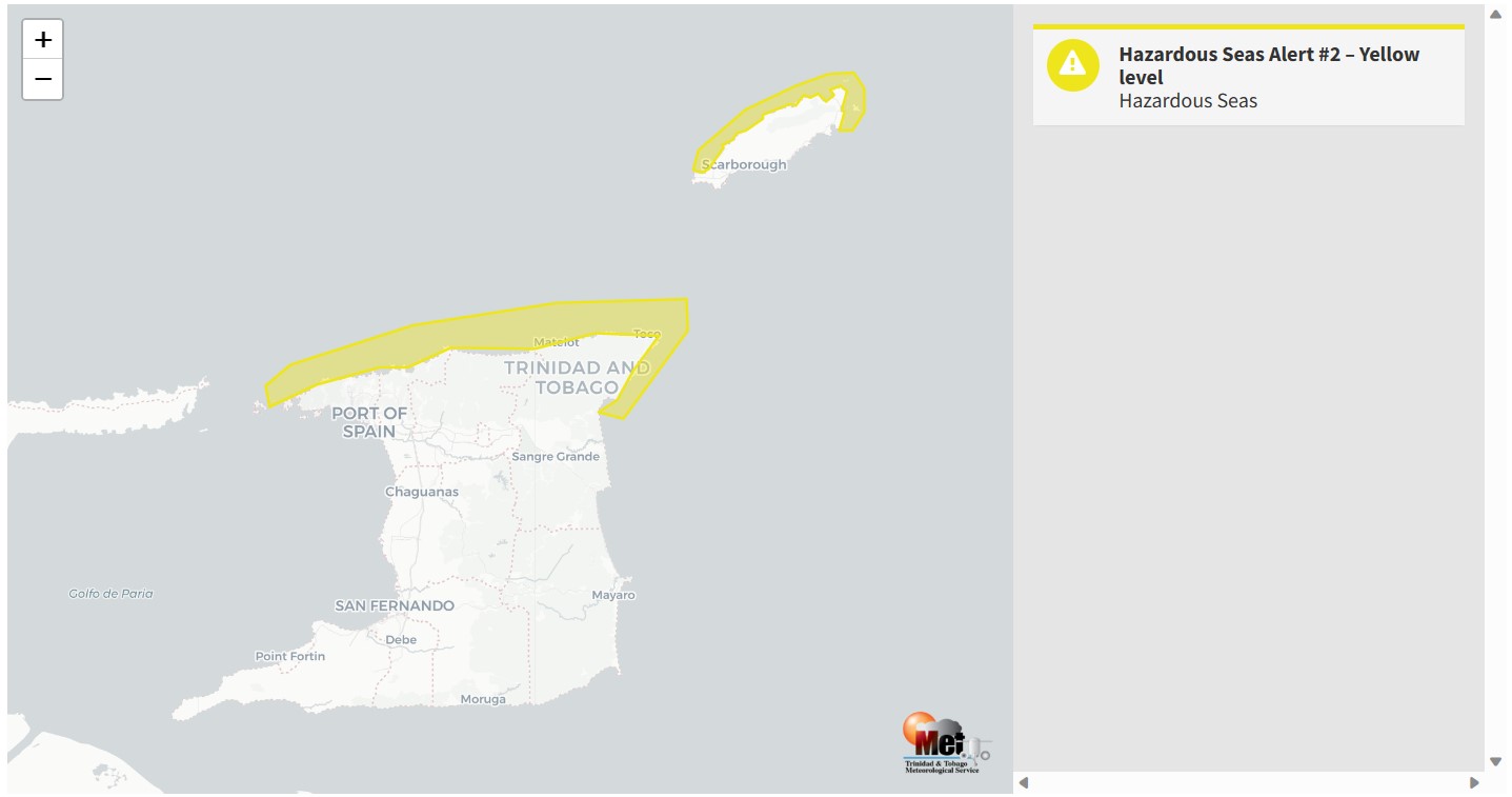
— Alerts/Watches/Warnings: A Hazardous Seas Alert (Yellow Level) remains in effect for northern and eastern Trinidad and Tobago from 2:00 PM Wednesday, May 3rd, 2023, and remains in effect through 2:00 PM Saturday, May 6th, 2023, from the Trinidad and Tobago Meteorological Service. There are no tropical storm or hurricane watches or warnings in effect for T&T at this time.
The Hazardous Seas Alert
The Trinidad and Tobago Meteorological Service updated the Hazardous Seas Alert (Yellow Level) on Thursday at 2:39 PM. The alert went into effect for northern and eastern areas of Trinidad and Tobago from 2:00 PM Wednesday, May 3rd, 2023, and remains in effect through 2:00 PM Saturday, May 6th, 2023.
Trinidad and Tobago is not under any tropical storm watch or warning at this time.
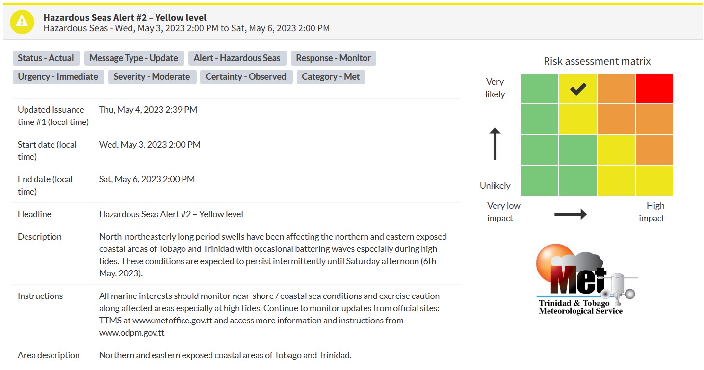
“North-northeasterly long period swells have been affecting the northern and eastern exposed coastal areas of Tobago and Trinidad with occasional battering waves, especially during high tides. These conditions are expected to persist intermittently until Saturday afternoon (6th May 2023),” according to the Trinidad and Tobago Meteorological Service. This “alert” status takes into account the possibility of the event occurring. This hazardous sea event has been observed.

The color of the alert indicates the severity of the event and the probability of the event occurring. Currently, the alert level is Yellow. This means that the hazards have been observed, and the severity of impacts is moderate for this particular alert. Large battering waves and a high risk of rip currents are the two main hazards associated with this swell event.
For a moderate Hazardous Seas Alert, there is the potential for possible injuries, where behavioral changes are required to ensure safety. There may be minor damage to property, with income-earning temporarily disrupted and a couple of communities affected.
The Met Office is advising sea bathers, fishermen, and small craft operators to carefully monitor coastal sea conditions and exercise caution along the coast.


