


A surface to low-level confluent pattern trailing a trough system maintains unsettled conditions across Trinidad and Tobago, leading to more rain in the forecast for the country through midday tomorrow (Tuesday).
What you need to know
— Rainfall: Through the next 24 hours, sporadic periods of rain with isolated moderate to heavy showers and thunderstorms forecast, with higher totals favoring the eastern and southern halves of Trinidad, and interrupting cloudy skies. Rainfall totals between 15 and 25 millimeters are forecast across both islands over the next 48 hours, with locally higher amounts exceeding 25 millimeters.
— Hazards: Street, flash, and riverine flooding are very likely in heavier showers or thunderstorms. Wind gusts in excess of 55 KM/H accompanying heavy showers or thunderstorms are also possible during and ahead of heavy showers or thunderstorms. Localized wind damage, such as fallen trees, is possible. Lightning will accompany thunderstorms. Landslides are also possible, mainly across Tobago and northern/southern Trinidad.
Latest Alerts

Adverse Weather Alert Discontinued For T&T

Flooding Continues To Subside As Riverine Flood Alert Discontinued
Trinidad and Tobago is NOT under any tropical storm or hurricane threat, watch, or warning at this time.
The Adverse Weather Alert
The Trinidad and Tobago Meteorological Service updated and downgraded the Adverse Weather Alert (Orange Level) on Monday at 2:52 PM. The alert went into effect for Trinidad, Tobago, and surrounding marine areas from 5:00 AM Saturday, November 26th, 2022, and now extended through 12:00 PM Tuesday, November 29th, 2022.
Trinidad and Tobago is not under any tropical storm watch or warning at this time.
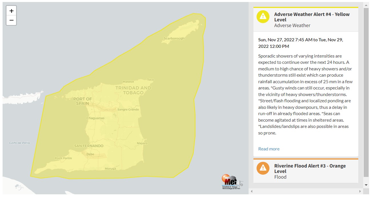
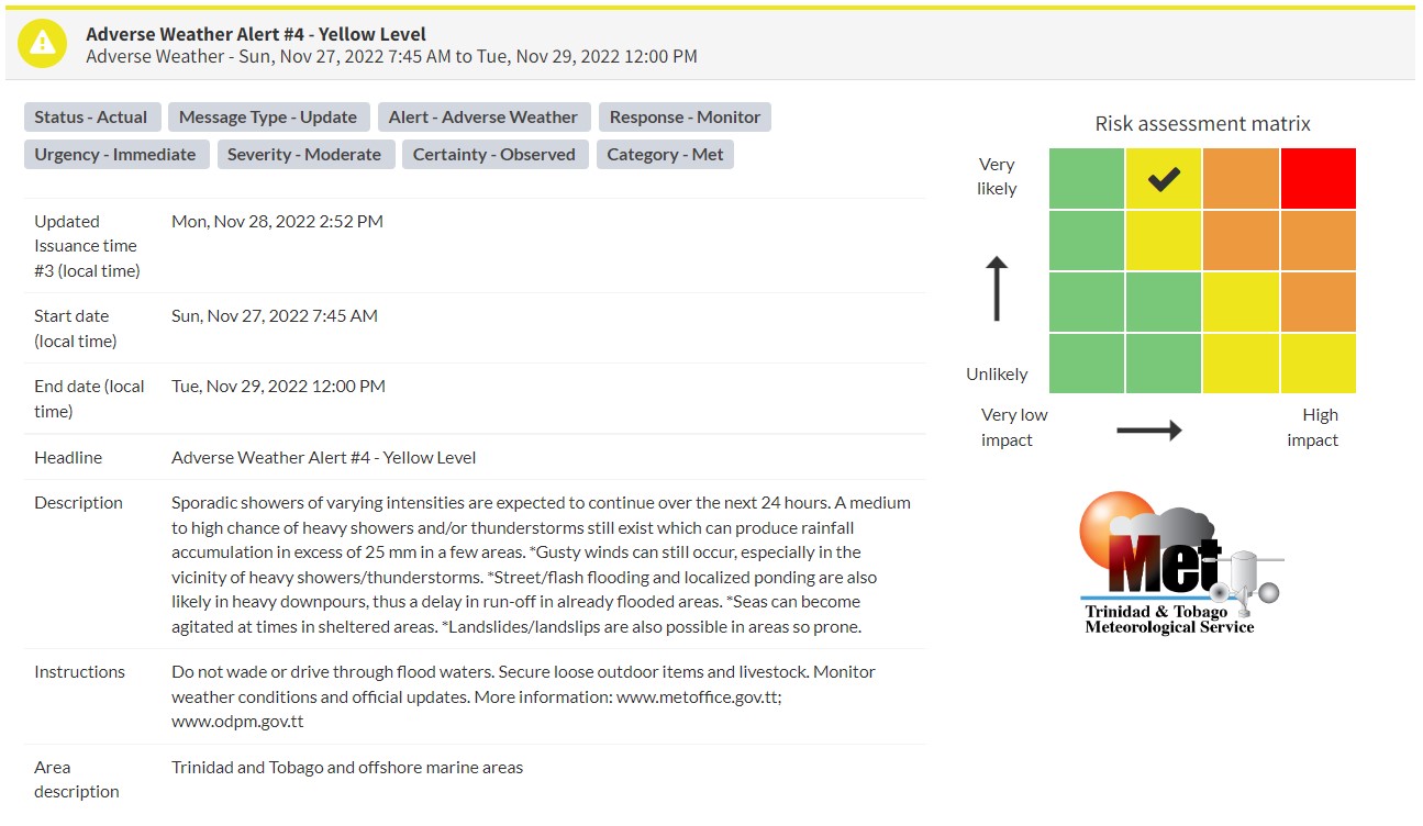
“Sporadic showers of varying intensities are expected to continue over the next 24 hours. A medium to high chance of heavy showers and/or thunderstorms still exist which can produce rainfall accumulation in excess of 25 mm in a few areas,” according to the Trinidad and Tobago Meteorological Service.
This “alert” status takes into account the possibility of the event occurring. This adverse weather event is likely with the following impacts according to the TTMS:
- Rainfall greater than 25mm and in excess of this amount in isolated areas.
- Gusty winds possible, especially in the vicinity of heavy showers/thunderstorms.
- Street/flash flooding and localized ponding are also likely in heavy downpours.
- Seas can become agitated at times in sheltered areas.
- Landslides/landslips are also possible in areas so prone.

The color of the alert indicates the severity of the event and the probability of the event occurring. Currently, the alert level is Yellow. This means that the hazards are likely, and the severity of the impacts is moderate for this particular alert. You should be aware of the hazards in your area associated mainly with gusty winds in excess of 55 KM/H, street, flash, and riverine flooding, landslides, as well as frequent lightning.
For a moderate Adverse Weather Alert, there is the potential for possible injuries, where behavioral changes are required to ensure safety. There may be minor damage to property, with income-earning temporarily disrupted and a couple of communities affected.
The Met Office is advising the public to monitor weather conditions and updates from official sources and not wade or drive through flood waters.


