Major river levels remain near or above 80% capacity. With additional rainfall on the horizon, the Trinidad and Tobago Meteorological Service upgraded the Riverine Flood Alert (Yellow Level) for all of Trinidad to Orange Level, with severe impacts now likely.
What you need to know
— What has happened: Over the last 24 hours, between 25 and 100 millimeters of rain fell across parts of Trinidad and Tobago associated with the Intertropical Convergence Zone, a favorable low-level environment and Tropical Wave 51. Additional rainfall accumulations between 25 and 75 millimeters are forecast through the next 48 hours, with locally higher totals.
— What to expect: Riverine flooding is ongoing, particularly for smaller water courses and tributaries to major rivers. Runoff will be slowed by spring tides which continues through Friday.
Latest Alerts

Riverine Flood Alert Discontinued For South Trinidad

Adverse Weather Alert Discontinued. Heavy Rainfall Still Possible
Trinidad and Tobago is NOT under any tropical storm or hurricane threat, watch, or warning at this time.
The Riverine Flood Alert
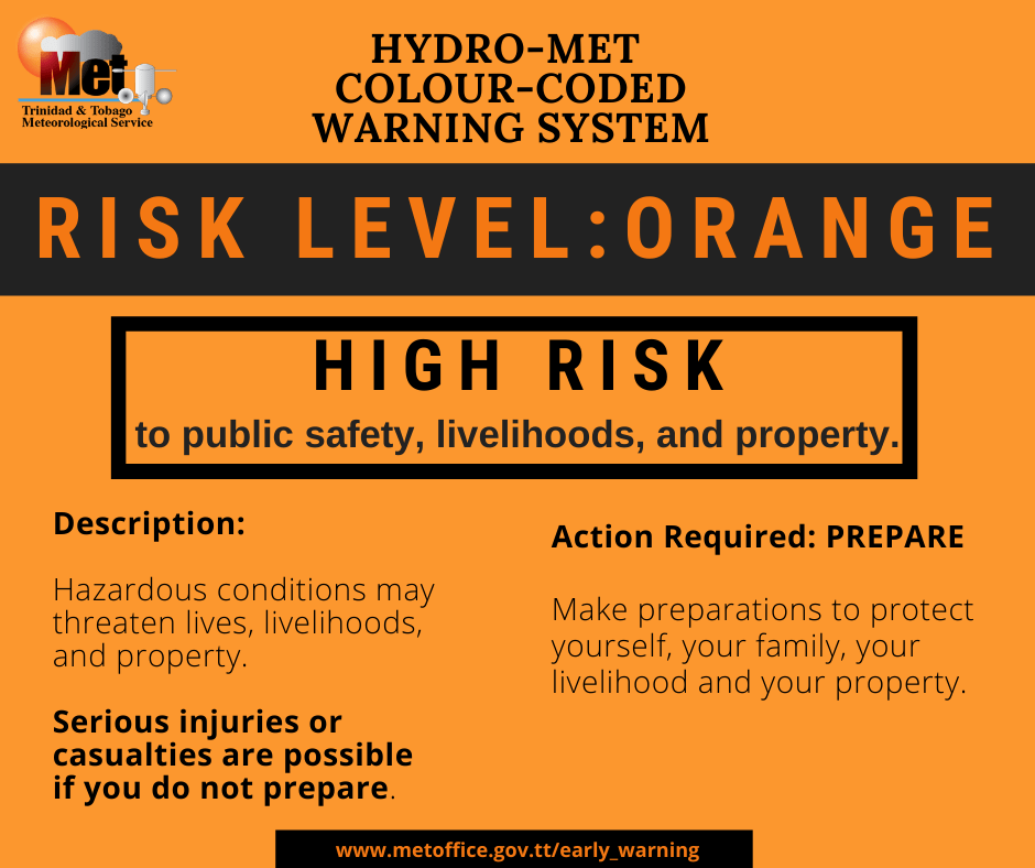
The Trinidad and Tobago Meteorological Service updated the Riverine Flood Alert (Yellow Level) to Orange Level on Wednesday at 2:51 PM. The alert went into effect for Trinidad from 6:45 AM Wednesday, November 9th, 2022, and remains in effect until 4:00 AM Friday, November 11th, 2022.
Trinidad and Tobago is not under any tropical storm watch or warning at this time.


“Major river levels across Trinidad are currently near or above 80%, and smaller watercourses are also at critical levels. Periods of rainfall will likely continue over the next 36 – 48 hours, which will result in further elevation of the river levels. As a result, there is now a high risk to public safety, livelihood and property. Run-off will be slow at high tide times, which are approximately 4:14 pm today (Wednesday 9th November 2022) and 5:17 am & 4:45 pm tomorrow (Thursday 10th November 2022),” according to the Trinidad and Tobago Meteorological Service. This “alert” status takes into account the possibility of the event occurring. This riverine flood event is likely.

The color of the alert indicates the severity of the event and the probability of the event occurring. Currently, the alert level is Orange. This means that the hazard is likely, and you need to be aware of the impacts of street, flash, and riverine flooding in your area. Severe impacts are likely.
For a severe Riverine Flood Alert, there is the potential for a loss of a single life or serious injuries; physical defenses are needed, major losses are possible in confined areas, income earning is impossible for several days, and several communities are affected where external help is needed for recovery.
The public should finalize preparations to protect lives, livelihoods, and property, activate your safety plan, secure food, water, and medicine for at least 7 days in waterproof containers, and protect important assets and documents. Do not take unnecessary risks. Follow the instructions of government officials. Monitor official sources for information