


All major rivers across Trinidad are being closely monitored following prolonged heavy rainfall overnight Saturday into Sunday. Major river levels across Trinidad are above 75% capacity, with several smaller tributaries and some major rivers already overtopping since early Sunday morning.
What you need to know
— What has happened: Over the last five days, between 50 and 150 millimeters of rain fell across parts of Trinidad and Tobago, with isolated totals exceeding 200 millimeters. Compounding the flooding situation, over the last 18 hours, an additional 25-75 millimeters of rain fell across the country, with isolated totals up to 100 millimeters.
— What to expect: Over the next five days, more rainfall is forecast. Riverine flooding is expected to continue across all major river basins in Trinidad.
The Riverine Flood Alert
The Trinidad and Tobago Meteorological Service issued the first Riverine Flood Alert (Yellow Level) at 7:17 AM Sunday, with its first update at 3:13 PM Sunday. The alert went into effect for Trinidad from 7:15 AM Sunday, October 30th, 2022, and remains in effect until 10:00 AM Tuesday, November 1st, 2022. With forecast rainfall over the week, this alert could be extended or reissued by mid-week.
Trinidad and Tobago is not under any tropical storm watch or warning at this time.
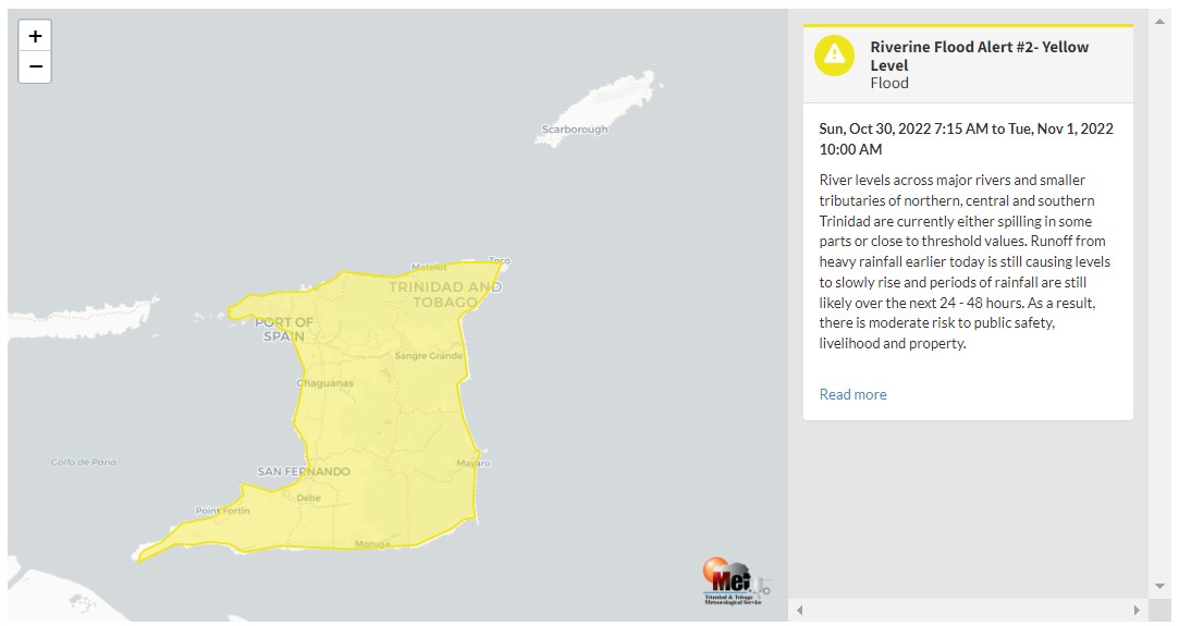
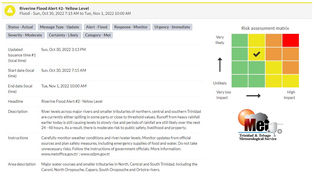
“River levels across major rivers and smaller tributaries of northern, central, and southern Trinidad are currently either spilling in some parts or close to threshold values. Runoff from heavy rainfall earlier today is still causing levels to rise slowly and periods of rainfall are still likely over the next 24 – 48 hours. As a result, there is a moderate risk to public safety, livelihood, and property.” according to the Trinidad and Tobago Meteorological Service. This “alert” status takes into account the possibility of the event occurring. This riverine flood event is likely.

The color of the alert indicates the severity of the event and the probability of the event occurring. Currently, the alert level is Yellow. This means that the hazards are likely, and the severity of the impacts is moderate for this particular alert. You should be aware of the hazards in your area, and you need to be aware of the impacts of street, flash, and riverine flooding in your area.
For a moderate Riverine Flood Alert, there is the potential for possible injuries, where behavioral changes are required to ensure safety. There may be minor damage to property, with income-earning temporarily disrupted and a couple of communities affected.
The Met Office is advising the public to monitor weather conditions, river levels, and updates from official sources and not wade or drive through flood waters.


