


An active tropical wave has moved across Trinidad and Tobago, bringing heavy rainfall and gusty winds. While rainfall chances have marginally decreased, winds are forecast to increase across the region.
What you need to know
— Rainfall: Through the weekend, periodic rain, moderate to heavy showers, and isolated thunderstorms are forecast. On Friday, isolated heavy to violent showers and isolated thunderstorms are possible, producing rainfall totals between 15-25 millimeters across the country, with higher rainfall totals exceeding 25 millimeters across Tobago and eastern Trinidad, as well as western coastal areas.
— Hazards: Street/flash flooding is likely on Friday. Chances for riverine flooding remain fairly low on Friday but gradually increase next week. Gusty winds, in excess of 55 KM/H accompanying heavy showers or thunderstorms are also forecast. Lightning will accompany thunderstorms. Landslides are possible across elevated areas.
— Alerts/Watches/Warnings: This Adverse Weather Alert (Yellow Level) remains in effect for Trinidad and Tobago from 8:00 AM Thursday, June 2nd, 2022 through 2:00 PM Friday, June 3rd, 2022 from the Trinidad and Tobago Meteorological Service.
The Adverse Weather Alert
The Trinidad and Tobago Meteorological Service has updated the Adverse Weather Alert (Yellow Level) on Thursday afternoon at 1:04 PM. The alert goes went into effect at 8:00 AM Thursday, June 2nd, 2022 through 2:00 PM Friday, June 3rd, 2022.
Trinidad and Tobago is not under any tropical storm watch or warning at this time.
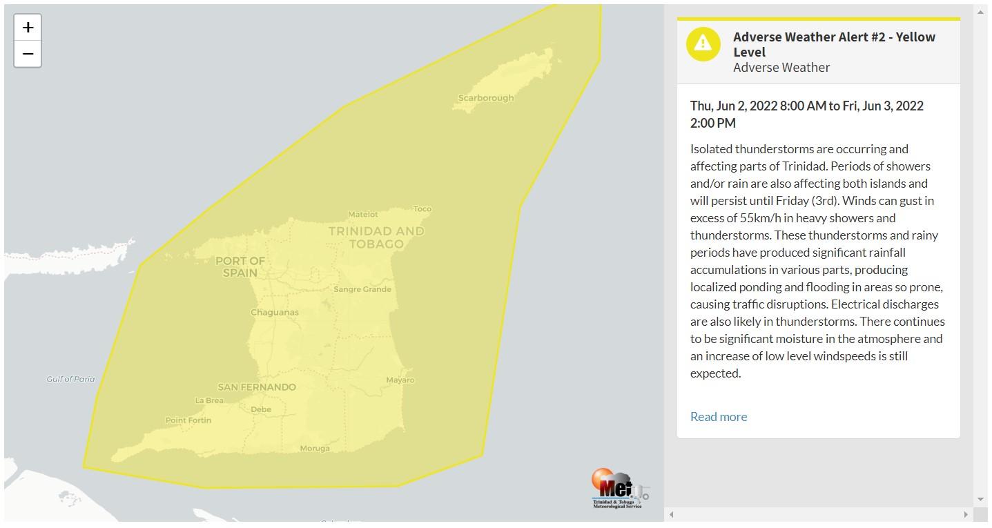
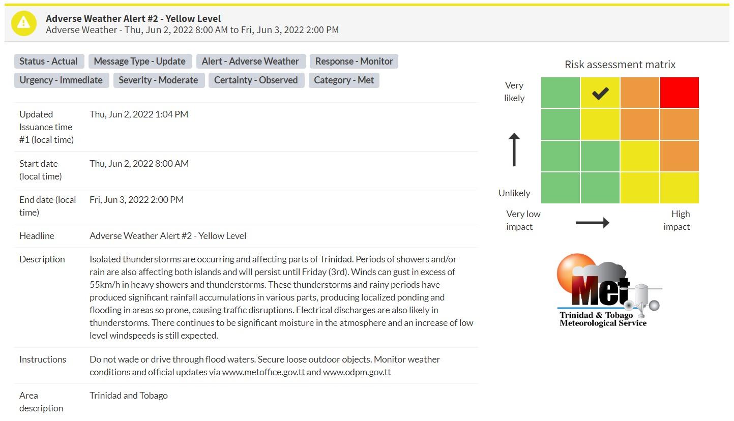
“Isolated thunderstorms are occurring and affecting parts of Trinidad. Periods of showers and/or rain are also affecting both islands and will persist until Friday (3rd). Winds can gust in excess of 55km/h in heavy showers and thunderstorms. These thunderstorms and rainy periods have produced significant rainfall accumulations in various parts, producing localized ponding and flooding in areas so prone, causing traffic disruptions. Electrical discharges are also likely in thunderstorms. There continues to be significant moisture in the atmosphere and an increase of low-level windspeeds is still expected.” according to the Trinidad and Tobago Meteorological Service. This “alert” status takes into account the possibility of the event occurring. This adverse weather event has been observed.

The color of the alert indicates the severity of the event and the probability of the event occurring. Currently, the alert level is Yellow. This means that the hazard has been observed, but the severity of impacts is moderate for this particular alert. You should be aware of the hazards in your area associated mainly with gusty winds in excess of 55 KM/H, street, and flash flooding as well as frequent lightning.
For a moderate Adverse Weather Alert, there is the potential for possible injuries, where behavioral changes are required to ensure safety. There may be minor damage to property, with income-earning temporarily disrupted and a couple of communities affected.
The Met Office is advising the public to be alert for cloud-to-ground lightning activity and not venture into floodwaters, secure loose objects outdoors as well as monitor weather conditions and updates from official sources.
Small craft operators should be on the alert for above normal or choppy sea conditions in strong winds.


