


The Intertropical Convergence Zone (ITCZ) has shifted north of Trinidad and Tobago, producing rain, showers, and thunderstorms mainly north and east of the country, with conditions settling across T&T. However, with the approach of Tropical Wave 48, the ITCZ is forecast to begin affecting T&T yet again from late Saturday into Sunday.
What you need to know
— Rainfall: Through Saturday, variably cloudy skies with isolated showers and thunderstorms are forecast. Additional rainfall totals between 5 and 15 millimeters are forecast across both islands, with isolated higher totals of up to 25 millimeters.
— Hazards: Street and flash flooding with localized ponding remains likely in heavier showers or thunderstorms, with riverine flooding continuing through Saturday. Wind gusts in excess of 55 KM/H accompanying heavy showers or thunderstorms are also possible during and ahead of heavy showers or thunderstorms. Localized wind damage, such as fallen trees, is possible. Lightning will accompany thunderstorms. Landslides are also possible, mainly across Tobago and northern Trinidad.
The Adverse Weather Alert
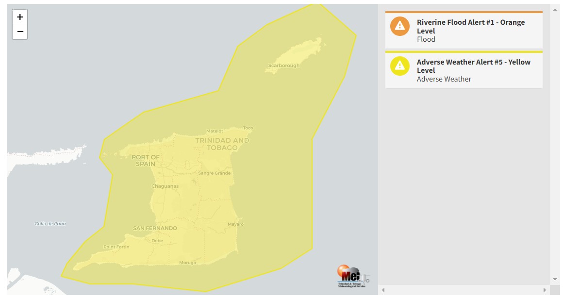
The Trinidad and Tobago Meteorological Service updated the Adverse Weather Alert (Orange Level), downgrading it to Yellow Level on Friday at 1:43 PM. The alert went into effect for Trinidad, Tobago, and surrounding marine areas from 9:00 AM Tuesday, October 25th, and remains in effect through 3:00 PM Saturday, October 29th, 2022.
Trinidad and Tobago is not under any tropical storm watch or warning at this time.
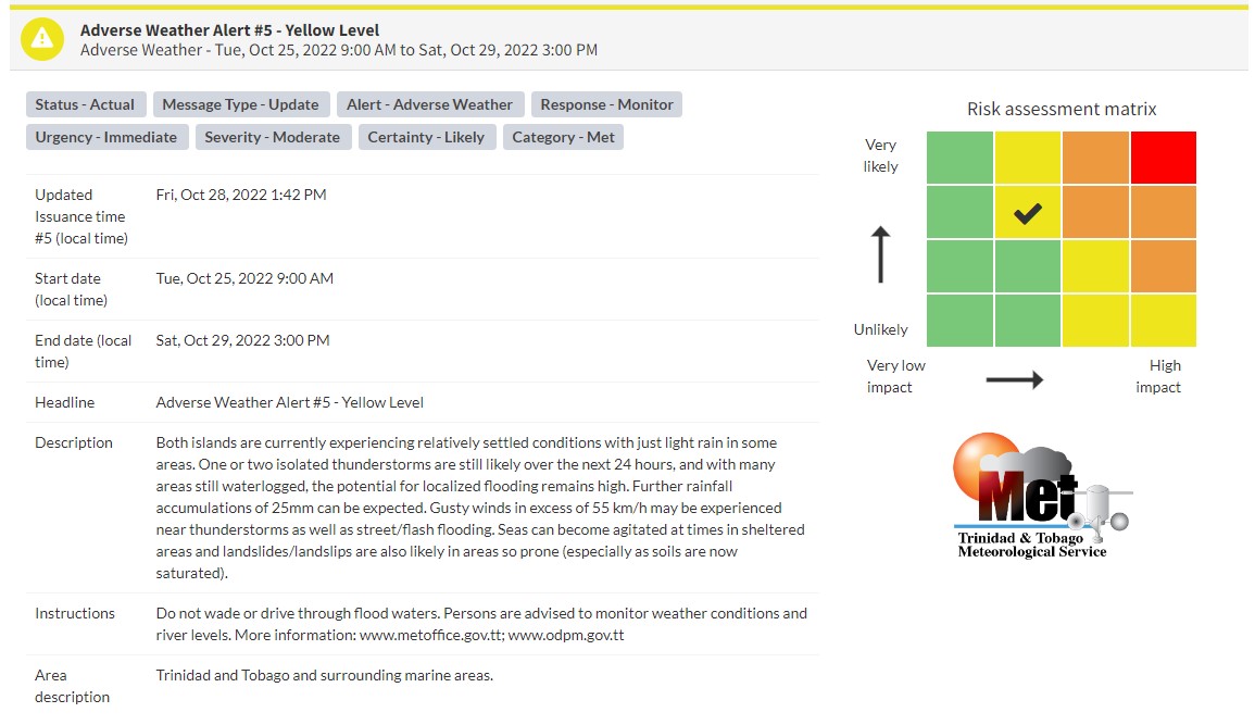
“Both islands are currently experiencing relatively settled conditions with just light rain in some areas. One or two isolated thunderstorms are still likely over the next 24 hours, and with many areas still waterlogged, the potential for localized flooding remains high. Further rainfall accumulations of 25mm can be expected. Gusty winds in excess of 55 km/h may be experienced near thunderstorms as well as street/flash flooding. Seas can become agitated at times in sheltered areas and landslides/landslips are also likely in areas so prone (especially as soils are now saturated),” according to the Trinidad and Tobago Meteorological Service. This “alert” status takes into account the possibility of the event occurring. This adverse weather event is likely.

The color of the alert indicates the severity of the event and the probability of the event occurring. Currently, the alert level is Yellow. This means that the hazards are likely, and the severity of the impacts is moderate for this particular alert. You should be aware of the hazards in your area associated mainly with gusty winds in excess of 55 KM/H, street, flash, and riverine flooding, landslides, as well as frequent lightning.
For a moderate Adverse Weather Alert, there is the potential for possible injuries, where behavioral changes are required to ensure safety. There may be minor damage to property, with income-earning temporarily disrupted and a couple of communities affected.
The Met Office is advising the public to monitor weather conditions, river levels, and updates from official sources and not wade or drive through flood waters.


