


As the Intertropical Convergence Zone lingers just south of Trinidad and Tobago, forecast rainfall will improve air quality. However, a steady stream of Saharan Dust lies just north of the ITCZ and will continue to move across the Windwards, including northern T&T, over the next 10 days.
What you need to know
— Saharan Dust Surges: Ongoing mild to moderate concentrations are forecast to persist through the next 10 days across Trinidad and Tobago, with higher dust levels across northern Trinidad and Tobago, as well as the southern Windward Islands.
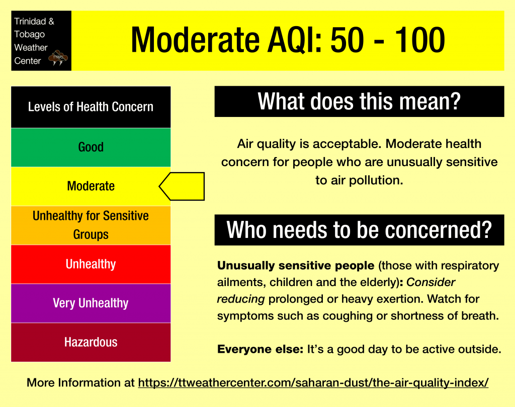
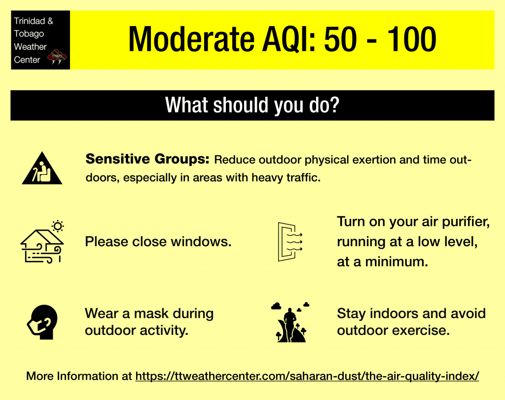
— Impacts: Air quality is forecast to remain good to moderate throughout the forecast period.
— What Should You Do: Throughout the forecast period, sensitive groups are advised to take the necessary precautions, particularly during high traffic.
Current AQI Levels Across T&T
As of 4:00 AM Sunday, May 18th, 2025, the official air quality monitoring stations from the Environmental Management Agency (EMA) at Beetham outside of Port of Spain and San Fernnado report moderate air quality, while all other stations (Signal Hill, Point Lisas, Toco, Arima) are not currently transmitting PM2.5 or PM10 data.
Unofficial air quality monitoring stations at Longdenville and Woodbrook report good air quality.
These measurements are based on PM2.5 (particulates the size of 2.5 micrometers and smaller, usually associated with increases in Saharan Dust, vehicle exhaust, and smoke) and PM10 particulates.
Outside of rainfall, visibility, used as a proxy for Saharan Dust concentrations, at the A.N.R. Robinson International Airport at Crown Point, Tobago, has dropped to 7 kilometers, while at Piarco, visibility has fluctuated primarily due to increased showers and thunderstorms in the area.
Saharan Dust Forecast For T&T
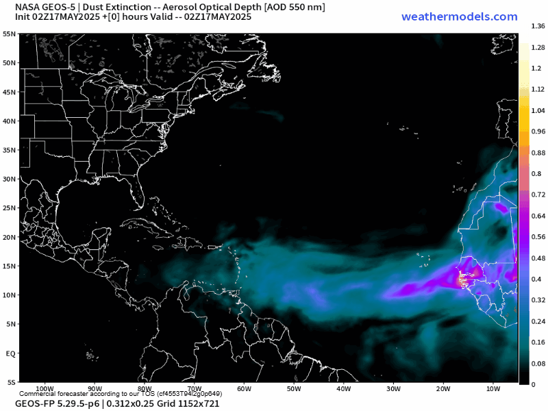
Over the next 10 days, the forecast remains generally unchanged day-to-day with mild to moderate concentrations of Saharan Dust moving across the Windwards and T&T.
Trinidad and Tobago is forecast to see marginal improvement on Wednesday, but the dust sticks around the country through the end of May.
As a result, air quality is forecast to range between good and moderate levels, with rainfall through Wednesday tempering air quality impacts, particularly for Trinidad.
What does this mean for you?
Mild to moderate concentrations of Saharan Dust periodically over the next seven to ten days are likely to bring air quality to moderate levels, chiefly affecting the most sensitive groups of the population. The general public is not required to take action.
We’re moving into a period where the Intertropical Convergence Zone, tropical waves, and occasional tropical cyclones may shield Trinidad and Tobago from the Saharan Dust events. While tropical waves are notable in moving dust across the Atlantic and the Eastern Caribbean, these periodic tropical waves also improve air quality.
The concentration of the dust that follows the wave depends on its strength as it moves off the West African Coast. This is because of stronger thunderstorms across Central Africa. As strong winds move downward and outward from these thunderstorms, the wind kicks up dust as it moves across parts of the Saharan Desert and transports it into the upper atmosphere. This “plume” of dust follows the axis of the wave as it progresses westward into the Atlantic.
Dust that makes it into the upper levels of the atmosphere can then get transported across the Atlantic Ocean. The plumes of dust eventually affect the Eastern Caribbean.
Larger, more concentrated plumes of Saharan dust begin in April and continue through November.


