


As a strong tropical wave (Invest 96L/Tropical Wave 17) moves across the Windwards on Wednesday, seas remain elevated across the area, with occasional choppy seas near T&T due to nearby shower/thunderstorm activity.
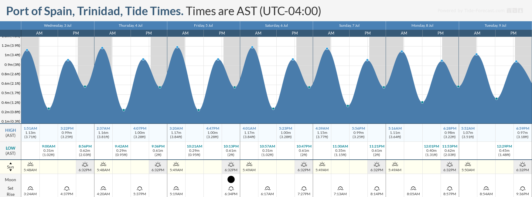
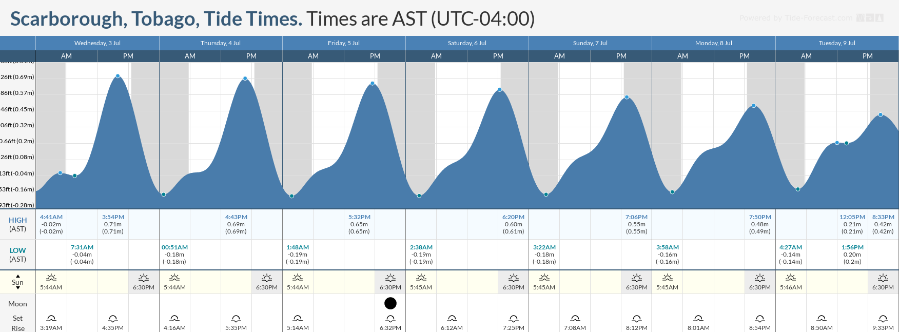
However, from Thursday through the remainder of the forecast period, increasingly settled weather is forecast to return, with persisting Saharan Dust across the region. While the overall sea state will return to the typical slight/moderate levels in open waters, mariners will still need to exercise caution due to decreased visibility near dawn and dust due to high concentrations of Saharan Dust, as well as ongoing Spring Tides through July 8th.
Latest Alerts

TTMS Issues Adverse Weather Alert For T&T
Trinidad and Tobago is NOT under any tropical storm or hurricane threat, watch, or warning at this time.
Seas Forecast For Trinidad and Tobago

Wednesday: Seas are forecast to be moderate in open waters, with waves up to 2.5 meters, and in northeastern areas, waves may occasionally exceed 2.5 meters. In sheltered areas, waves are forecast to be generally below 1.0 meter due to light to near calm winds across Trinidad, but conditions may become locally rough and/or choppy in the vicinity of heavy showers or thunderstorms. Winds are forecast to be variable, from the north to northeast during the early morning with speeds between 5 and 15 knots, then from the mid-morning through midday, from the southwest to west, between 0 and 10 knots, and then from midday from the south to east between 10-15 knots, gusting to 20 knots. Swell periods between 6 and 9 seconds are forecast. Spring Tides ongoing. Choppy conditions are likely in the Gulf of Paria, particularly in the evening and along south-facing coastlines, due to northward/northwestward-moving showers and thunderstorms.
Thursday through Sunday: Seas are forecast to be moderate in open waters, with waves up to 2.0 meters. In sheltered areas, waves are forecast to be near 1.0 meters, with conditions that may become locally rough and/or choppy in the vicinity of heavy showers or thunderstorms. Winds are forecast to be from the east-northeast to southeast between 10 to 20 knots, gusting to 25 knots. Swell periods between 6 and 9 seconds. Moderate to high Saharan Dust concentrations. Spring tides ongoing.
Monday through Tuesday: Due to a large but weak tropical wave (Tropical Wave 18), winds are forecast to decrease across the region, between 5 and 15 knots, leading to seas in open waters decreasing to 1.0 to 1.5 meters. In sheltered areas, waves are forecast to be less than 1.0 meter, but mostly near-calm conditions are likely. Swell periods between 6 and 9 seconds. Moderate to high Saharan Dust concentrations from mid-Monday. Spring tides to end on Monday.
Possible Impacts
Marine interests in the Gulf of Paria should be on alert for Wednesday as well due to an atypical wind regime that may produce larger waves in usually calm areas. With winds from the south/southeast, larger waves in the Gulf of Paria are possible along south-facing coastlines.
Spring tides, which are higher-than-usual high tides and lower-than-usual low tides, are forecast to end on Monday. Everyone will need to exercise caution, particularly during high tide periods.
Rip currents always pose a hazard on the nation’s beaches. If caught in a rip current, swim perpendicular to the current (parallel to the shore). Mariners, especially small craft operators, should ensure their vessels are securely anchored or docked, as choppy/breaking wave conditions may drag the vessel onto the ocean floor or reefs in shallow waters or even break anchorage/mooring.


