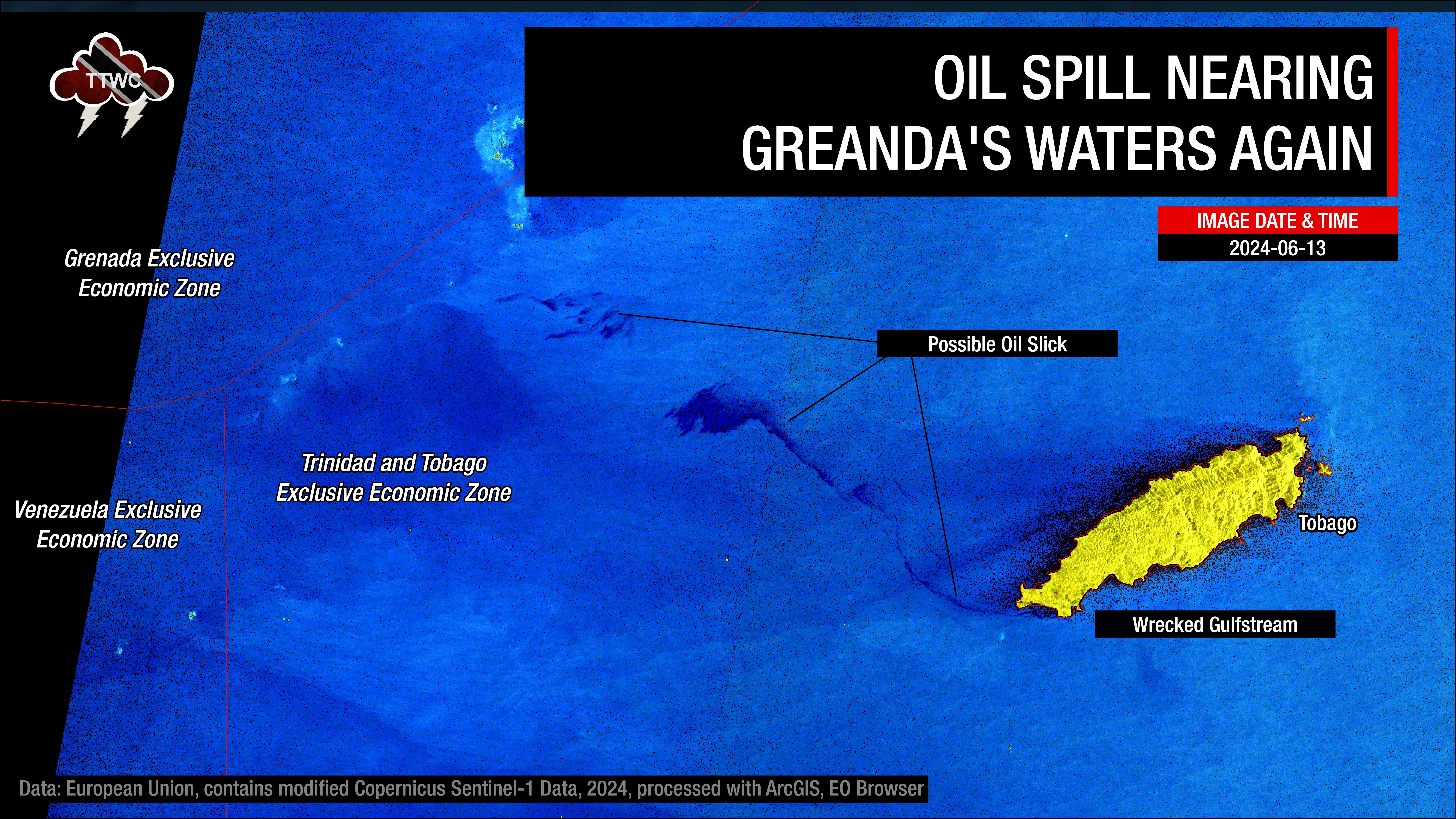
Four months after oil first washed up on Tobago’s coastlines, hydrocarbons from the capsized Gulfstream barge off the Cove Eco-Industrial Park, Tobago, spilled into the ocean once more.
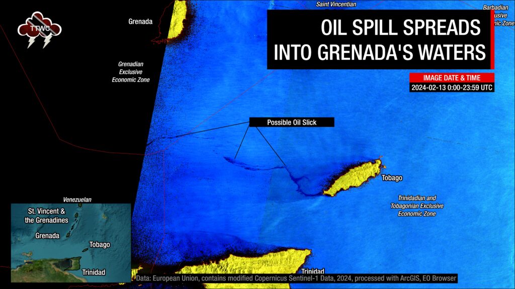
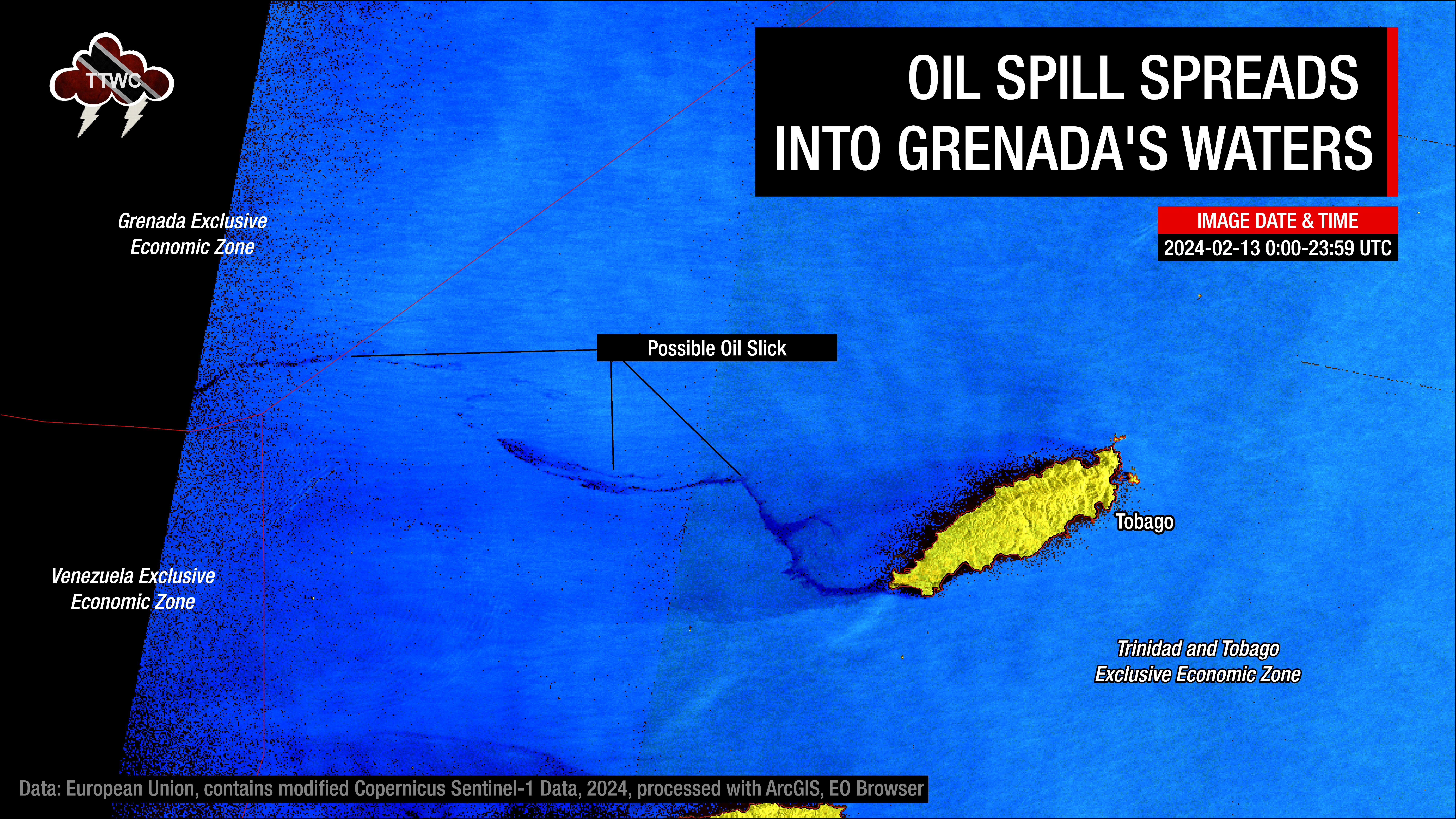
The latest satellite imagery by Copernicus Sentinel-1A has detected possible oil slicks moving out of Trinidad and Tobago’s marine area towards Grenada’s southernmost marine area of responsibility.
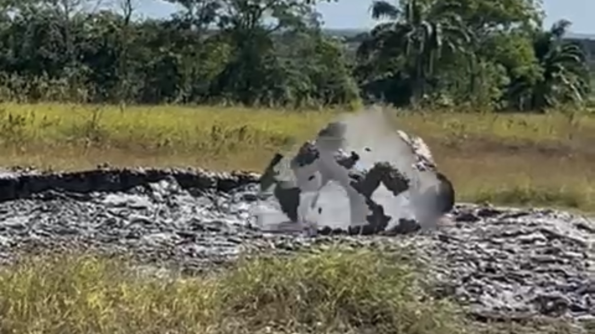
The Office of the Chief Secretary (OCS) of the Tobago House of Assembly (THA) said in a late-night release that a large amount of fuel had been discovered drifting away from Gulfstream.
Based on data analyzed by TTWC and sent to the Tobago Emergency Management Agency (TEMA), an anomaly similar to what was seen in February this year was seen on satellite data. The anomaly measured 39.5 nautical miles, approximately 74 kilometers away from western Tobago and extended from the west to northwest of Tobago into the Caribbean Sea.
There are two main areas of the possible oil slick. The area closest to Grenada’s marine waters, approximately 65.6 kilometers to the island’s southeast, measures approximately 17 kilometers in length, while the larger area extending from Tobago measures 54 kilometers in length. Both areas are moving generally west.
It is important to note that the thickness of the slick is not known, and this anomaly could also be sheen. Hydrocarbons, particularly when it is a thin slick or just sheen, are naturally dispersed into the ocean through wind and wave action.
According to the THA, the existing weather and sea conditions, including high tides and high wave swells, have disturbed the vessel, resulting in hydrocarbon deposits.
The Ministry of Energy and Energy Industries (MEEl) continues to manage the operations for the de-inventory of hydrocarbons from the capsized vessel off the coast of Cove, Tobago.
The de-inventory process involves pumping hydrocarbons from the cargo tanks on the vessel to a temporary storage location at Cove, Tobago. Tanker trucks then transport the hydrocarbons from the temporary storage location to the Port of Scarborough, where it is transferred to a bunkering vessel. This vessel then journeys to Pointe-a-Pierre, Trinidad, where the hydrocarbons will be offloaded and stored in a storage tank.
The oil-like substance spilled into the ocean overnight on February 6th and 7th, initially covering the windward coastlines of Tobago, closest to where the barge was stuck on Cove Reef. On Sunday, February 11th, 2024, the oil-like substance travelled up to 88 kilometers west and northwest of Tobago. The oil-like substance was later identified as bunker fuel.
The oil spill affected some 15 kilometers of Tobago’s southwestern coast, including Kilgwyn Bay, Canoe Bay, Petit Trou Lagoon, Rockly Bay, and Topaz Beach.
This is the second time oil from Gulfstream has approached Grenada’s southernmost territorial waters.
The February 13th, 2024 Incursion
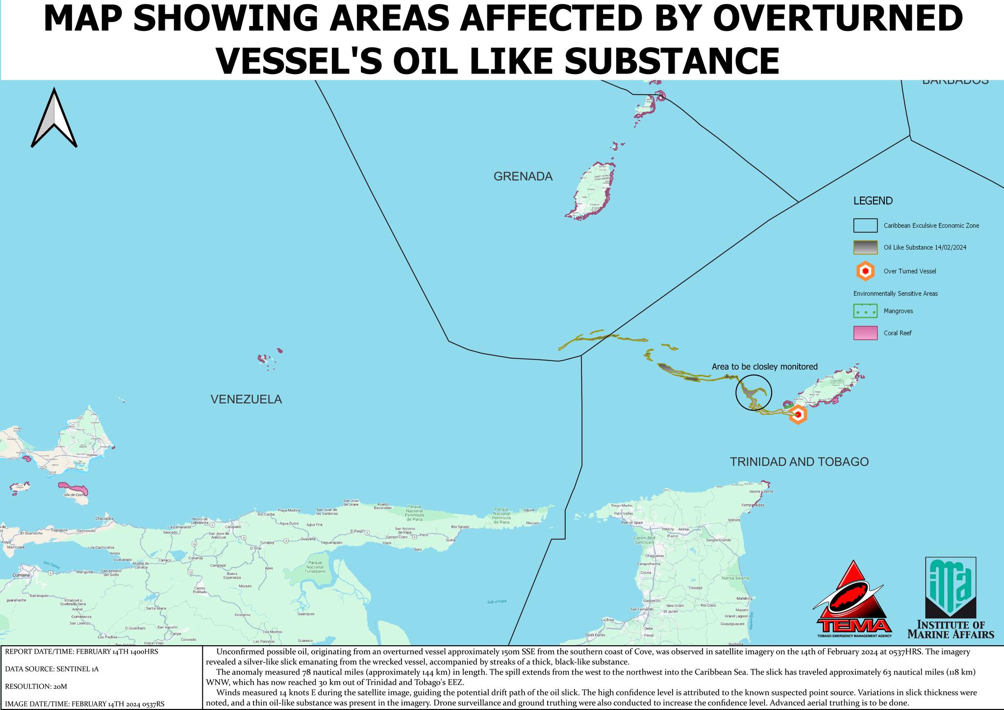
As of February 14th, high-resolution satellite imagery detected the possible oil slick travelling approximately 63 nautical miles, or 118 kilometers, west-northwest. Then, it reached 30 kilometers out of Trinidad and Tobago’s Economic Exclusive Zone (EEZ), which is the area of the sea in which T&T has exclusive rights regarding the exploration and use of marine resources, including energy production from water and wind.
The oil slick has now moved into the southernmost area of Grenada’s Economic Exclusive Zone by approximately 30 kilometers. According to TEMA, winds measured 14 knots from the east during the satellite image, guiding the potential drift path of the possible oil slick. Based on the current trajectory of the possible oil slick due to prevailing winds and ocean currents, the coastline of Grenada was not under any threat. At this time, no oil/oil-like substance has made it on Tobago’s west or northern coastlines.
TEMA also added that the high confidence level is attributed to the known suspected point source variations in slick thickness were noted, and a thin oil-like substance was present in the imagery drone surveillance and ground truthing were also conducted to increase the confidence level advanced aerial truthing is to be done by the T&T Air Guard.
On Wednesday, February 14th, 2024, one week after the Tobago Oil Spill began, the Trinidad and Tobago Coast Guard made headway in learning new information about the vessel’s origins.